
Good Morning! Our absolutely remarkable temperature turnaround continues. Monday’s high was only 47. Wednesday’s high reached 72. What a change! In fact, we’ll be Back in the 70’s today through the weekend and well into next week. Even the nights are moderating. Overnight lows in the 40’s will rise to the 50’s this weekend. A remarkable change. It’s a dry for the next several days. Here’s my brief video forecast discussion.
TODAY: Sunny and warmer. High 74. Light wind. Mostly clear, with a low around 45.
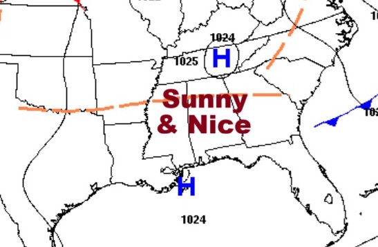
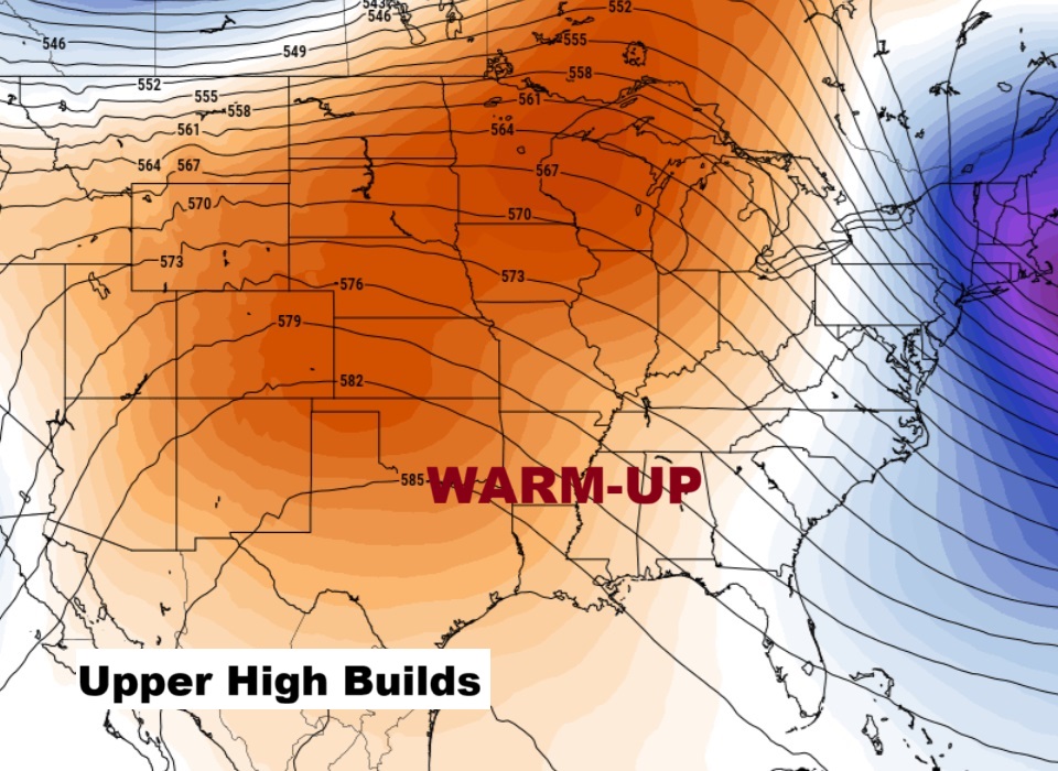
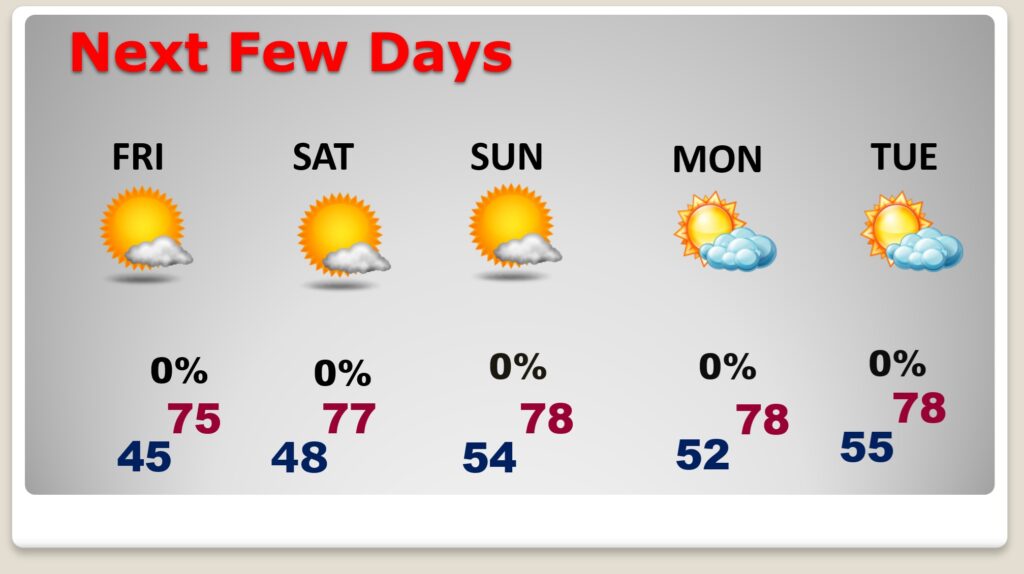
NEXT FEW DAYS: A series of very nice November days will stick around well into next week. We’ll be Back in the 70’s the today through the weekend and well into next week. Even the nights are moderating. Overnight lows in the 40’s will rise to the 50’s this weekend. We need rain desperately but it’s a dry forecast through at least the middle of next week. (Normal hi/lo 72/45)
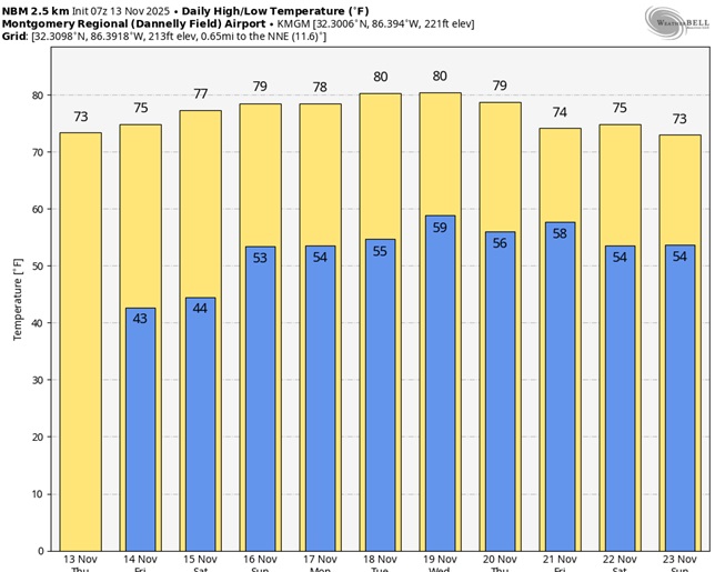
Here’s the 10 Day Model Temperature Trend. What a remarkable string of November days. No Arctic air.
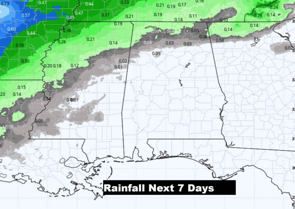
Here’s the bad news. No rain for several days. The new Drought Monitor map comes out this morning.
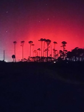
NORTHERN LIGHTS IN THE DEEP SOUTH: Once again overnight – yet another night of rare view at the northern lights. Beautiful. Historic! Caused by an intense Geo Magnetic Storm (CME).
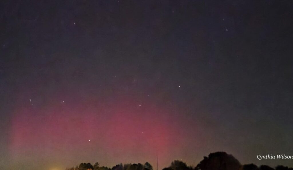
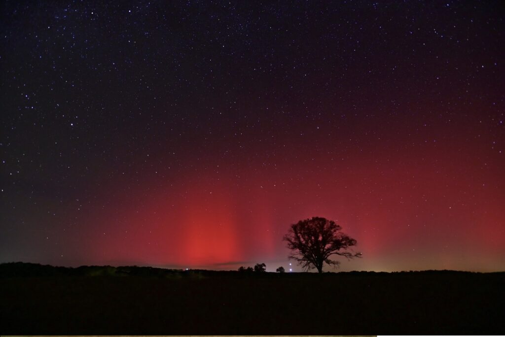
But, check this out! The Aurora was seen as far south as the Florida panhandle.
Thanks for reading this Blog this morning. This morning we are LIVE on the radio from 6 to 9 on NewsTalk 93.1. I’ll have another update for you in the 4 o’clock hour tomorrow morning. Have a nice day.
–Rich