
LATE BREAKING: Dense Fog Advisory till 9 from Lowndes and Montgomery county eastward. Visibility down to 1/4 mile.

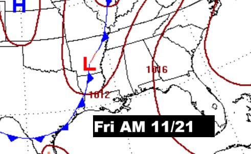
Good Morning! An approaching front will bring scattered showers and thunderstorms this afternoon and tonight and part of the day Saturday. Fingers crossed. We are in a severe drought. Future radar is not very optimistic on rainfall amounts. Meanwhile, we continue very warm. Yesterday’s Montgomery high of 84 shattered the 125 year record of 81 from 1900. We’ll tease 80 today – held down by clouds. If we get to 81 Saturday, we’ll tie the record from 2011. Sunday and Monday look dry and nice. Another storm system will bring showers and storms Tuesday/Tuesday night/early Wednesday. Sharply much cooler air will follow for Wednesday night and Thanksgiving into Black Friday and Iron Bowl weekend. Here’s my brief Video Forecast Discussion.
CLIMATE: I’m a history fanatic. Today’s Record high of 84, in Montgomery, blows away the old record of 81 from 1900. Back then, records were kept at the old Dexter Avenue Post office, near the Court Street fountain, down the street from the Capital. Records began in September 1872. 125 year old record falls.
TODAY: Scattered showers and thunderstorms by afternoon. Limited sunshine with a high near 79. Widely scattered showers, maybe a thunderstorm overnight. Mostly cloudy, with a low around 65

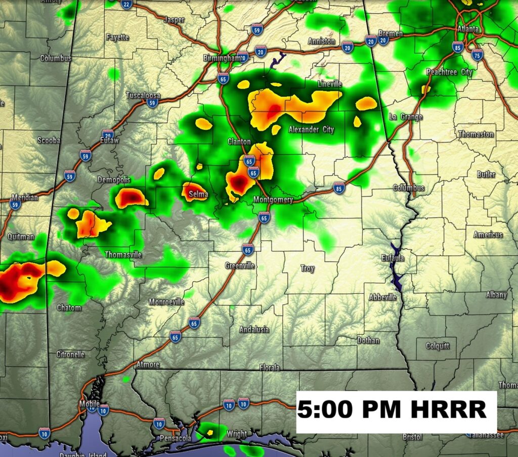
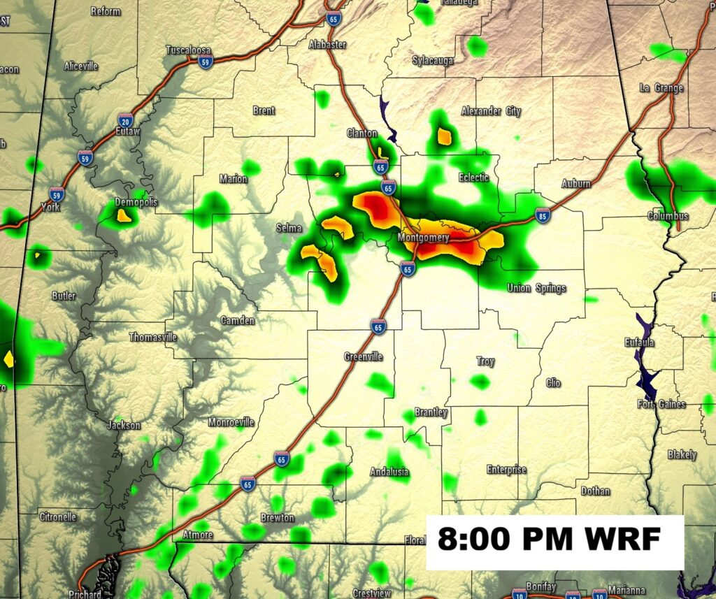
Future radar is not very optimistic on rainfall amounts.

Marginal Severe Risk covers northwest and west Alabama. Damaging winds guts are the main risk.

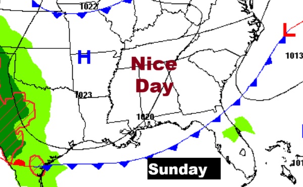
NEXT FEW DAYS: Still Warm on Saturday. If we get to 81 Saturday, we’ll tie the record from 2011. Some leftover widely scattered showers and thunderstorms will populate the radar Saturday. Sunday and Monday look dry and nice, with highs in the upper 70’s.

Another storm system will bring showers and storms Tuesday/Tuesday night/early Wednesday. Much cooler air will follow for Wednesday night and Thanksgiving into Black Friday and Iron Bowl weekend.
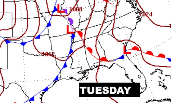

Next storm system Tuesday and Tuesday night. The front moves through early Wednesday.
Expected Rainfall from the Today, tonight & Saturday storm system is very disappointing for the SE half of Alabama.

Here’s expected rainfall through the next 7 days. This includes the Friday storms system and the Tuesday/Tuesday night storm system.

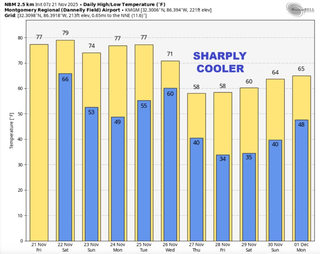
Here’s the 10 Day Model Temperature Trend. Much cooler air will arrive by Wednesday night. It will be much cooler Thanksgiving into Black Friday and Iron Bowl weekend.
DROUGHT MONITOR: As the drought in Alabama continues to grow worse, the brand new drought monitor map now shows 66% of state has at least a moderate drought, and at least 41% of the state is in a severe or extreme drought situation. Next chance of widely scattered showers/storms begins Friday/ Friday night and again the following Tuesday.

THANKSGIVING WEEK: Showers and storms become likely by Tuesday afternoon and Tuesday night into Wednesday morning before frontal passage. It will be much cooler Thanksgiving into Black Friday and Iron Bowl weekend.

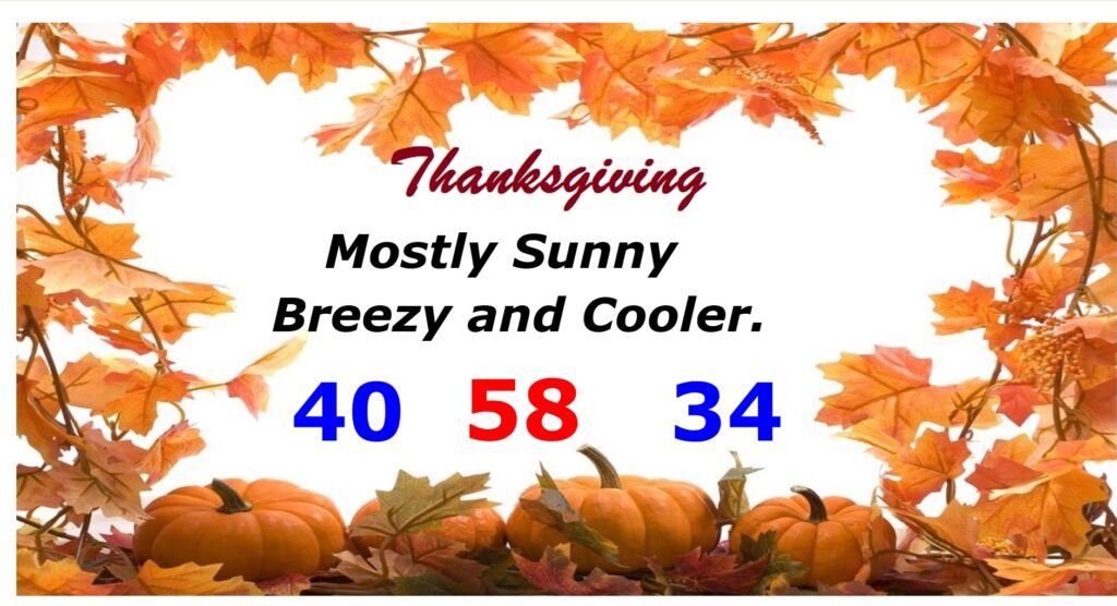
THANKSGIVING: Dry. Breezy and cooler. Mostly sunny. Morning low 40. Daytime high 58. Low Thursday night 34.
IRON BOWL: For the biggest game of the year in Alabama (Alabama at Auburn, Saturday November 29 at 6:30p CT)… the weather is looking breezy and very cold and dry with temperatures falling through the 30s during the game
THE DISTANT FUTURE?:
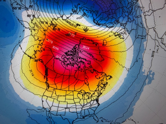
LONG RANGE …could we be in for some major cold air events, especially in December?
A major sudden stratospheric warming event — potentially one of the earliest on record — now appears likely to unfold from late November into early December.
To qualify as a “major” event, the stratosphere must experience both a rapid temperature surge and a marked slowdown in high-altitude winds.
The resulting disruption of the polar vortex could quickly cascade downward into the troposphere — where our weather occurs — sending Arctic air southward into Canada and the United States shortly after Thanksgiving.
Details of this developing event are not known yet.
This pipeline of cold air is expected to strengthen through December as high pressure becomes firmly established over Russia.
Several waves of frigid air seem likely across the United States next month, especially across the northern half of the country.
Because stratospheric warming events evolve slowly, the effects may take some time to fully emerge — and once they do, they could linger well into the new year.
It’s shaping up to be an interesting ride.
Thanks for reading this Blog this morning. This morning we are LIVE on the radio from 6 to 9 on NewsTalk 93.1. I’ll have another update for you in the 4 o’clock hour tomorrow morning. Have a nice day.
–Rich