
Good Morning! Today is the first day of Meteorological Winter. There will be multiple rain intervals over the next 7 days and beyond. Tonight will be very wet with the potential for significant rainfall totals. Then, expect another very wet surge Friday PM into Saturday. There will be more rain the following week. So, during this SEVERE drought – the news about the potential significant rainfall in the next 7 days is just what the doctor ordered. Much of the week will be chilly. Tuesday will be a day of falling temperatures. Coldest morning will be Wednesday. Here’s my brief forecast discussion.
TODAY: A 50 percent chance of rain, mainly after 3pm. Cloudy, with a high near 57.
TONGHT: Rain. Low around 49. Chance of precipitation is 100%. New precipitation amounts between 1 and 2 inches possible.

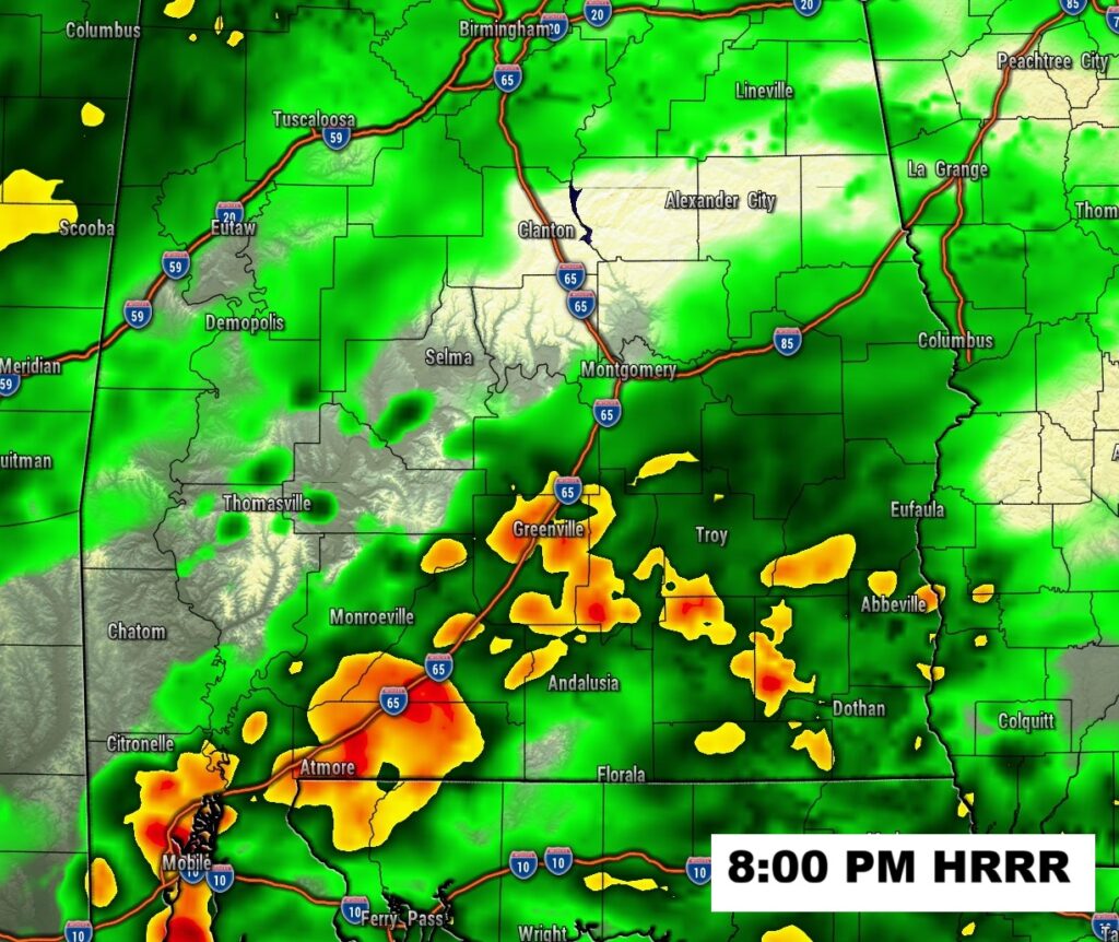
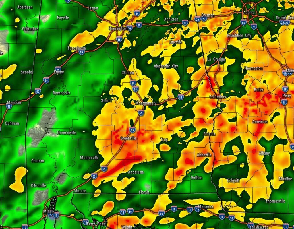
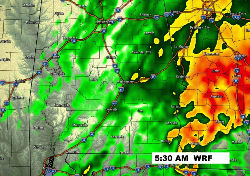
FUTURE RADAR: Take a look. Get ready for a soaker tonight.

NEXT FEW DAYS: There will be another very wet surge Friday PM into Saturday. We’ll continue below normal for the week ahead. (Normal hi/lo 66/40) Much of the week will be dry. More rain the following week. Good news in this Severe Drought. Much of the week will be chilly. Coldest morning will be Wednesday.

Here’s the set-up for the Friday storm system.

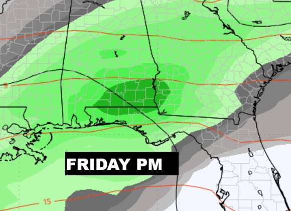
Here’s the anticipated rainfall. The first graphic shows the potential rainfall tonight. The second graphic shows the total rainfall through Saturday.


Herse’s the 10 day model blend temperature trend. Chilly most of the time. Normal hi/lo 66/40.

Thanks for reading this Blog this morning. This morning we are LIVE on the radio from 6 to 9 on NewsTalk 93.1. I’ll have another update for you in the 4 o’clock hour tomorrow morning. Have a nice day.
–Rich