
Good Morning! It’s a very chilly December forecast as Arctic air takes over. Clouds will gradually give way to sunshine later. Risk of more rain returns Thursday. Rain becomes even more likely late Thursday night and Friday could be a soaker especially across south Alabama. Leftover showers may linger into Saturday, too. Some of the models are advertising significant rainfall totals especially for the southern half of our state. Temperatures may fall short of 50 Thursday and Friday. Disappointing. Here’s my brief forecast discussion.
TODAY: Cloudy, then gradually becoming mostly sunny. Chilly. High near 52.
TONGHT: Increasing clouds, COLD. Low around 35.
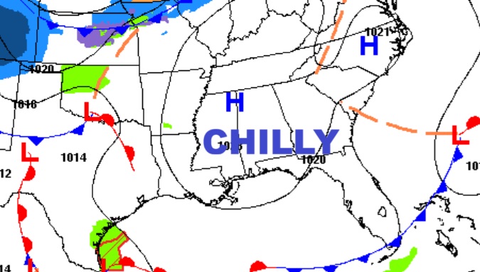
Arctic Air dominates much of the nation. Coldest air of the season so far. DISSAPOINTING.
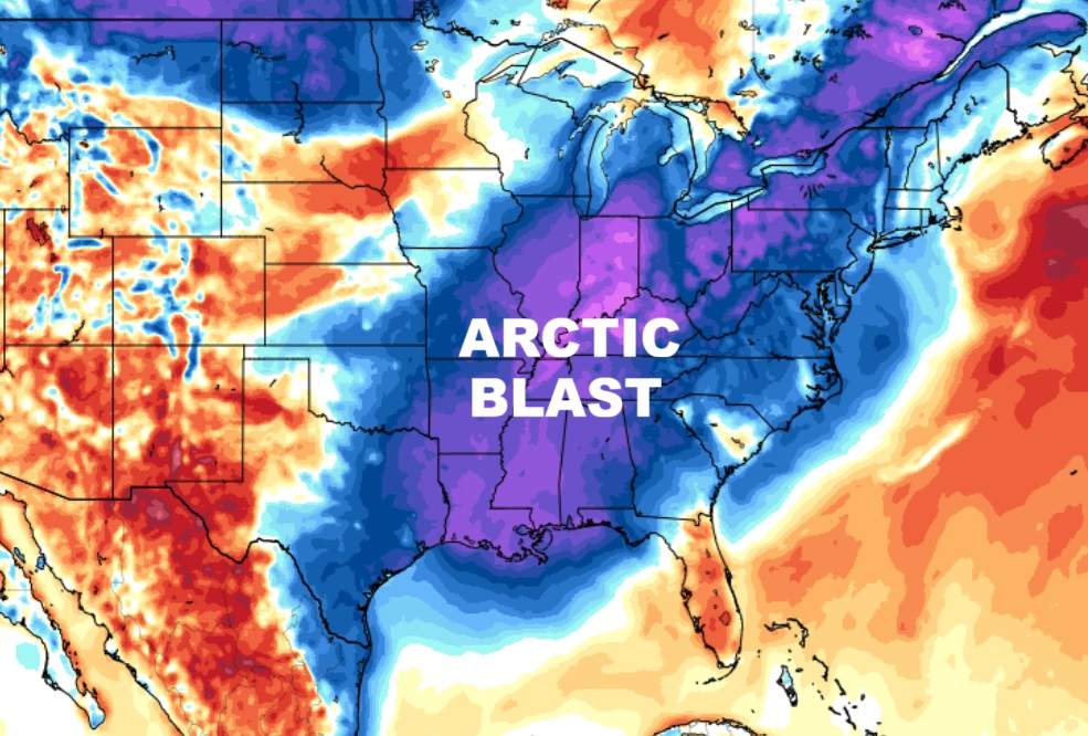
NEXT FEW DAYS: Arctic air dominates. Risk of rain returns Thursday. Rain becomes likely late Thursday night and Friday. Leftover showers could linger into early Saturday, too. Highs Thursday through Friday will be disappointing. Raw. Thursday and Friday we may not make it out of the 40’s with that cold rain. Sunday looks a little better with a high near 60.

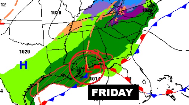
Here’s the set-up for the Friday storm system. A parade of low pressure areas will slide along the northern Gulf coast. Periods of rain Thursday into early Saturday.

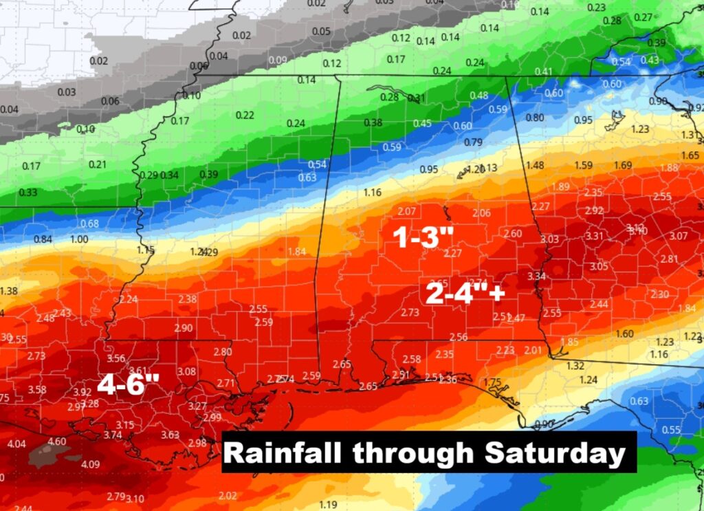
Here’s the anticipated rainfall through Saturday. Hopefully, more beneficial rain, especially over the southern counties.
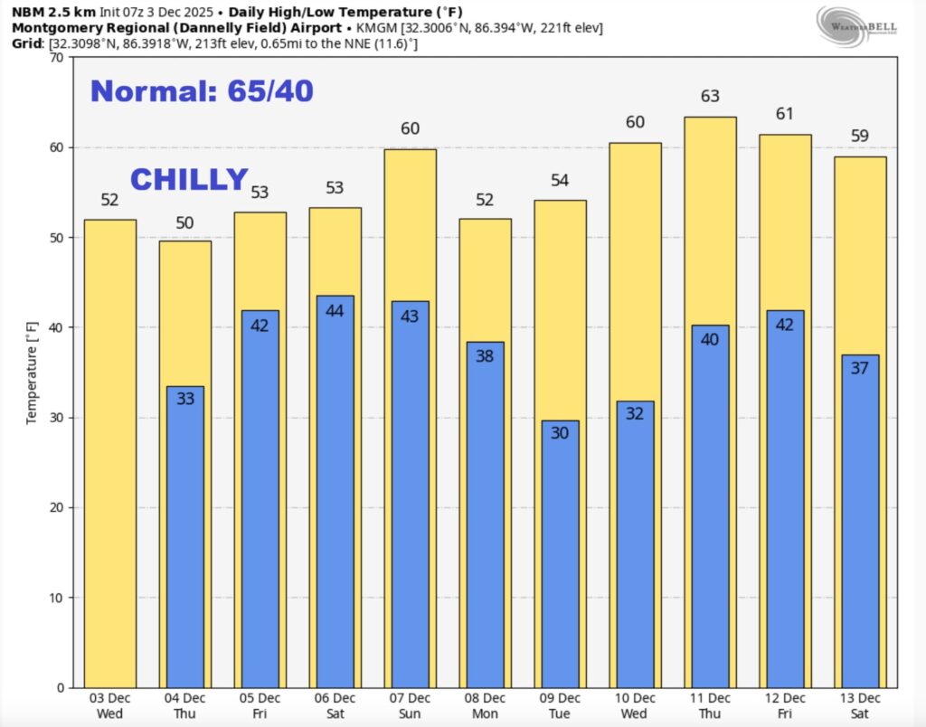
Herse’s the 10 day model blend temperature trend. Below normal most of the time. Chilly. Disappointing.
Thanks for reading this Blog this morning. This morning we are LIVE on the radio from 6 to 9 on NewsTalk 93.1. I’ll have another update for you in the 4 o’clock hour tomorrow morning. Have a nice day.
–Rich