
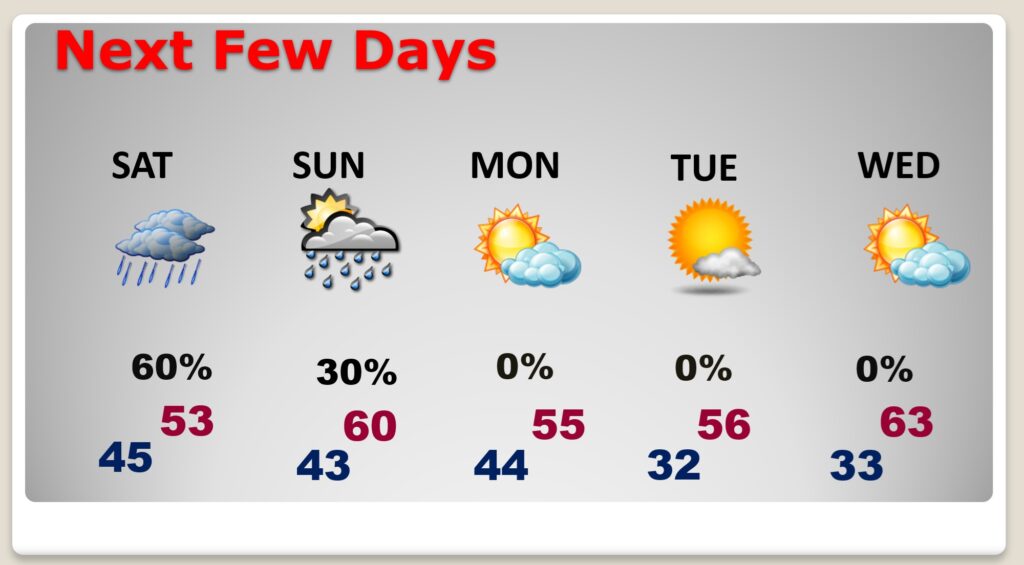
Good Morning! A very chilly December pattern continues, and it will continue wet at times. Not a pleasant pattern, and unfortunately, it has already had an impact on scheduled holiday events in the area. It won’t rain all the time. There will be several dry hours. But, there will continue to be periods of light rain at times through Saturday and possibly even early Sunday. By far, the highest rainfall totals will be south of the I-85 corridor. Southeast Alabama will see the heaviest totals. Meanwhile, temperatures will continued cold most of the time for the next few days. Here’s my brief forecast discussion.
TODAY: COLD Rain likely, mainly between noon and 3pm. Cloudy, with a high near 51. TONIGHT: Spotty rain at times. Otherwise, cloudy, with a low around 44.
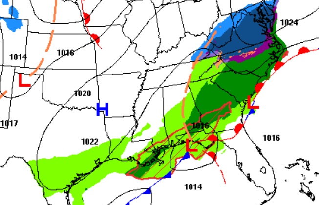
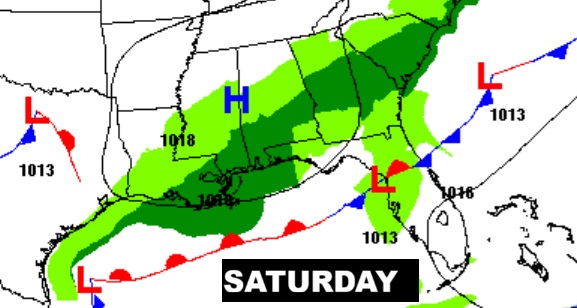
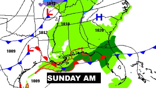
A series of Lows will hug the Gulf Coast today through Sunday.
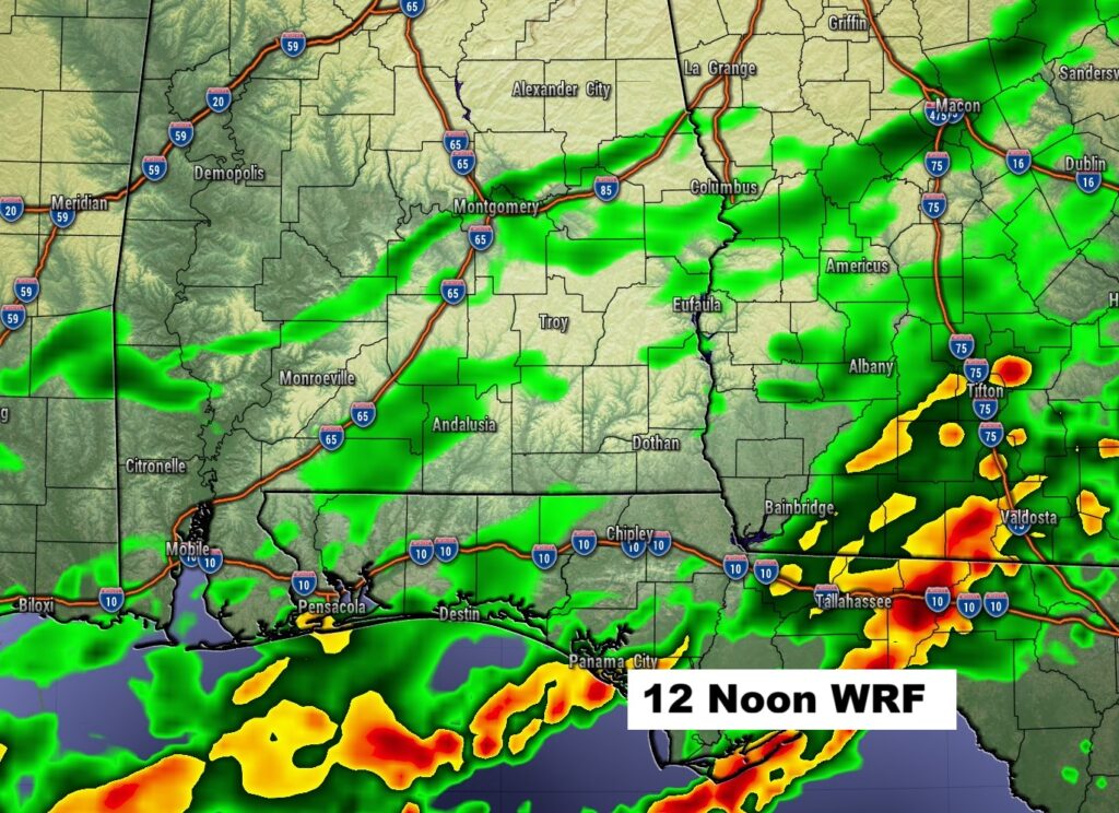
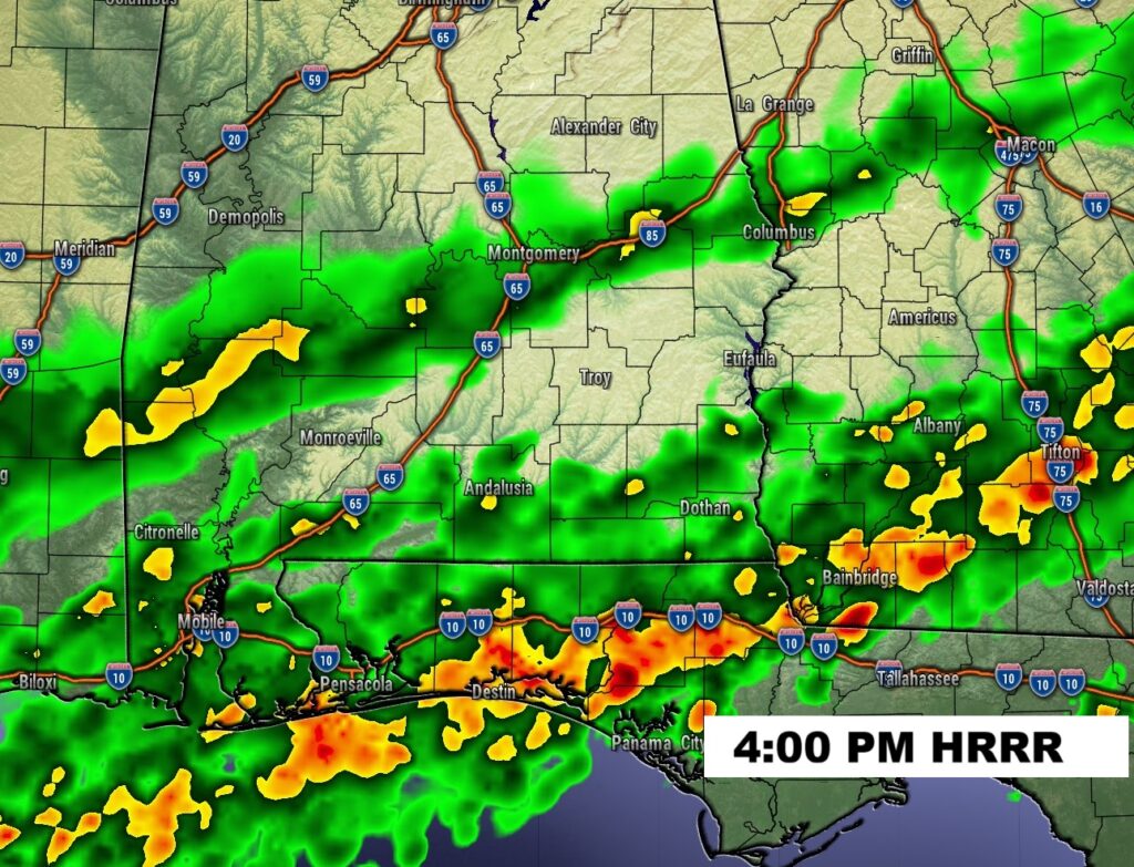
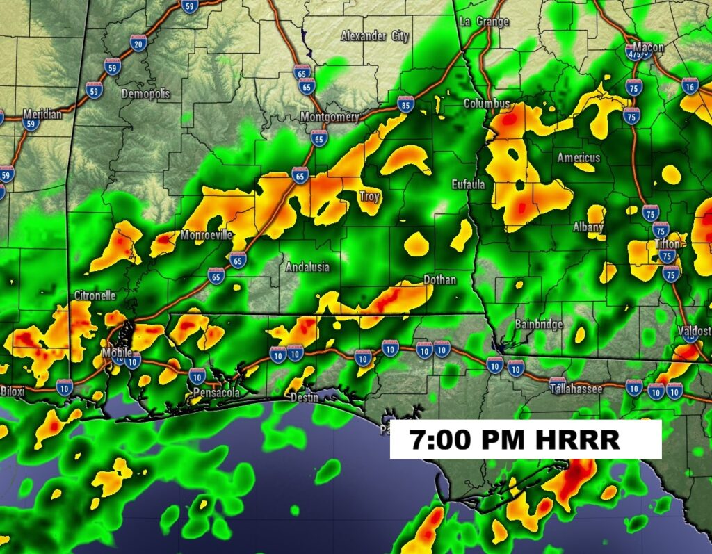
FUTURE RADAR: Obviously the most concentrated rain will be closer to the coast.
NEXT FEW DAYS: There will be periods of a cold rain today through Saturday – as a series of Lows slide eastward across the Gulf coast. Leftover showers may linger into Sunday AM, too. It won’t rain all the time. There will be several dry hours. But, there will continue to be periods of light rain at times. Temperatures may hover near 50 today, after a dismal high of 45 yesterday. We may tease 60 by Sunday afternoon.
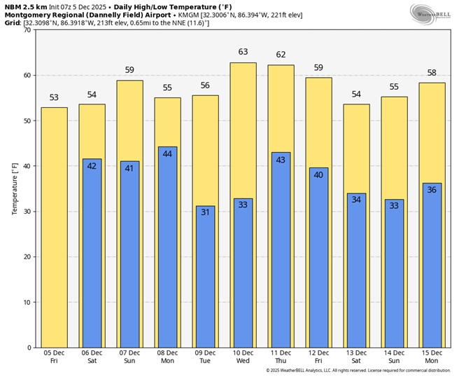
Herse’s the 10 day model blend temperature trend. Chilly most of the time. Normal 65/40.
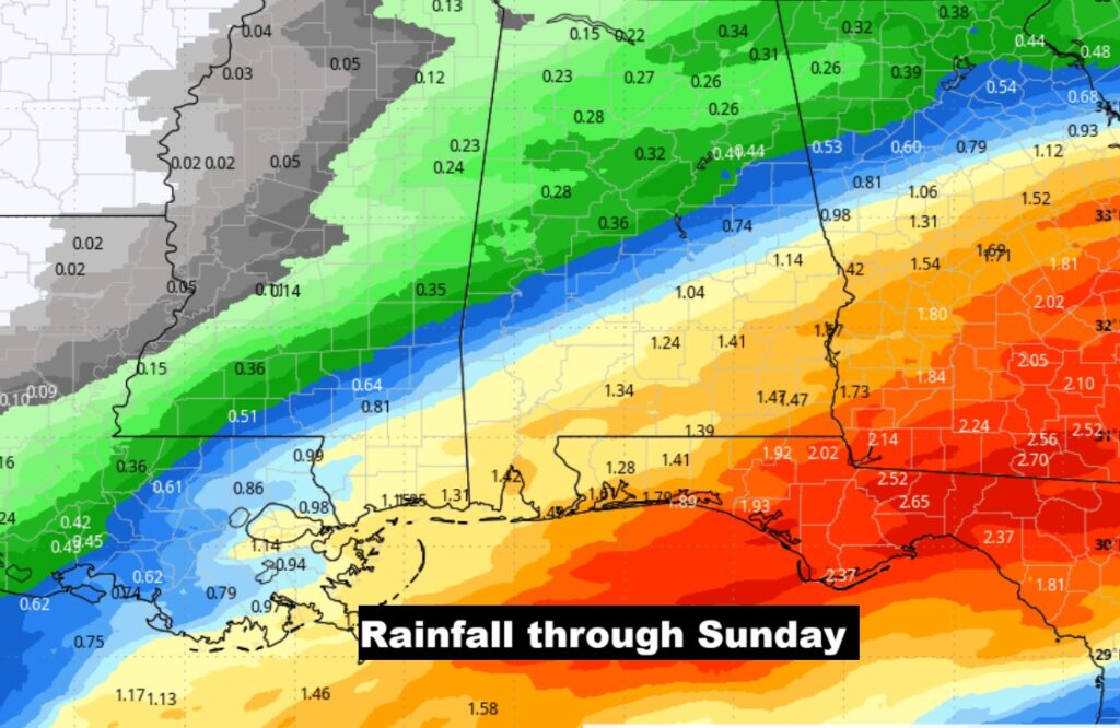
Here’s the anticipated rainfall through Sunday. By far, the highest rainfall totals will be south of the I-85 corridor. Southeast Alabama will see the heaviest totals.
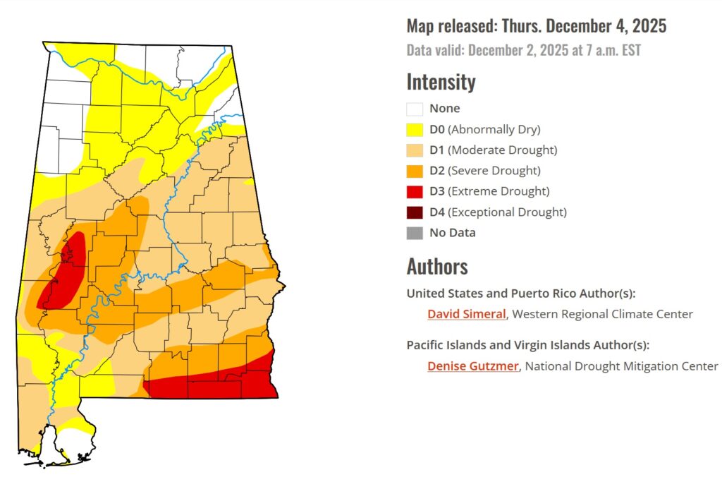
DROUGHT MONITOR: Any raindrops we get over the next 7 days will hopefully help put a dent in the escalating Drought.
Thanks for reading this Blog this morning. This morning we are LIVE on the radio from 6 to 9 on NewsTalk 93.1. I’ll have another update for you in the 4 o’clock hour tomorrow morning. Have a nice day.
–Rich