
Good Morning! Gloomy, cloudy days will fade into our past. There should be a good bit of sunshine for the next few days. It’s COLD this morning. By Dawn, we’ll be in the upper 20’s. Today will be quite cool – but not nearly as breezy. Still well below the normal. (63/40). But, we’ll warm, to near normal by Wednesday afternoon. Friday’s high will reach the middle 60’s. Right now it’s a dry forecast through Sunday. And, at the moment, I don’t see and Arctic Blasts in our future…YET. Here’s my brief video forecast discussion.
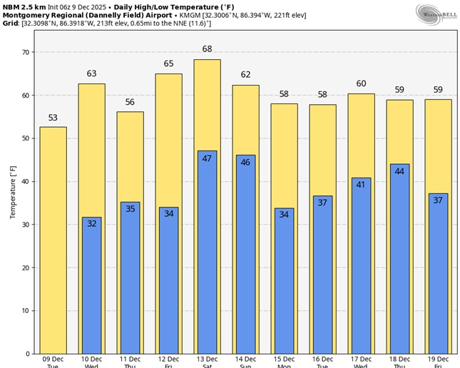
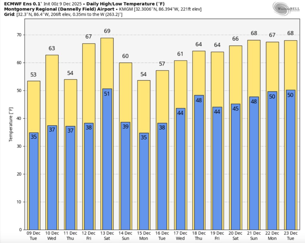
TODAY: Cold at Dawn. Upper 20’s. Mostly sunny. Rather cool. High 53. (Normal 63/40) Light wind. Clear and cold again tonight. Low 33.
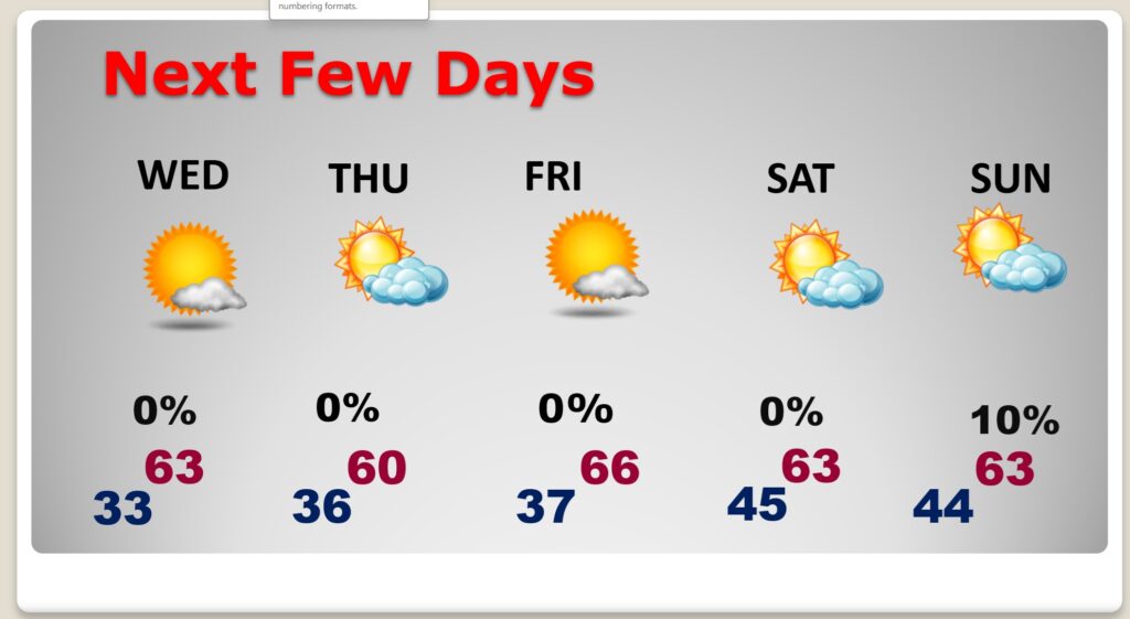
NEXT FEW DAYS: Temperatures will be more reasonable by Wednesday as highs rebound into the 60’s. Right now, it’s a dry forecast through Sunday. Friday could be the warmest day. High 66. Nights will moderate into the 40’s over the weekend.
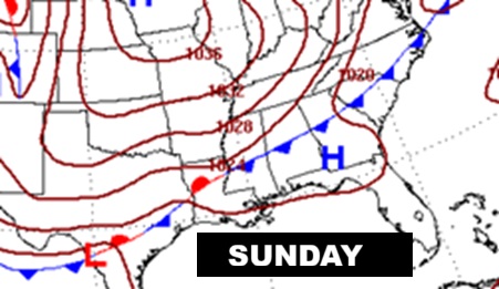
Sunday’s map shows a frontal system moving southward. Maybe some showers for north Alabama, but probably a dry front for us.
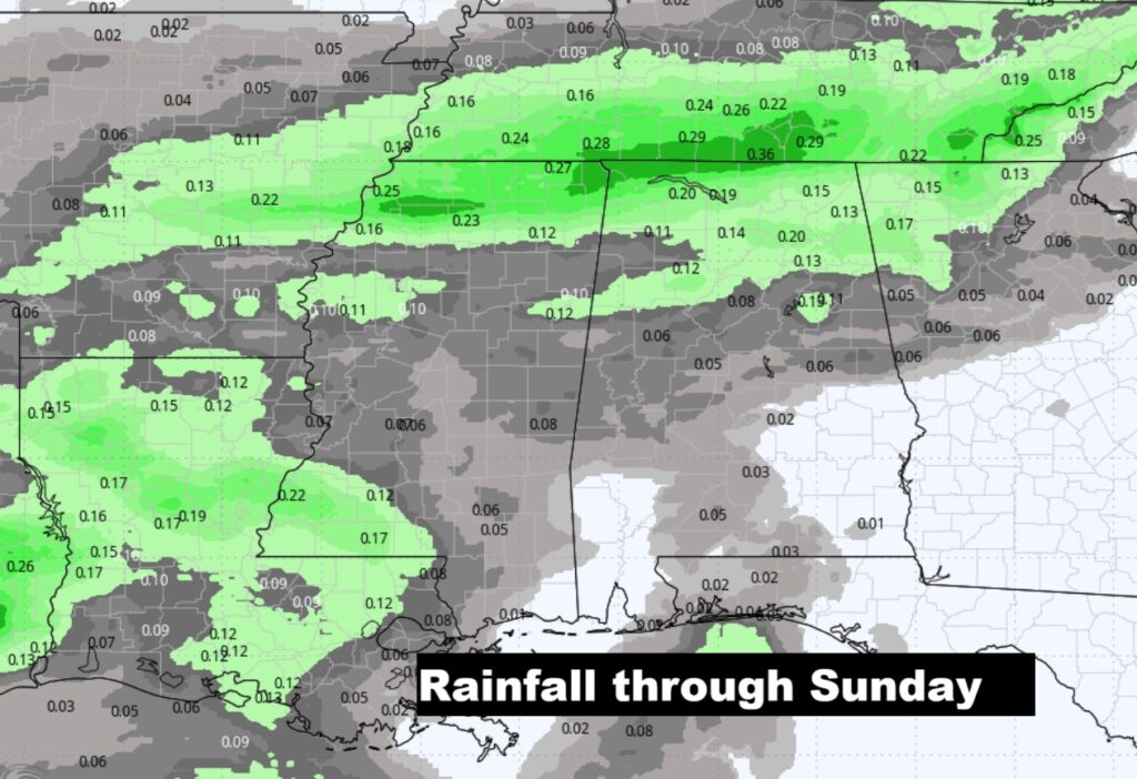
Here’s the expected rainfall map. Right now, it’s a dry forecast through Sunday.
The 10 Day model blend temperature trend. No shocking arctic air on the horizon for US, yet.
Here’s the 16 days EURO Temp trend as we get closer to Christmas.
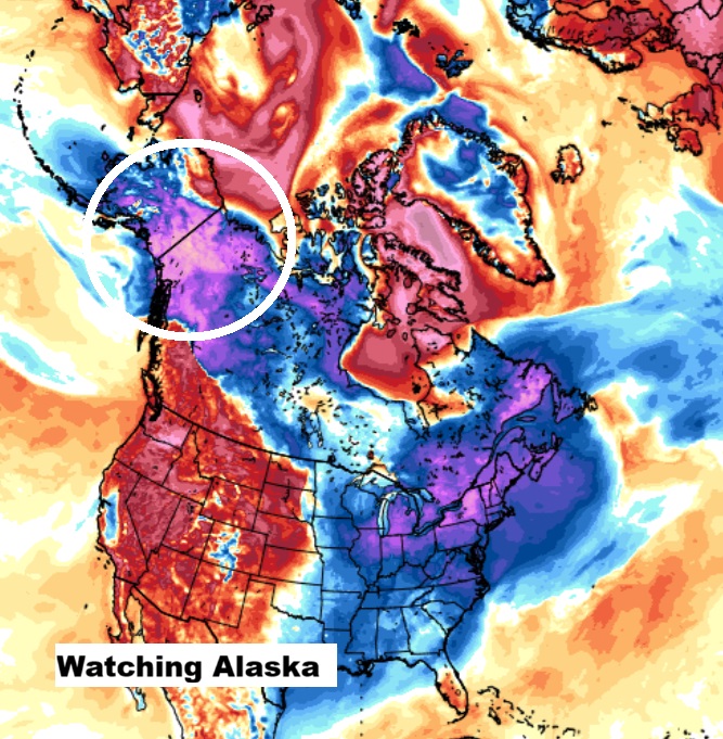
We keep monitoring EXTREME COLD over Alaska. Will that drain into the US eventually. Probably. For now we’re monitoring.
Thanks for reading this Blog this morning. This morning we are LIVE on the radio from 6 to 9 on NewsTalk 93.1. I’ll have another update for you in the 4 o’clock hour tomorrow morning. Have a nice day.
–Rich