
Good Morning! We have a pretty remarkable Christmas forecast. It’s not only a storm-free/Dry forecast. Much above normal temperatures start today. Highs in the 70’s are expected today through Sunday. But, hang on cold weather fans. Your time is coming. An approaching cold front will bring scattered showers by Sunday PM, followed by a BIG Arctic plunge. Monday will be about 30 degrees colder. Tuesday and Wednesday morning looks bitterly cold. A complete change of climate. Here’s my brief video Forecast Discussion.
TODAY: Mostly sunny. Spring-like. High near 74. South wind 5 to 10. Mainly clear tonight. Not as cool. Low 51.

NEXT FEW DAYS: Dry through Saturday. Highs in the 70’s are expected today through Sunday. But, hang on cold weather fans. Your time is coming.
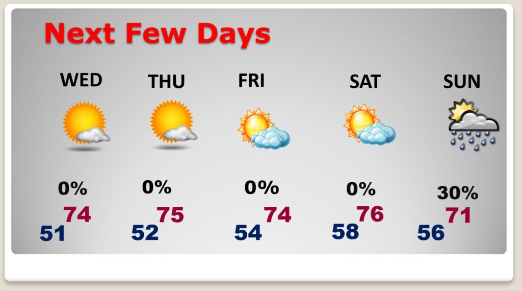
An approaching cold front will bring scattered showers by Sunday PM, followed by a BIG Arctic plunge


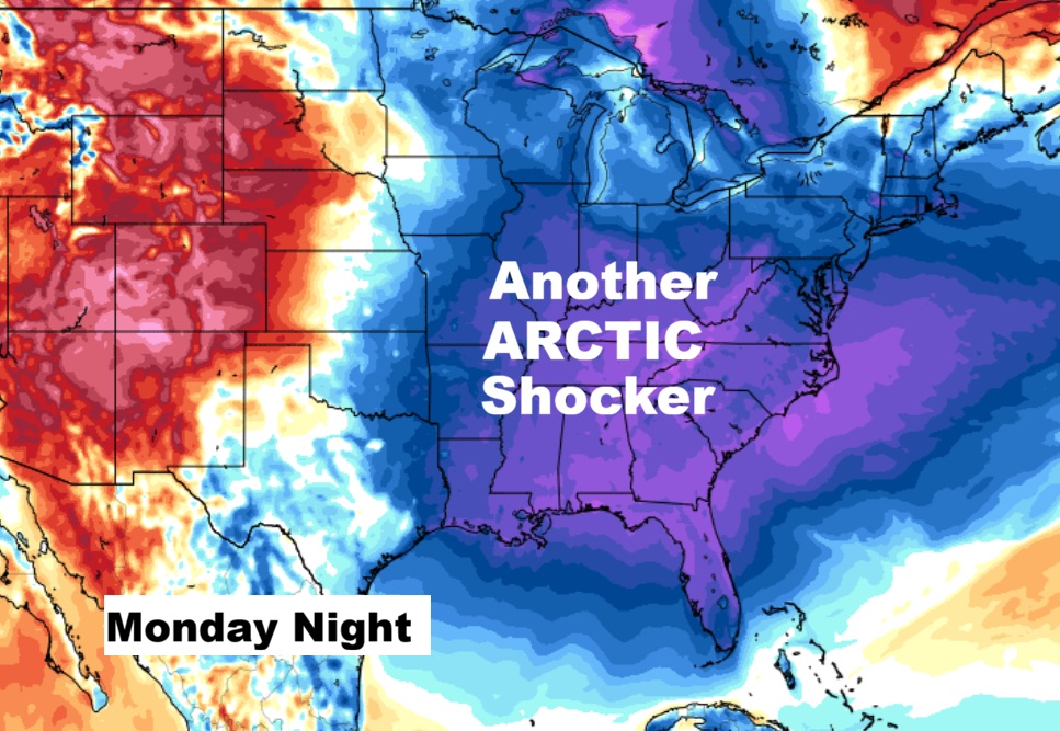
The 10 Day model blend temperature trend. Enjoy the Christmas warmth. A major Arctic plunge arrives by Monday. Another sharker.

Here’s the 16 day from the Euro model. Warm this week. MUCH cooler next wee as we head toward the New Year.

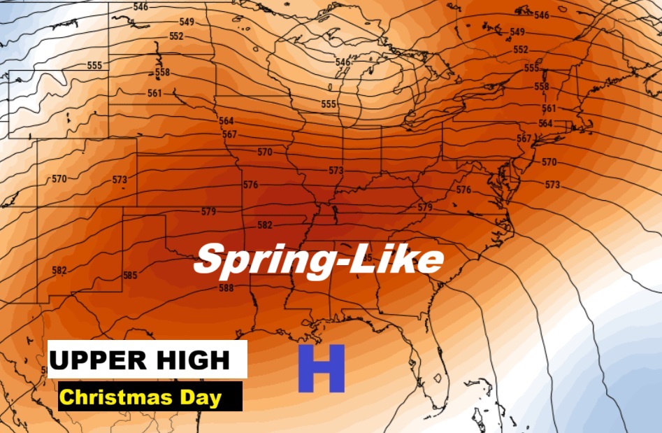
CHRISTMAS FORECAST: It’s a remarkable Christmas forecast. Enjoy it. Next week this warm weather will be a memory.

An Amazing ridge of upper ridge of high pressure will be in control. Temperatures over the America Heartland will be running 25-30 degrees above normal.
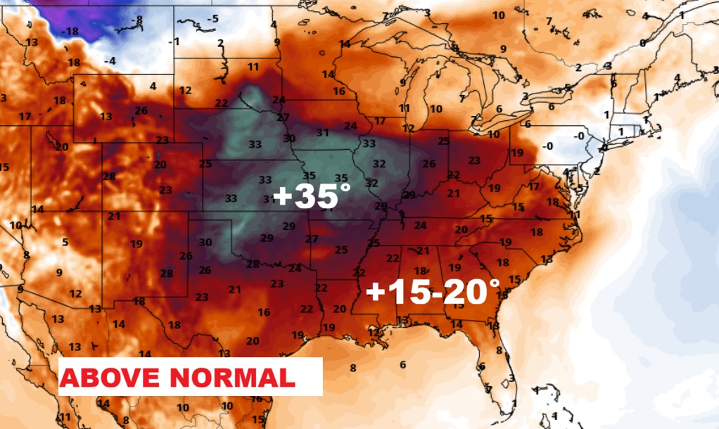
Take a look at the projected high temperatures across the Southeast US Christmas afternoon.

Normal hi/lo on Christmas Day would be 60/38.
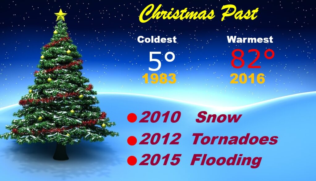
Christmas Day Records: 82 in 2016 – and 5 in 1983.
Thanks for reading this Blog this morning. This morning we are LIVE on the radio from 6 to 9 on NewsTalk 93.1. I’ll have another update for you in the 4 o’clock hour tomorrow morning. Have a nice day.
–Rich