
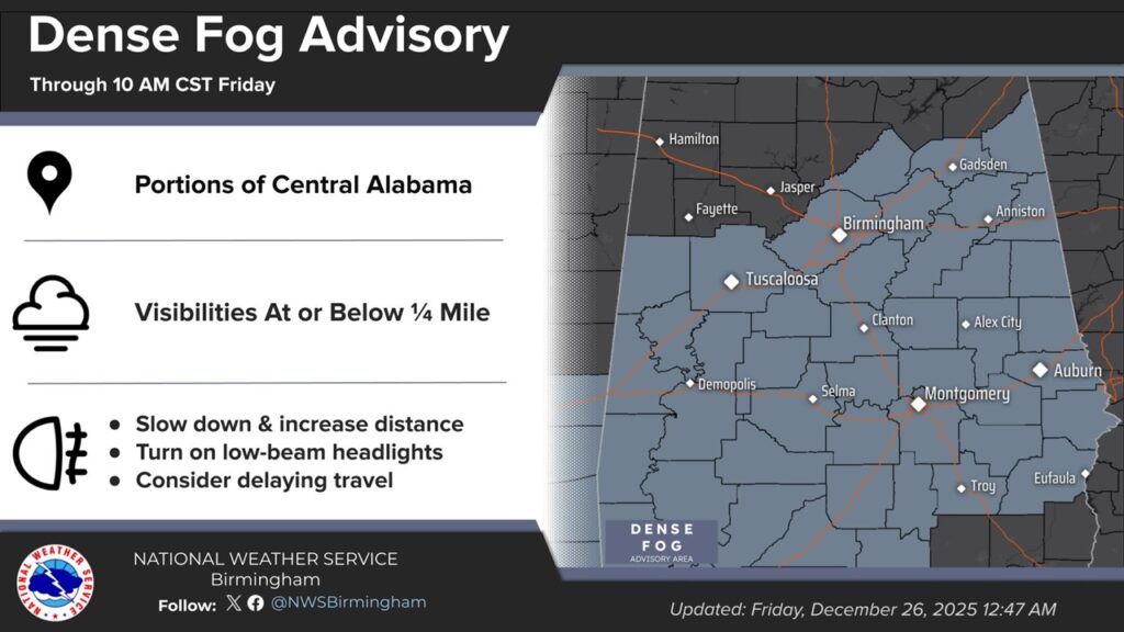
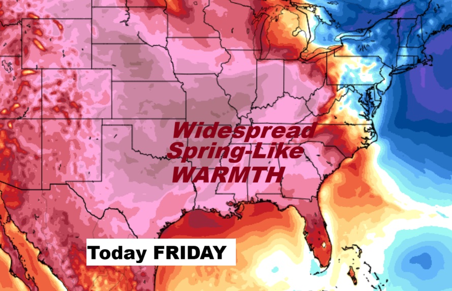
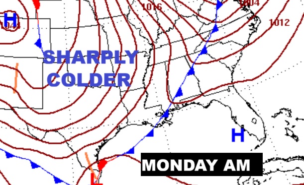
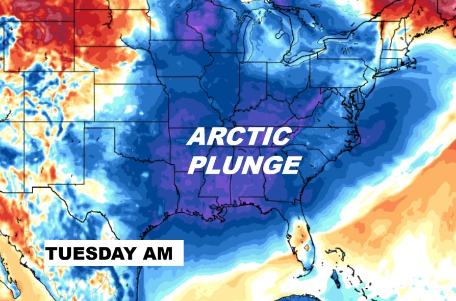
Good Morning! For about the 5th day in a row a DESNE FOG ADVISORY is in effect early this morning. Visibility near zero in spots. Otherwise, What an amazing pattern Christmas week pattern we’ve been enjoying. Christmas Eve we had a near record high of 78. Christmas day was amazing with 77. Near 76 today and Saturday and 77 Sunday. ENJOY it because.. An approaching strong cold front will bring scattered showers by late Sunday night and half the day Monday, followed by a major Arctic plunge. Monday night we’ll plunge to the 20’s. Tuesday’s high will only be in the lower 40’s. Wednesday morning looks bitterly cold in the lower 20’s. A complete change of climate.
CLIMATE SUMMARY: The Christmas Day High was 77 after a morning low of 50. Record high 82 in 2016. Normal: 60/38. Last Christmas High 64.
TODAY:
DENSE FOG ADVISORY: For about the 5th day in a row a DESNE FOG ADVISORY is in effect early this morning. Visibility near zero in spots. Dense fog before 9am.
Otherwise, mostly sunny, with a high near 76. West wind 5 to 10 mph. TONIGHT: Partly cloudy, with a low around 59. Calm wind.
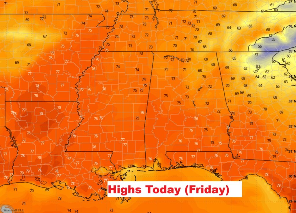
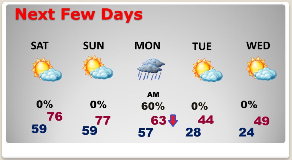
NEXT FEW DAYS: Dry through Saturday. Highs in the 70’s are expected today through Sunday. Showers move in the overnight hours Sunday night, and through Monday morning. Then, temperatures will start to plunge. A major Arctic plunge is on the way. Monday night will plunge to the 20’s. Tuesday’s high will only be in the lower 40’s. Wednesday morning looks very cold. Lower 20’s.
Here’s the 10 Day Model Blend Temperature Trend.

Thanks for reading this Blog this morning. Have a wonderful holiday Weekend!
–Rich