
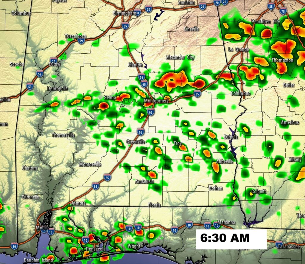
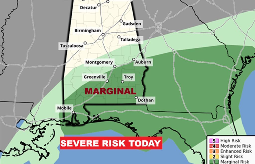
Good Morning! Early this morning, Radar is active with more scattered showers, as a low pressure and frontal system moves through our state. The greatest threat of the most concentrated showers and storm will be over the Southeast third of the state today, where there is a Level 1 Marginal Severe Risk. Behind the front it will turn cooler tonight and Sunday, but not cold. Sunshine returns Sunday. Look for a pronounced warming trend next week. Highs in the 70’s will return. Next small chance of showers returns by about Thursday.
TODAY: Rain and thunderstorms likely before noon, then a chance of rain. Mostly cloudy, with a high near 69. Southwest wind around 5 mph becoming north in the afternoon.
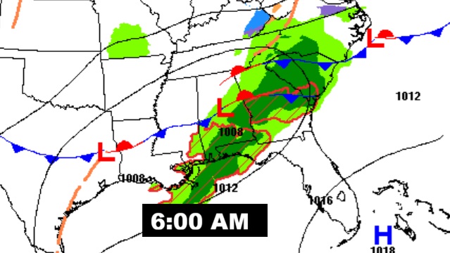
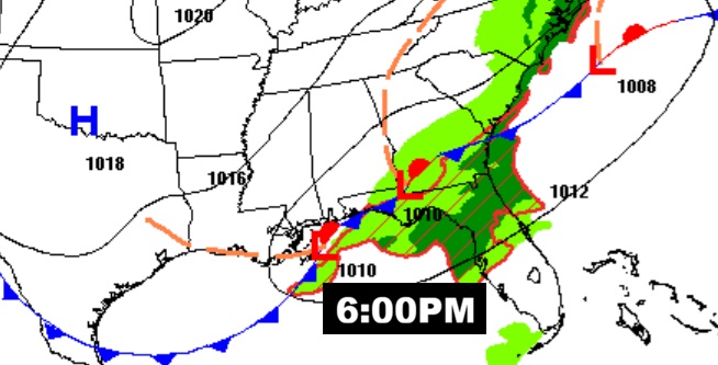
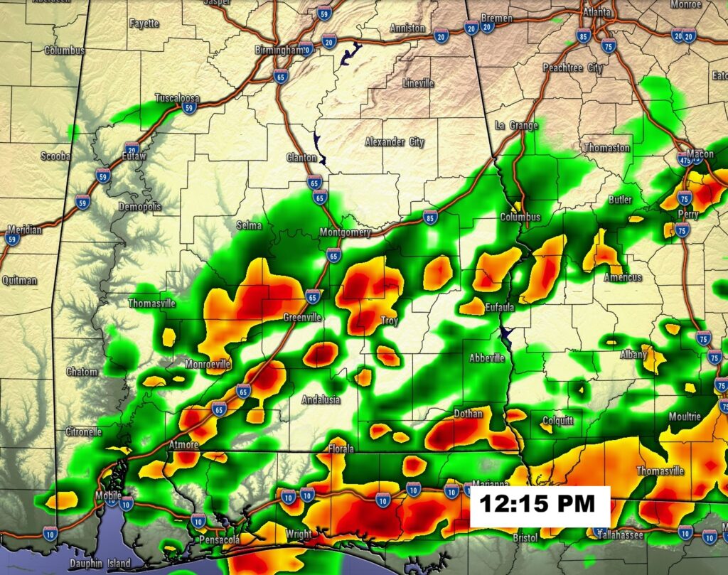
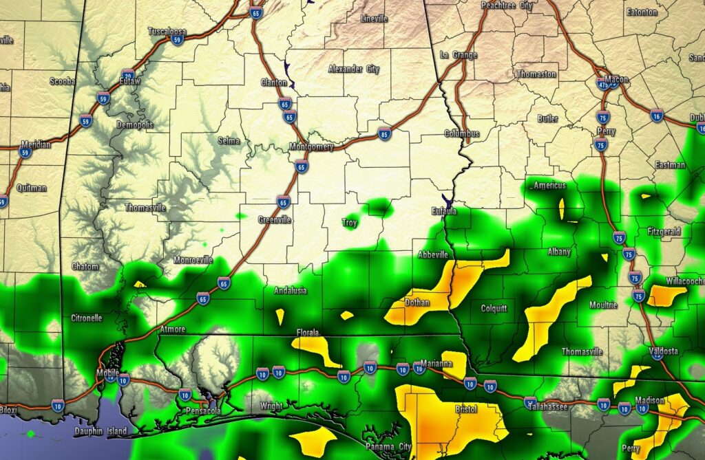
FUTURE RADAR: The models may be a little overdone, especially the shot a little after Noon. But, the point is, the greatest threat of the more concentrated showers and storm will be over the Southeast third of the state today.
MARGINAL SEVERE RISK: Today’s Level 1 Marginal Severe Risk covers all of SE Alabama, mostly from Montgomery southeastward. Damaging wind gusts are the main risk. A brief tornado or two can’t be ruled out.
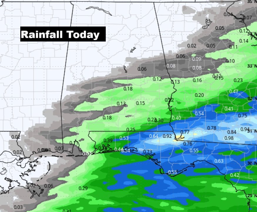
Here’s the expected rainfall next 12 hours or so. As of 4:30 AM, MGM has had .05”. Same thing at my house in East Montgomery: .05”.
FULL MOON: Been getting glimpses of that spectacular Full Wolf Supermoon this morning. We’ll likely be able to get a good view tonight. Moonrise this evening at 5:14 PM.

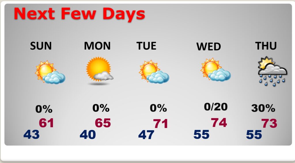
NEXT FEW DAYS:
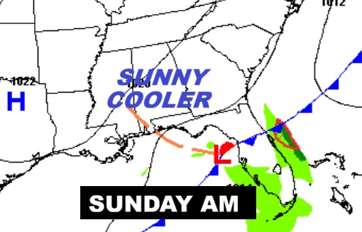
Sunshine returns Sunday. It will be briefly a little cooler. Look for a pronounced warming trend next week. Highs in the 70’s will return. Next small chance of showers returns by about Thursday.
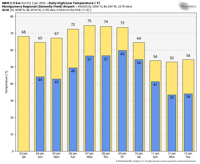
Here’s the 10 Day Model Blend Temperature Trend. Next week looks warm and comfortable, before the next cool-down.
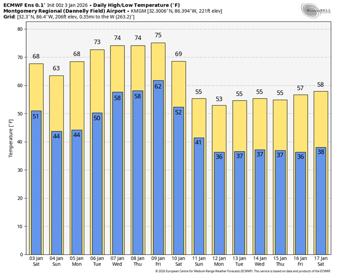
Here’s a peak at the EURO 16 day Ensemble outlook. Next week looks quite warm…in the 70’s. But, notice that pronounced cooler trend toward the middle of the month.
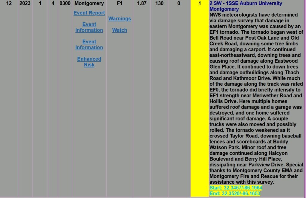
TORNADOES ON THIS DATE 2023: There were a series of nine tornadoes on this day in 2023 and 4 more on January 4th in thew wee hours.
There was one EF-2 In Elmore county at 1:42PM (1/3/2023). There were four EF-1s and two EF-2’s.
On the 4th – the city of Montgomery had a EF-1 tornado at 3AM which did considerable damage in many neighborhoods. Came close to my house here in East Montgomery. I was covering the tornadoes from the station in that time.


Thanks for reading this Blog this morning. The next scheduled complete Blog update and Video Forecast Discussion is scheduled for the 4 o’clock hour on Monday morning. Have a great weekend.
-Rich