
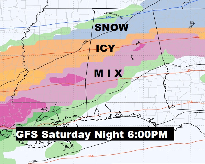
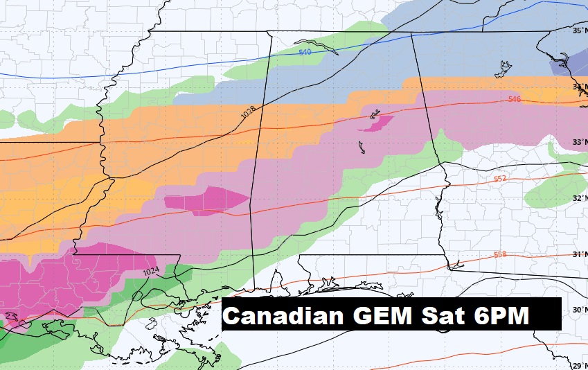
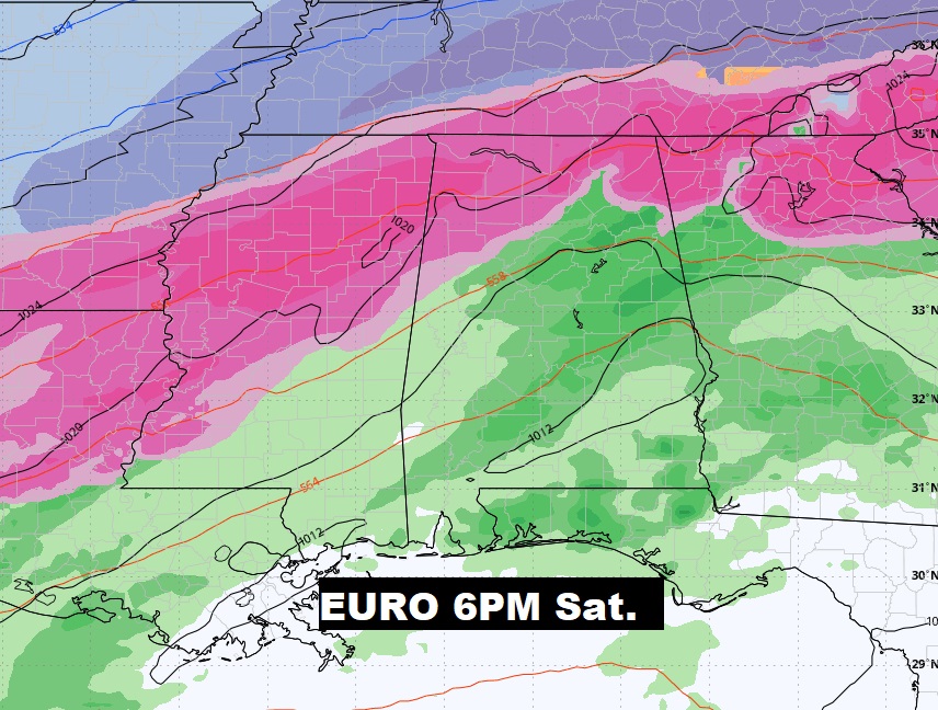
UPDATE: Do we ever trust the American GFS models on it’s winter weather’s projection beyond 5 days? Rarely, if ever. But, now run after run, it’s got our attention. Could there be a Deep South Winter Weather issue this weekend. We’ll now be watching future model runs like a hawk. #alwx
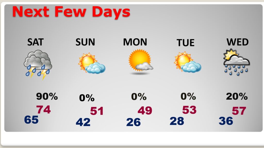
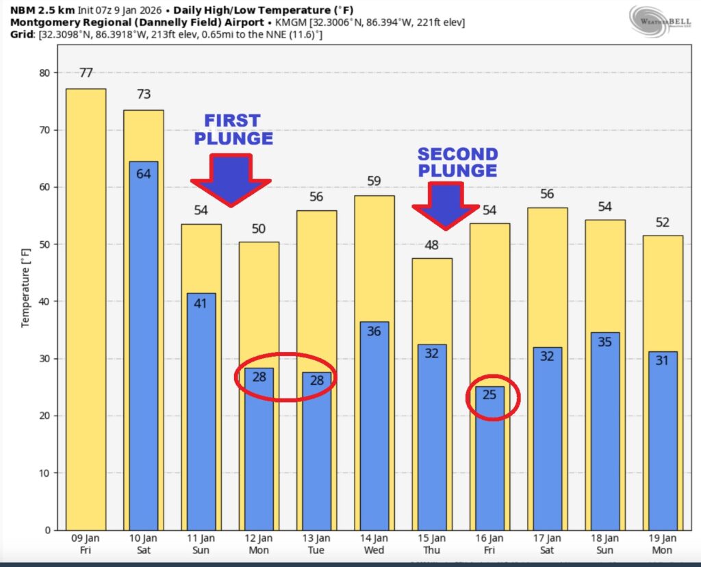
Good Morning! Get ready for a big change as a storm system and Cold Front Approaches. This will set the stage for the first severe weather threat of the New Year. Much of west Alabama is in a Level 2 Severe Risk, with the greatest Tornado Risk. There is a Marginal Severe Risk for most of us. Damaging wind gusts are the main threat. A few tornadoes are not out of the question. Sharply Colder Arctic Air follows starting Saturday night and Sunday. We’ll be in the 20’s Sunday night. Monday we may fail to make it to 50 degrees. There will be a Second Arctic Plunge later next week in the Wednesday night/Thursday time frame. The Second surge could be colder. Click below for more. Have a nice day! Here’s my brief video forecast discussion.
TODAY: Patchy fog before 8am. Rain and thunderstorms likely, by this afternoon Otherwise, cloudy, with a high near 77. South wind 6 to 12 mph. TONIGHT: Rain and storms likely. . Cloudy, with a low around 65. South wind 5 to 10 mph, with gusts as high as 20 mph.
NEXT FEW DAYS:
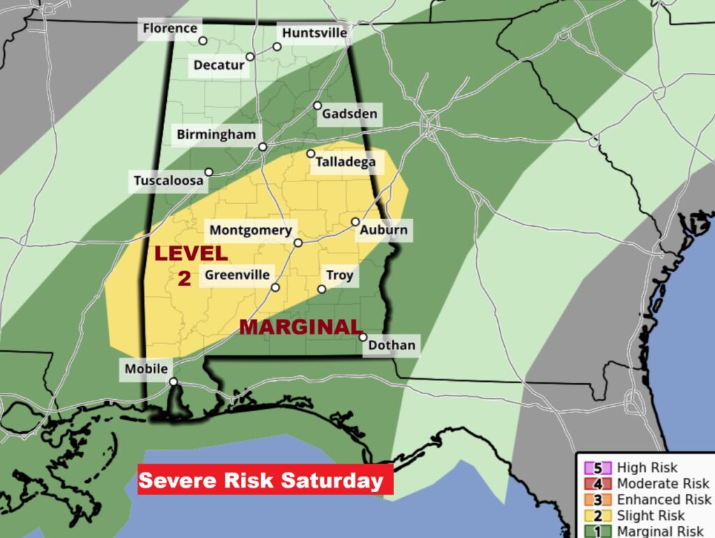
Second surge of surge of showers begins early Saturday. Some storms could be severe. Marginal Severe Risk.
We’ll be in the low to mid 70’s Saturday. Sharply Colder Arctic Air follows starting Saturday night and Sunday. We’ll be in the 20’s Sunday night.
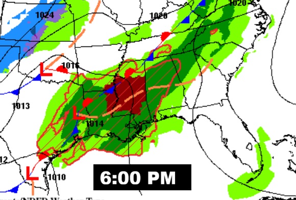
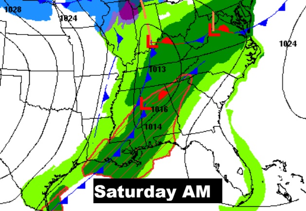
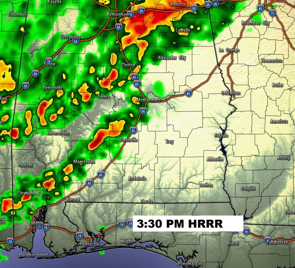
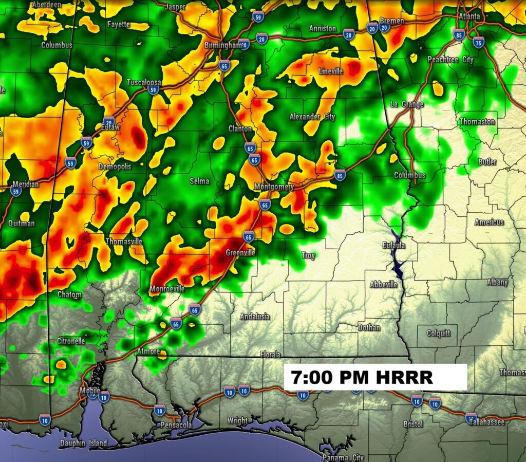
Here’s the complex Severe set-up this evening and Saturday.
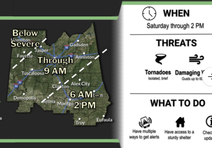
Much of west Alabama is in a Level 2 Severe Risk, with the greatest Tornado Risk. There is a Marginal Severe Risk for most of us. Damaging wind gusts are the main threat. A few tornadoes are not out of the question.
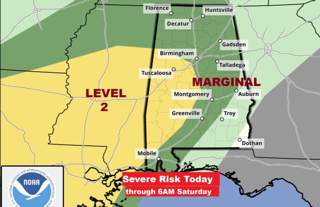
Unfortunately, SPC has upgraded the Day 2 Saturday Severe outlook to Level 2 for most of central Alabama and south Alabama south to Troy. While damaging winds are the main threat, isolated tornadoes can not be ruled out. Stay weather aware. Severe weather Round one begins this afternoon and this evening . The round 2 Risk map begins at 6AM Saturday. #alwx
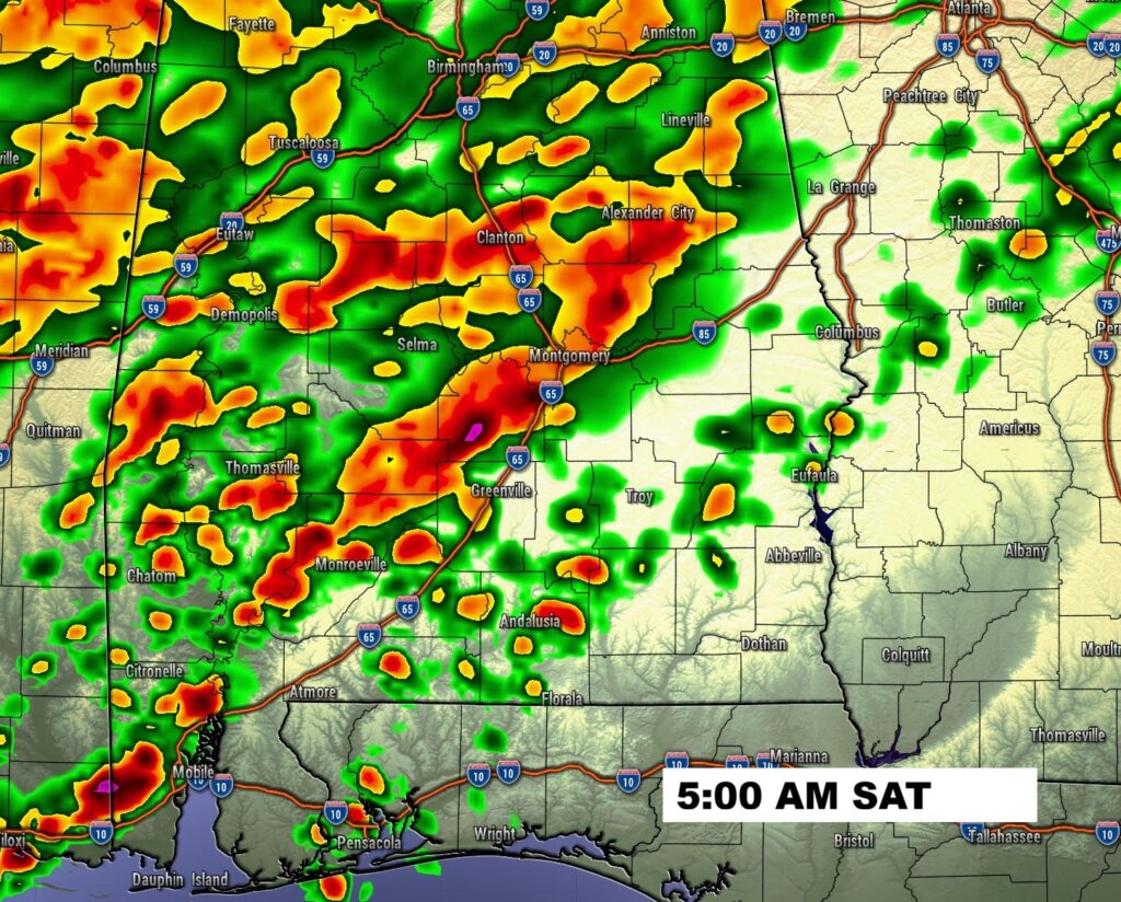
FUTURE RADAR: Radar will be very active. Round one severe weather will begin this afternoon. Round two starts early Saturday.
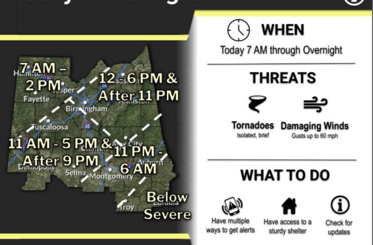
The potential timing map for today is complex.
Here’s the timing for the Day 2 Severe Threat Saturday.
Here’s the expected rainfall next 7 days. Excessive rainfall totals could cause flooding across much of central and northwest Alabama. Flash Flood Watch from the Alabama river northward.
Here’s the model blend 10 day expected rainfall outlook. Warm through Friday with highs in the 70’s. Sharply Colder Arctic Air follows starting Sunday.
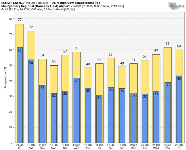
Here’s a peak at the EURO 16 day Ensemble outlook. Get ready for a big change of climate.
Thanks for reading this Blog this morning. This morning we are LIVE on the radio from 6 to 9 on NewsTalk 93.1. I’ll have another update for you in the 4 o’clock hour tomorrow morning. Have a nice day.
–Rich