A Tornado Watch is now in effect for most of central Alabama, until 10:00AM. The watch area is as far south as Montgomery and Lowndes county, and extends eastward into Georgia. Damaging wind gusts to 70 mph, large hail (up to half inch size) and a few tornadoes possible, If you live in a mobile or manufactured home go to a safer structure during this tornado watch. Our weather App will keep you up to date with instant push notifications for Severe Weather Warnings. Plus, radar and future radar. It’s FREE in the App store. Search: Rich Thomas weather. Allow notifications. Stay Weather Aware! Do not trust weather sirens. They can be unreliable. This is officially US Tornado Watch number 3 for 2026. #alwx
If you our Weather App, you probably heard my voice coming out of your phone at 3:50 AM announcing the Tornado Watch. If you go under a warning at your location, you’ll here my voice again.
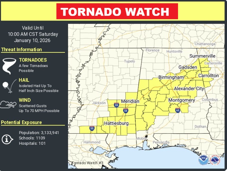
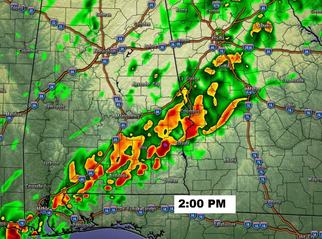
A Tornado Watch continues in effect for most of central Alabama, until 10:00AM. Check out Future Radar showing a vivid squall line (QLCS) moving into the US 80/I-85 Corridor at 8:45 AM, along the Cold Front moving southeastward. Then, notice after about lunchtime the storm threat shifts into Southeast Alabama. In the Tornado Watch area expect: Damaging wind gusts to 70 mph, large hail (up to half inch size) and a few tornadoes possible. #alwx


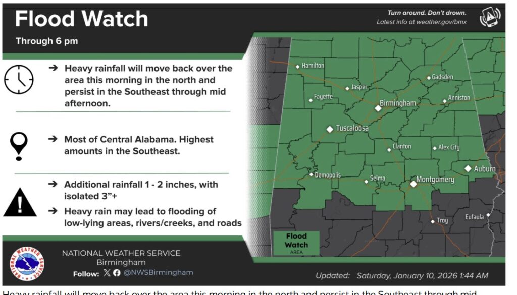
Also, a Flash Flood Watch continues in effect as far south as Montgomery and Lowndes county where 1-2″ of rain is expected and locally up to 3″.4
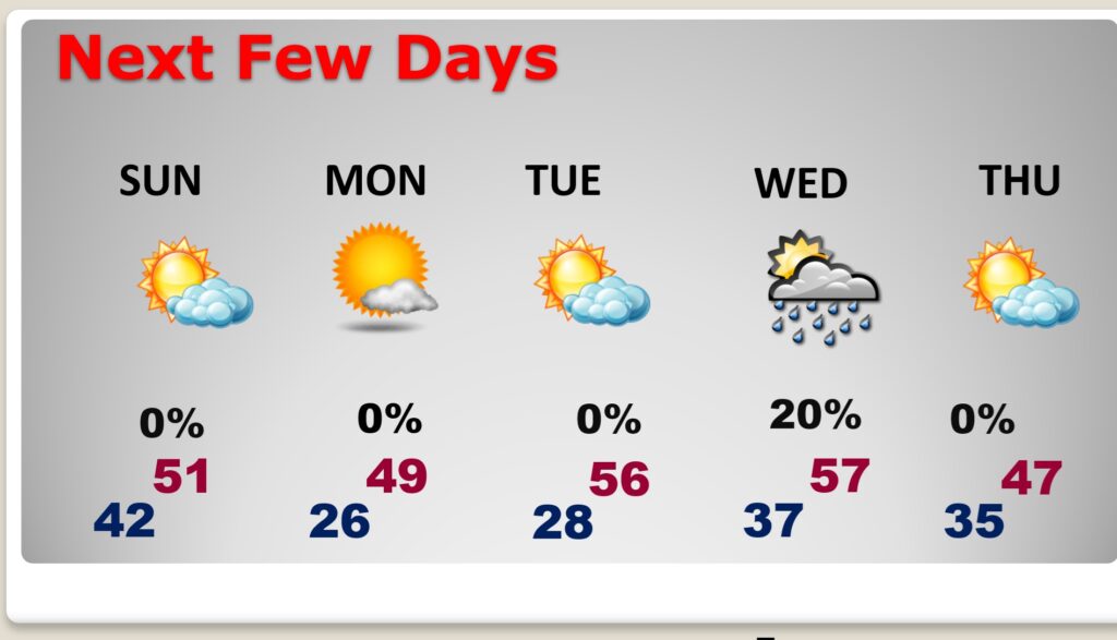
NEXT FEW DAYS:
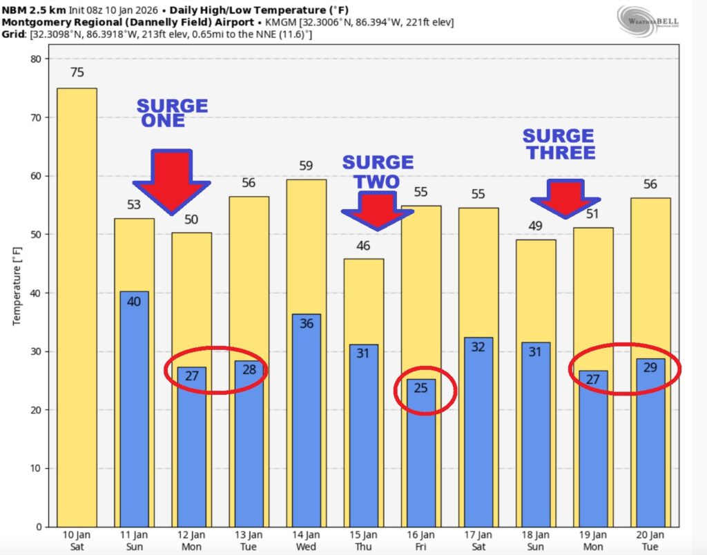
After today’s Severe Weather Threat ends, get ready for some big changes. Sharply Colder Arctic Air follows starting Saturday night and Sunday. We’ll be in the 20’s Sunday night. Monday we may fail to make it to 50 degrees. There will be a Second Arctic Plunge later next week in the Wednesday night/Thursday time frame
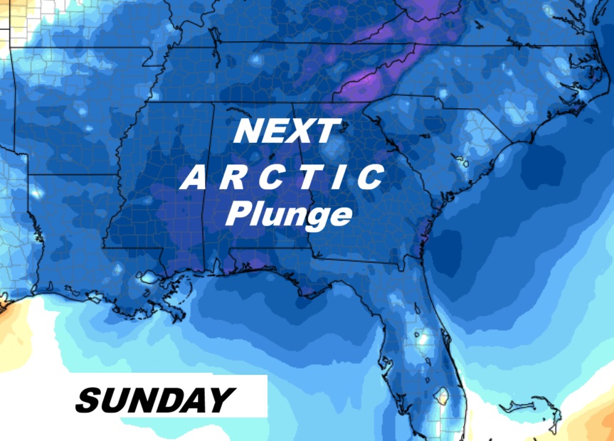
There are multiple shots of Arctic Air in our future in the next 10 days.