
Good Morning! Happy Friday. It’s cold. After this extremely cold start this morning…. not a bad day ahead. Today is likely to be the “warmest” day of this week. We may tease 60 degrees. That sounds nice. But, this milder air will be quite brief. An approaching cold front could bring some overnight rain to the state. Scattered showers are possible. More precipitation is possible with a second front pre-dawn Sunday. The probability of ANY precipitation is low. Some models continue to advertise the possibility of snow flurries mixed in with light rain. But, with each the model run, the probability of ANY snow is very small. The greatest probability would be in the extreme southeast counties early Sunday morning.
Meanwhile, repeated Arctic Incursions will continue – with some very chilly days and very Cold nights will into next week.
Here’s my brief video forecast discussion.
TODAY: Sunny. Milder. High near 60. (Normal 59/36) Light southeast wind becoming south 5 to 10 mph in the morning. Winds could gust as high as 20 mph.
TONIGHT:
Increasing clouds, with a low around 44. Risk of scattered showers overnight ahead of the next front.
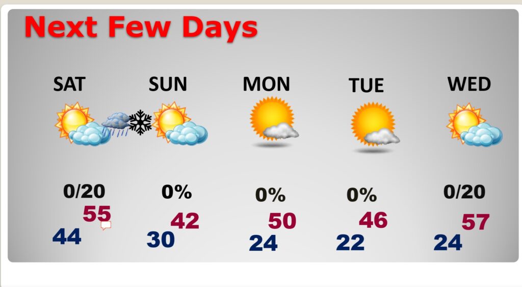
NEXT FEW DAYS: The shower risk on Saturday ends early. It’ll be cooler. Partly cloudy. High 55. Small risk of precipitation early Sunday morning. Only 20%. COLD Sunday, Sunday night and MLK day Monday. Coldest nights will be Sunday night, Monday night and Tuesday night with low to mid 20’s. Warmest day next week will likely be Thursday with lower 60’s possible.
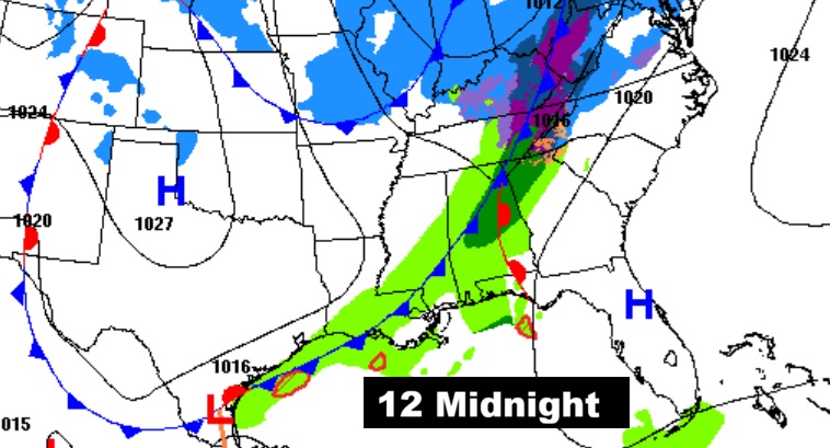
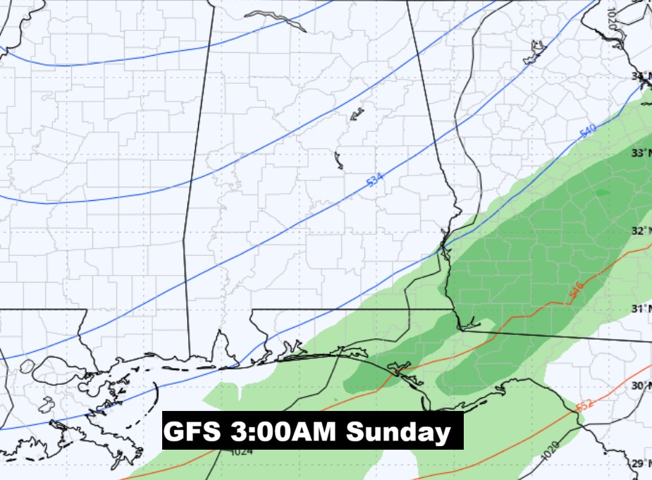
WINTER WEATHER ISSUES EARLY SUNDAY MORNING?: More precipitation is possible with a second front pre-dawn Sunday. The probability of ANY precipitation is low. Some models continue to advertise the possibility of snow flurries mixed in with light rain. But, with each the model run, the probability of ANY snow is very small. The greatest probability would be in the extreme southeast counties early Sunday morning.
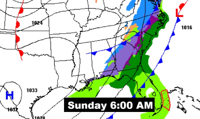
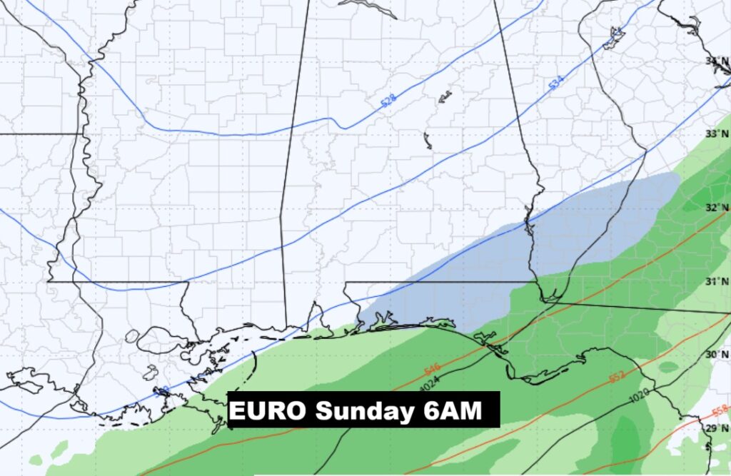
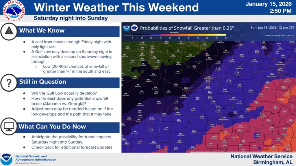
NWS addresses the complexities of potential snowflakes mixed with raindrops pre-dawn Sunday AM. TINY chance. Not quite zero – but fortunately very small.
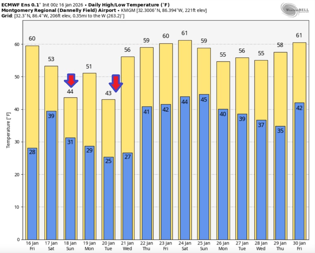
Here’s the model blend 10 day temperature trend. There will multiple Arctic intrusions into the early and middle part of next week. Very Cold nights and chilly days.

Here’s a peak at the EURO 16 day Ensemble outlook. Notice: more reasonable temperatures are on the horizon later in the week.

Thanks for reading this Blog this morning. This morning we are LIVE on the radio from 6 to 9 on NewsTalk 93.1. I’ll have another update for you in the 4 o’clock hour tomorrow morning. Have a nice day.
–Rich