
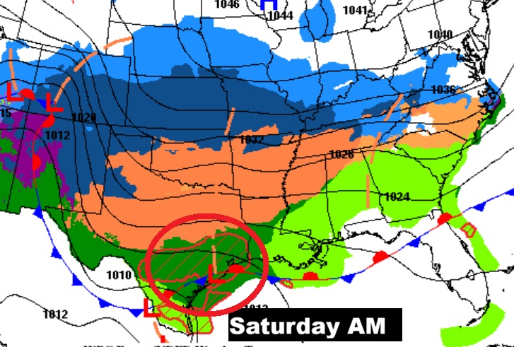
Good morning! There have been some rather significant modifications in the forecast scenario – especially for the upcoming weekend. The models indicate a significant change in the future track of Gulf coast low pressure. A more northerly track will ease the Winter Weather Threat in much of Alabama. The arrival of the extreme Arctic air will be delayed. This spells much more of wet forecast for most of us through the weekend. Disturbance number one will bring periods of scattered showers today, tonight and Friday. The rain treat increases by late Saturday and Saturday night. The main event will be Sunday. Rain and thunderstorms. We’ll monitor any future potential Severe Threat for Sunday. Much colder air moves in Sunday night and Monday. We could be in the teens Monday night. Here’s my video forecast discussion.
TODAY: Periods of showers at times today and tonight. High 59. Low tonight 48.
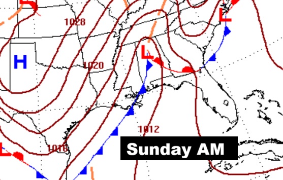
NEXT FEW DAYS: Expect periods of rain at times Friday, Friday night and Saturday. The main rain event will be delayed until late Saturday, Saturday night and Sunday. Showers and thunderstorms are MOST likely Sunday. We’ll monitor any future potential Severe Threat for Sunday.
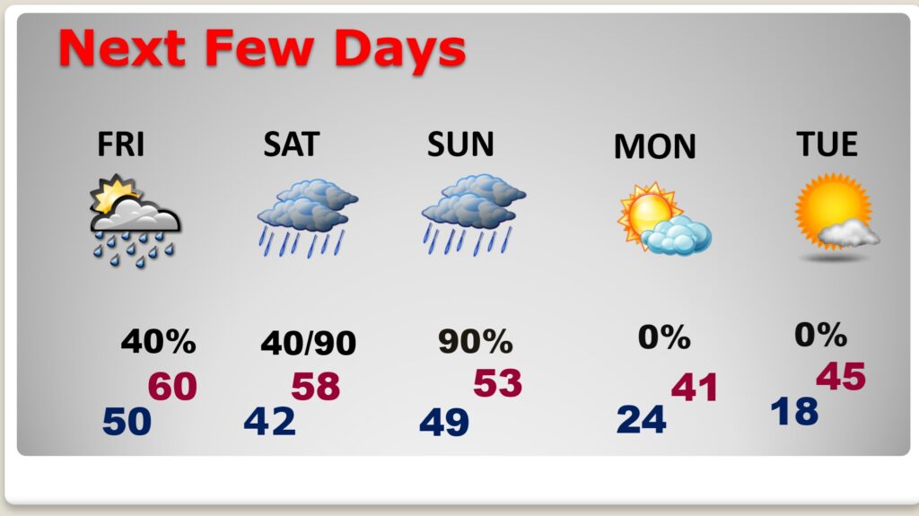
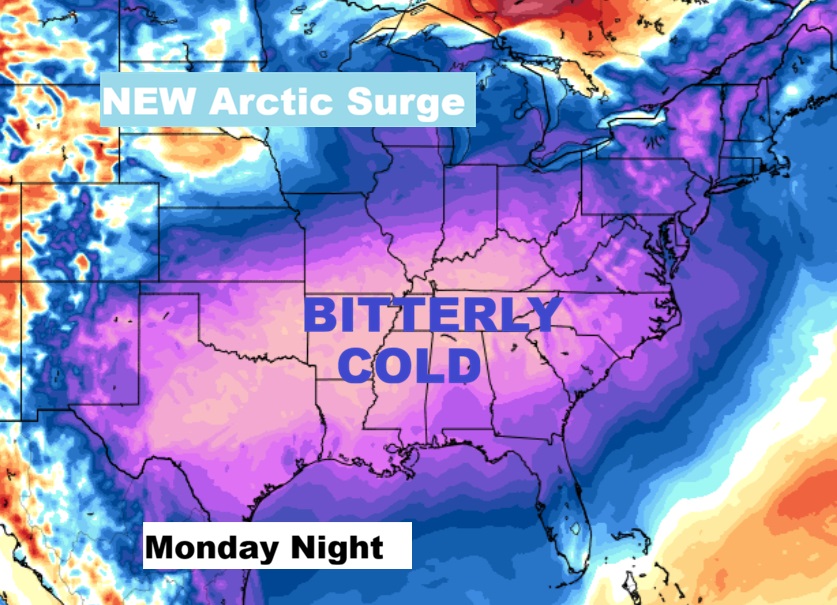
Sunday night: A chance of rain and snow, mainly before midnight. Mostly cloudy, with a low around 24. Much colder Monday as arctic air takes over. We could reach the teens Monday night.
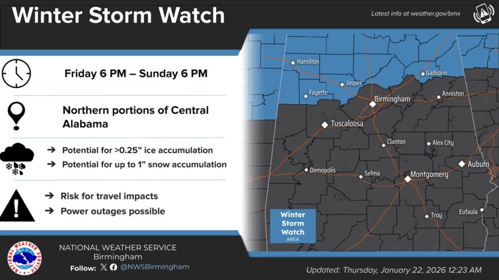
WINTER STORM THREAT SHIFTS NORTHWARD:
There is still going to be a major, potentially historic Winter Storm, where moist Gulf Air encounters Bitter Cold Arctic Air. Look at the extent of Winter Weather Alerts from Texas to the middle Atlantic coastal states.
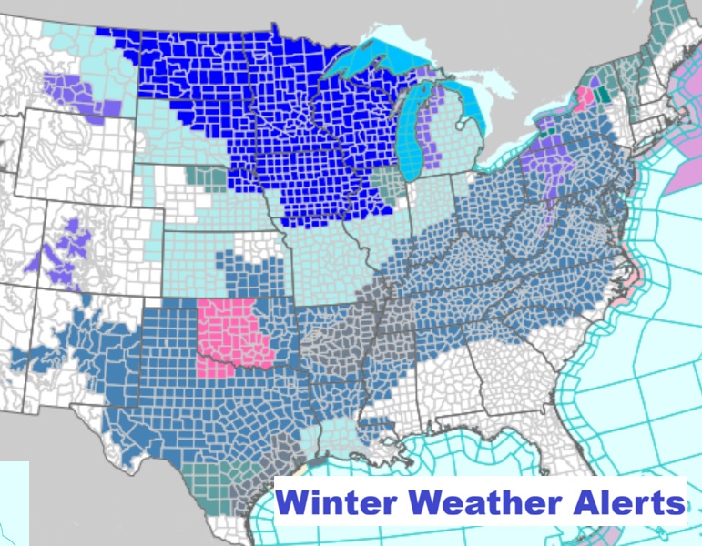
Notice the dramatic change on this map – with minor winter weather impacts now as far south as Tuscaloosa/Birmingham.
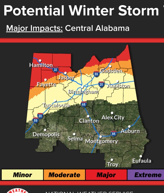
In Alabama: the winter storm watch is now north of a Gadsden/ Jasper/Fayette line starting Friday night.
The projected track of the main low is now much farther north. A dramatic change of tracks.
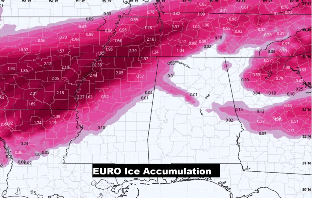
The Ice Storm Threat has shifted several more miles northward. It’s not a slam dunk done deal. But, for much of Alabama, the threat of a cripplingly ice storm has eased. Still though, the Euro model suggests a “Cold Wedge” could cause ice accumulation in central Georgia. That “wedge” needs to be watched.
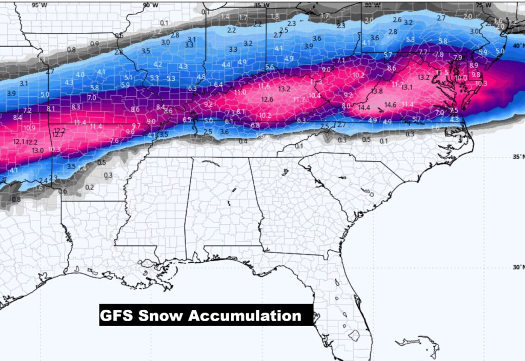
Besides the ICE STORM threat, look at that band of locally very heavy snow is now more likely farther north from Texas to the Ohio valley and middle Atlantic coast. Here’s the GFS.
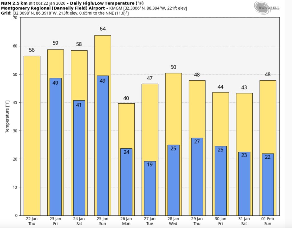
Here’s the model blend 10 day temperature trend. The extremely cold Arctic Advance is delayed till Sunday night and Monday. We could see teens Monday night.
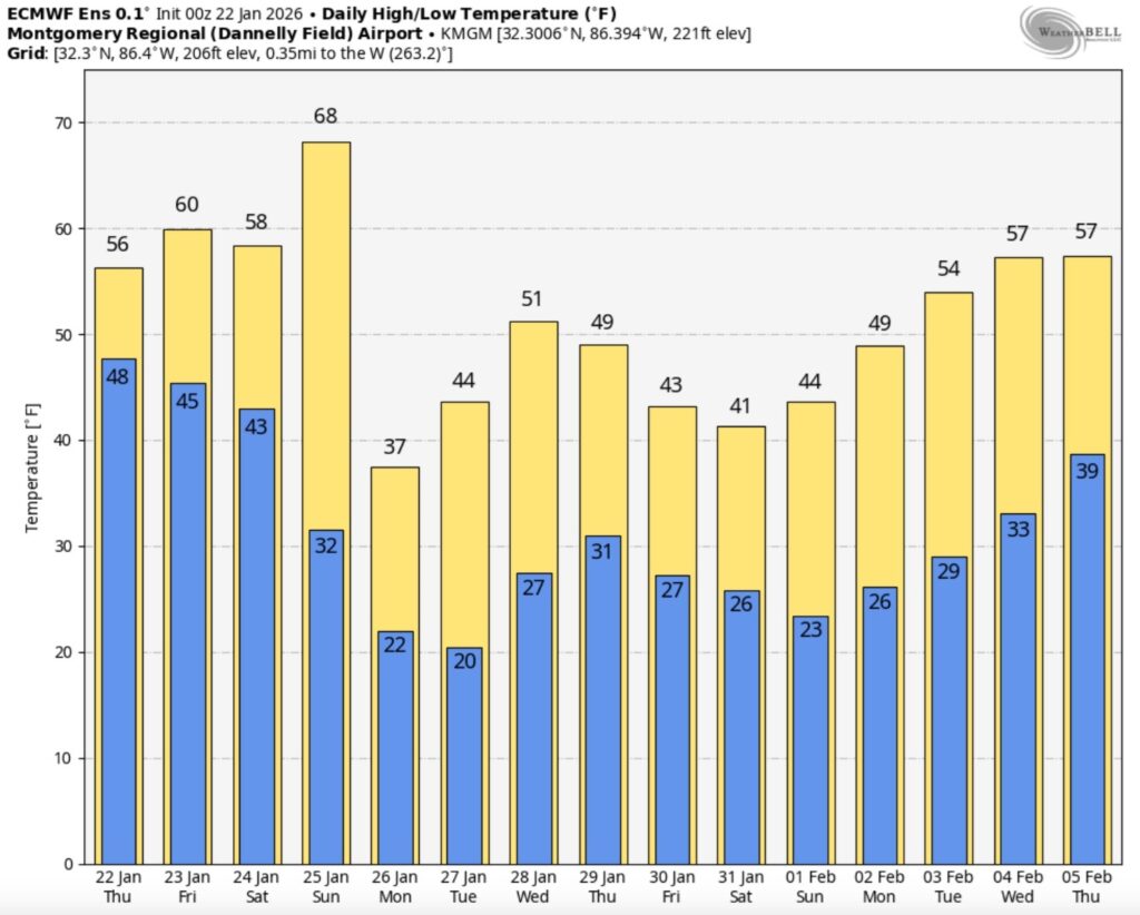
Here’s the EURO 16 day Ensemble temperature outlook. (Normal 60/36).
.
DAYS TILL SPRING: 57 days!

Thanks for reading this Blog this morning. This morning we are LIVE on the radio from 6 to 9 on NewsTalk 93.1. I’ll have another update for you in the 4 o’clock hour tomorrow morning.
–Rich