
Good Morning! Small rain chance for us today. Mainly early. Quiet today. The rain threat for us increases. again by Saturday afternoon and Saturday night. The main event will be Sunday with Rain and maybe strong thunderstorms. Now, a new wrinkle – a Marginal Severe Risk on Sunday, mainly in south Alabama from Montgomery southward. Much colder air moves in Sunday night. There could even be a brief Wintry Mix locally, before the precipitation ends Sunday night. Monday will be an Arctic Cold day. We could be in the teens Monday night. Bitter Cold Arctic Air is in our future. On this Blog Update we’ll profile the incredible historic dangerous scope of this monster winter storm that is about to assault a multi-state area on so many levels. Here’s my video forecast discussion.
TODAY: Risk of rain early. Otherwise, cloudy. High 59. Low tonight 41.
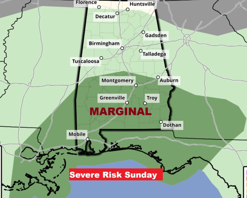
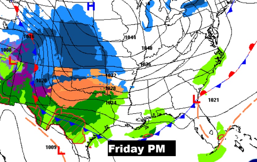
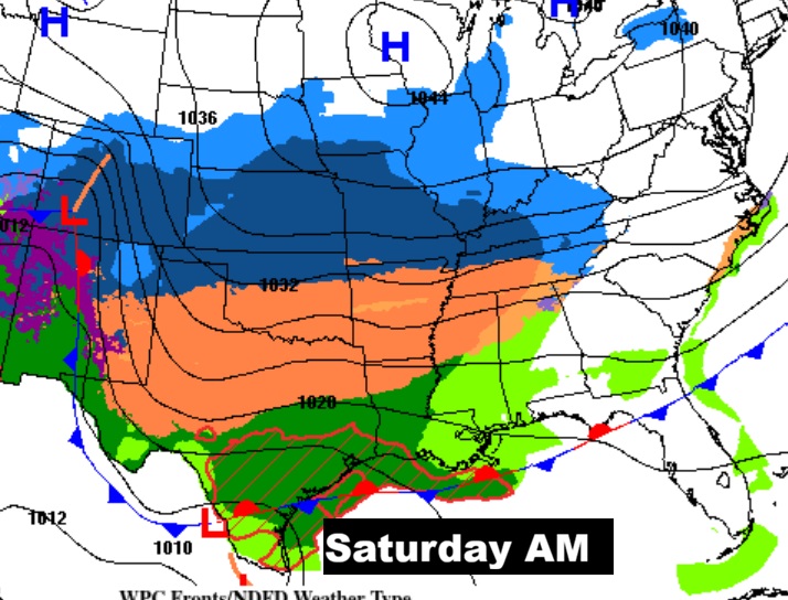
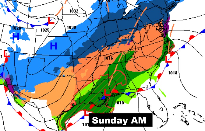
NEXT FEW DAYS: The next significant chance of rain begins Saturday afternoon and Saturday night. The main rain event will be Sunday. Showers and thunderstorms. Now, a new wrinkle – a Marginal Severe Risk on Sunday, mainly in south Alabama from Montgomery southward.
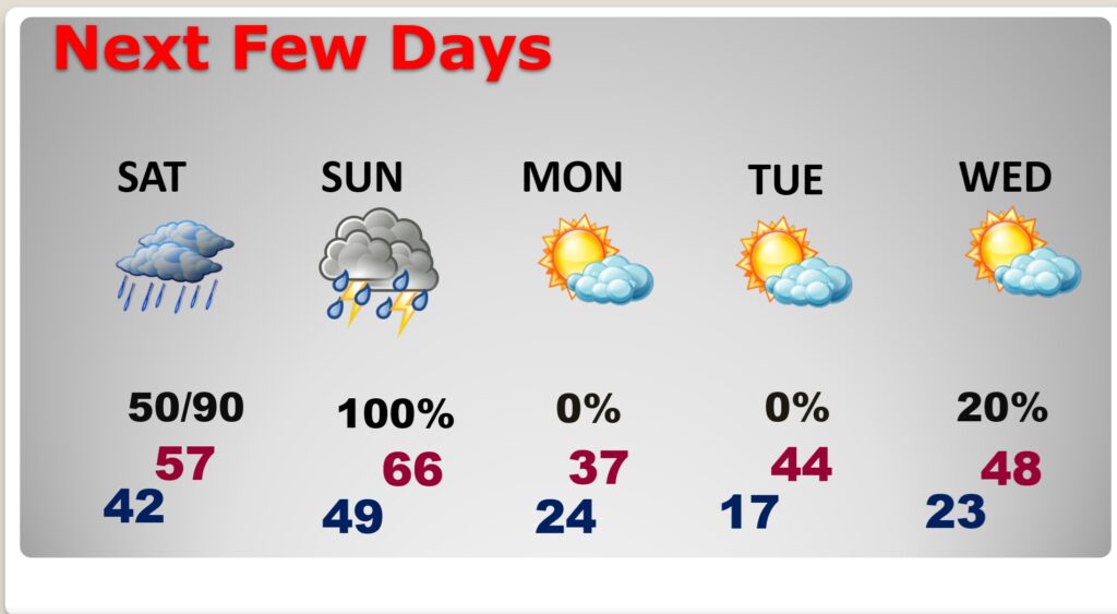
Sunday night: There could be a brief change over to a rain/snow mix, mainly before the precipitation ends by midnight. Mostly cloudy. Turning much colder, with a low around 24. Very cold Monday as arctic air takes over. We’re headed for the teens Monday night.
Marginal Severe Risk Sunday in the warm air sector. While damaging winds are the main threat. Tornadoes can’t be ruled out. Highs in the upper 60’s will be plenty warm, with high dewpoints.
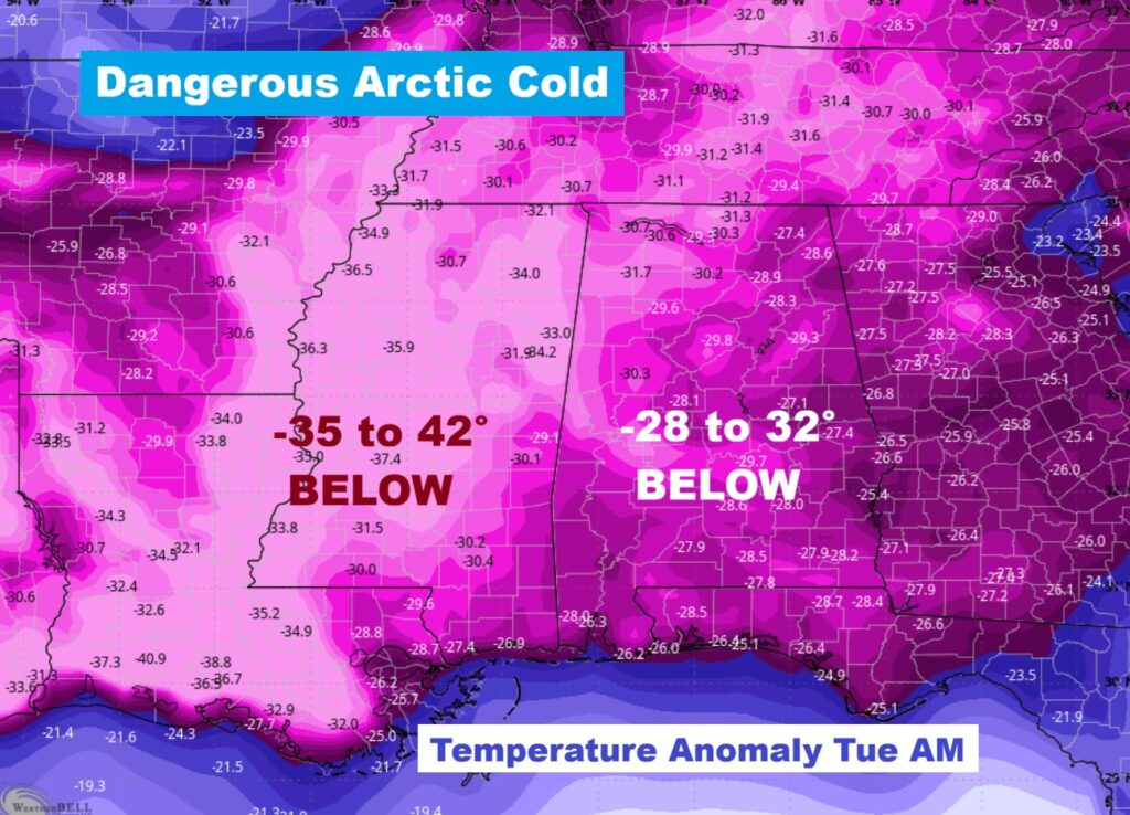
SERIOUS COLD: Temperature Anomaly Tuesday morning. This is dangerous cold. More than 30 degrees below normal or more.
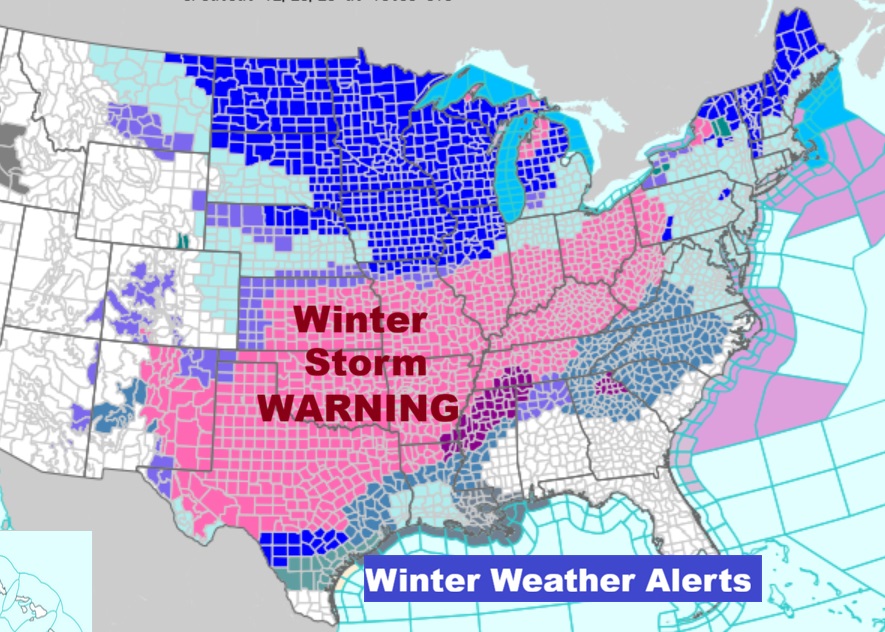
DANGEROUS MAJOR MULTI-STATE WINTER STORM:
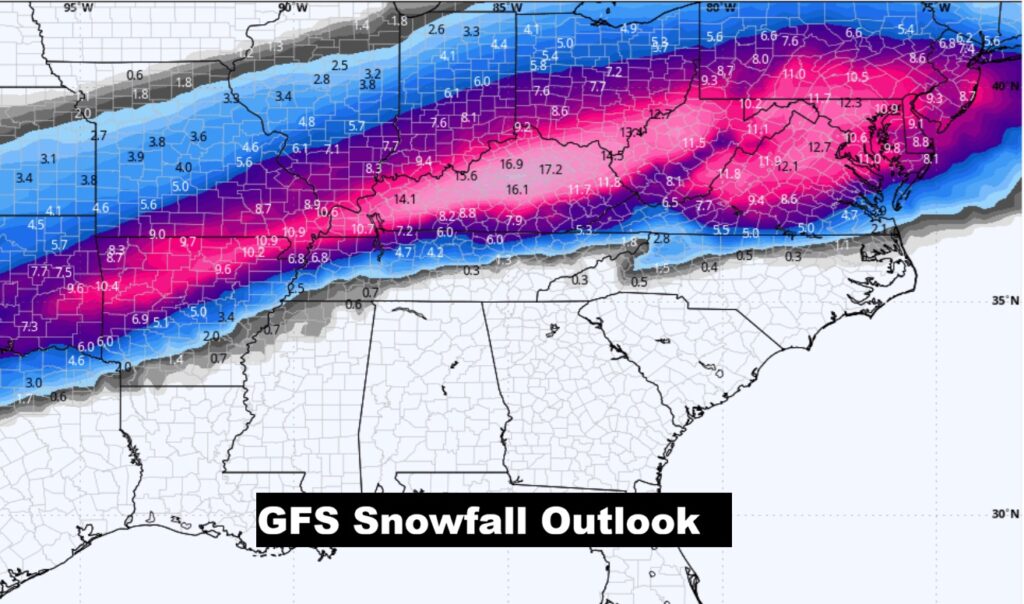
Rarely is there EVER a complicated Extremely Large scope dangerous Winter Storm of this proportion with such a variety of precipitation, including Winter’s Worst peril – ICE ACCUMULATION. In many cities there will be a variety of precipitation. Some places will see snow/sleet, then change over to rain, then dangerous Freezing Rain, then a layer of extremely heavy snow on top of a layer of dangerous Ice. All of that plus extreme Arctic Cold. Power outages will go on for many days. The United States Air Travel scenario will be snarled. Travel on roads will be impossible for a multi-state area. Even the Snow aspect of this storms for parts of the eastern US will rivel any numbers in a decade or more.
Look at the extent of Winter Weather Alerts from Texas to the middle Atlantic coastal states.
The projected track of the main low is now much farther north then the models were indicating earlier this week.
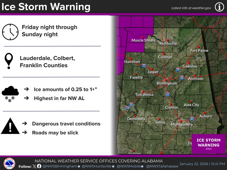
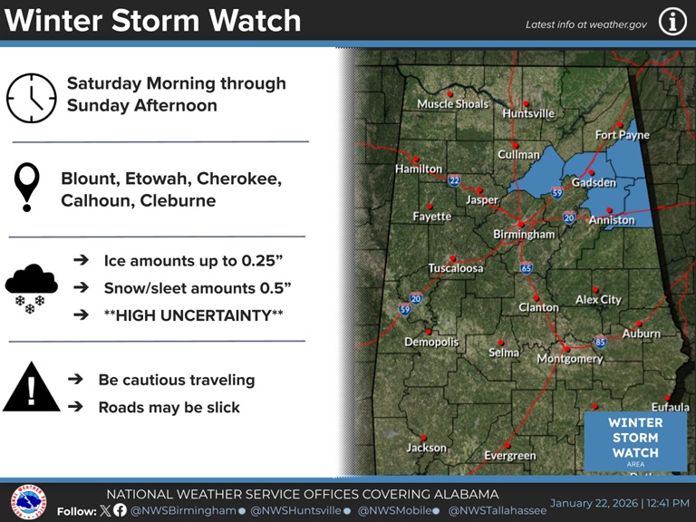
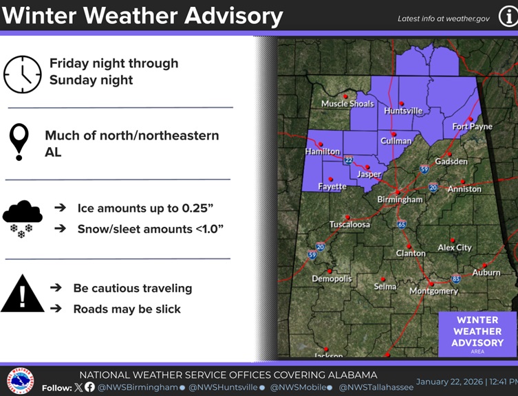
The Ice Storm Threat for Alabama has eased. Some of the main aspects will be in the extreme northern part of the state. There’s a variety of Winter Weather Alerts in north Alabama A winter weather advisory as far south as Fayette/Jasper. Other counties: Winter Storm Watch. Ice Storm Warning in the northwest is serious stuff.
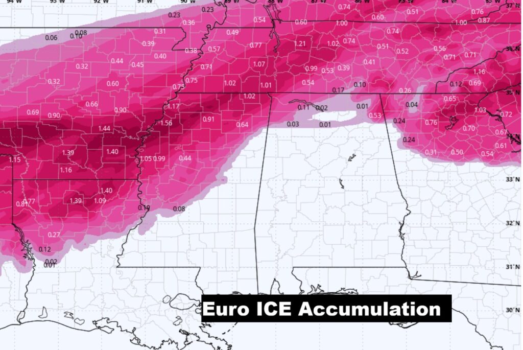
Besides the ICE STORM threat, look at that band of locally very heavy snow. Some of the snow totals will be crazy.
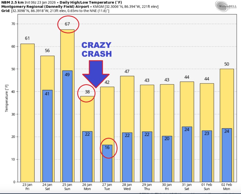
Here’s the model blend 10 day temperature trend. The extremely cold Arctic Advance is delayed till Sunday night and Monday. We could see teens Monday night. Serious COLD is in our future.
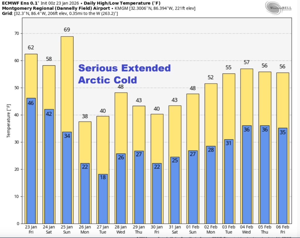
Here’s the EURO 16 day Ensemble temperature outlook. (Normal 60/36).
.
DAYS TILL SPRING: 56 days!
Thanks for reading this Blog this morning. This morning we are LIVE on the radio from 6 to 9 on NewsTalk 93.1. I’ll have another update for you in the 4 o’clock hour tomorrow morning.
–Rich