
Good Morning! Temperatures are still trying to moderate a little bit. Wednesday’s high was 51. That’s a little better. (Normal 61/37). The moderation won’t last long. Expect low 50’s today and Friday. The rain in chance on Friday is not quite zero, but it’s very low. Under 20% in central Alabama.
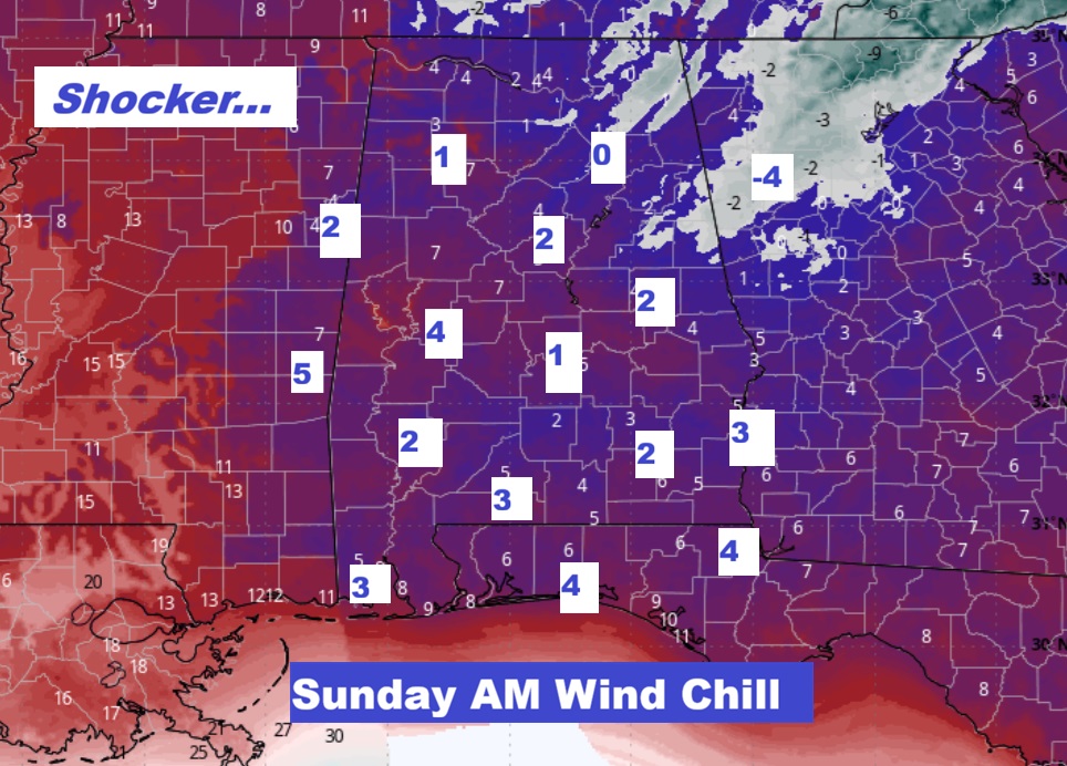
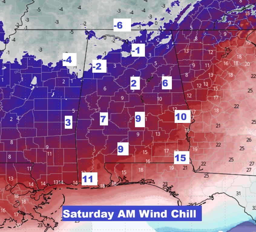
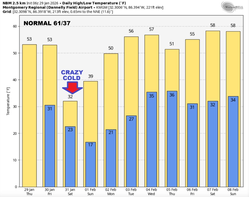
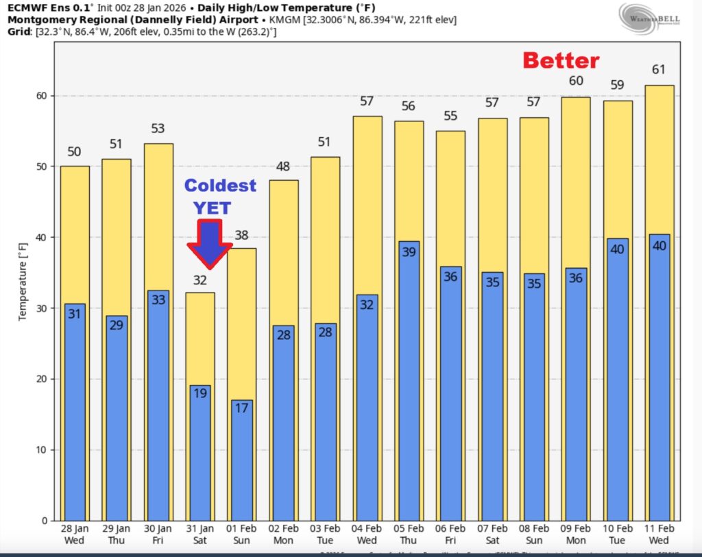
Yet Another Arctic surge will be arriving by Saturday. It will likely be the coldest yet. Saturday’s high may fail to reach the freeze mark. Expect Middle teens for a low Saturday night. One of the biggest story this weekend will involve the Wind Chill. Both Saturday and Sunday AM especially. The Sunday morning wind chill will be zero to 5 above. Meaningful temperature moderation is still several days away. Perhaps, the second week on February. Here’s my brief video forecast discussion.
TODAY: Increasing clouds. High 53. Light wind.
TONIGHT: Partly cloudy. Low 32. Calm Wind.
NEXT FEW DAYS: Friday’s high of 52 is the last “reasonable Day” before the next big drop. The rain in chance Friday is not quite zero, but it’s very low. Under 20% in central Alabama.
Yet Another Arctic surge will be arriving by Saturday. It will likely be the coldest yet. Saturday’s high may fail to reach the freeze mark. Expect Middle teens for a low Saturday night, if not lower. One of the biggest story will involve the Wind Chill. Both Saturday and Sunday AM especially. The Sunday morning wind chill zero to 5 above.
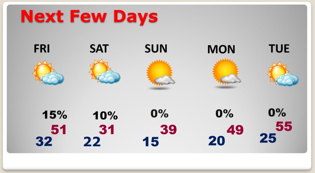
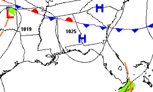
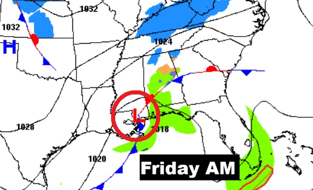
Low pressure along the Gulf coast may bring a few showers to South Alabama on Friday. I have our rain chance under 20%.
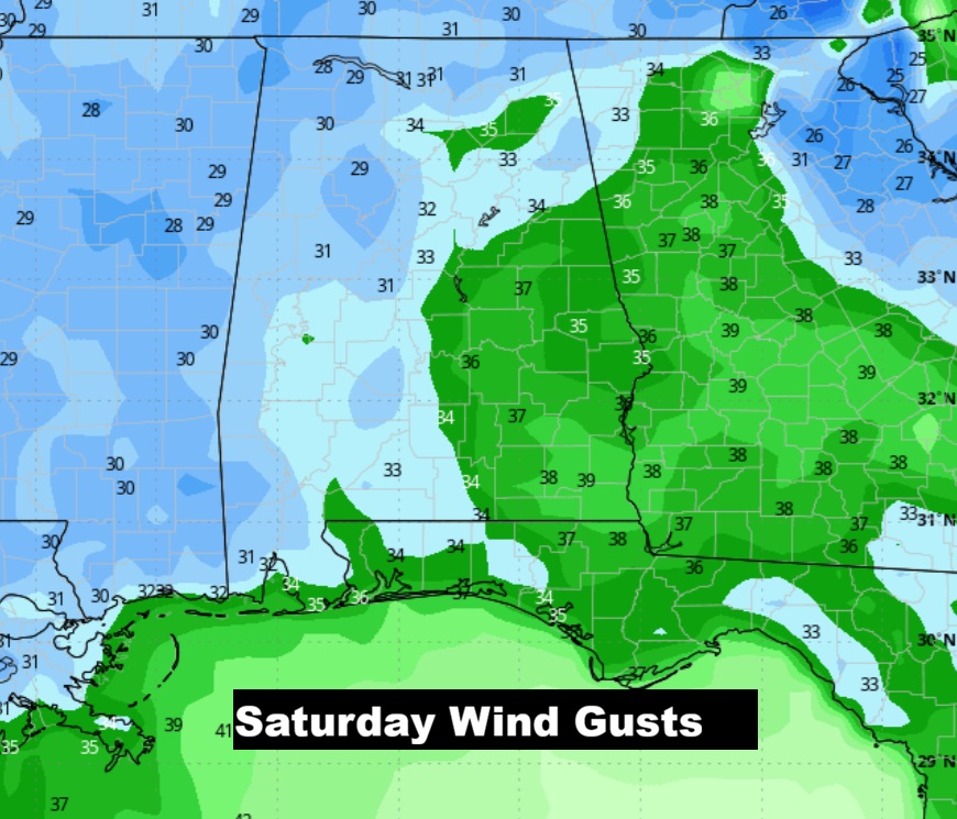
ARCTIC COLD AND WINDY: Not only will it be extremely cold this weekend, very gusty winds will add insult to injury. The GFS shows Saturday afternoon winds gusting 35+ mph. With the actual high near 31, wind chill will hover in the teens. Morning wind chill near 9 Saturday AM and Zero to 5 above Sunday AM. Dangerous Cold. Be sure to be ready to dress in layers. Even in Orlando, FL. Sunday AM wind Chill will be in the teens.
DANGEROUS WEEKEND WIND CHILL: Wow. Both Saturday and Sunday morning will be stupid cold. Dress in layers.
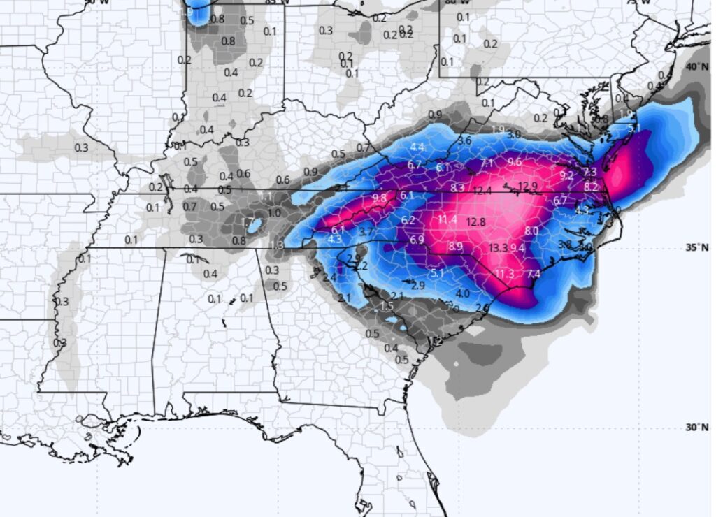
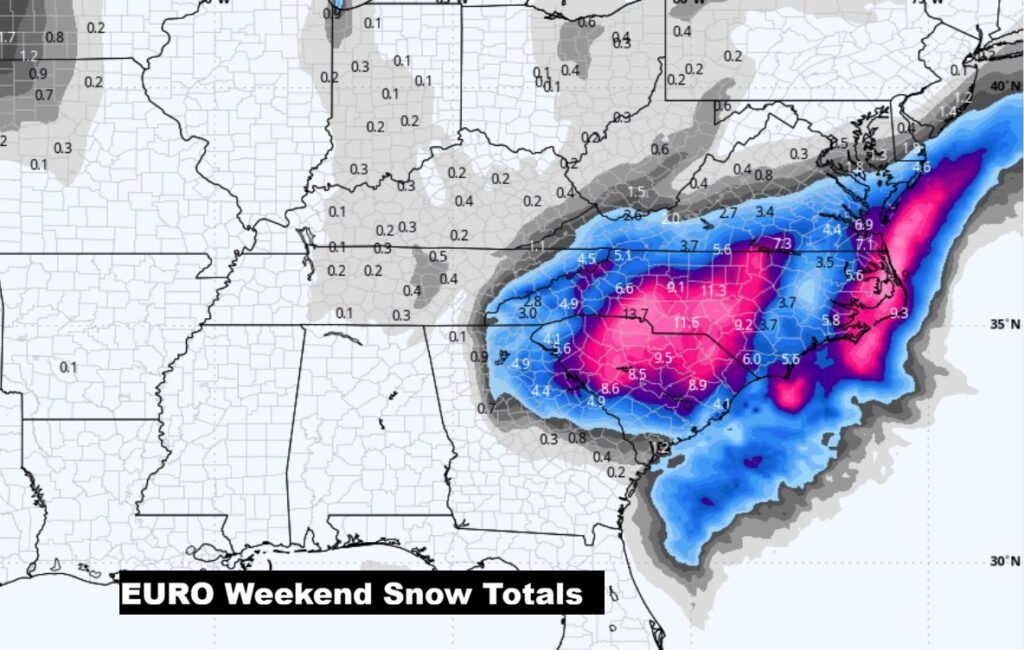
How could I ignore this? Potential historic weekend N’oreaster for the East Coast. Look at the potential snow in the Carolina’s. Then it grazes the Northeast states. Big story. The first Map is the GFS. Crazy numbers.
The 10 Day model Blend Temperature Trend. Temperatures will slowly start to moderate a bit next week.
Here’s the EURO 16 day Ensemble temperature outlook. Meaningful temperature moderation is still several days away. Perhaps, the second week on February. Normal hi/lo 61/37.
.
DAYS TILL SPRING: 51 days!
Thanks for reading this Blog this morning. This morning we are LIVE on the radio from 6 to 9 on NewsTalk 93.1. I’ll have another update for you in the 4 o’clock hour tomorrow morning. Have a nice day.
–Rich