
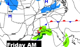
Good Morning! Enjoy today’s high in the low to mid 50’s. Because, the Polar Vortex is dropping southward toward the Deep South.
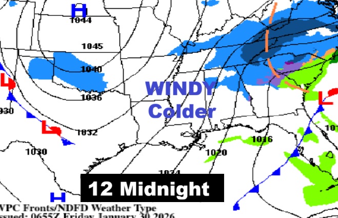
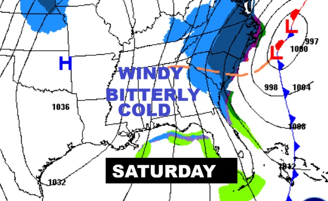
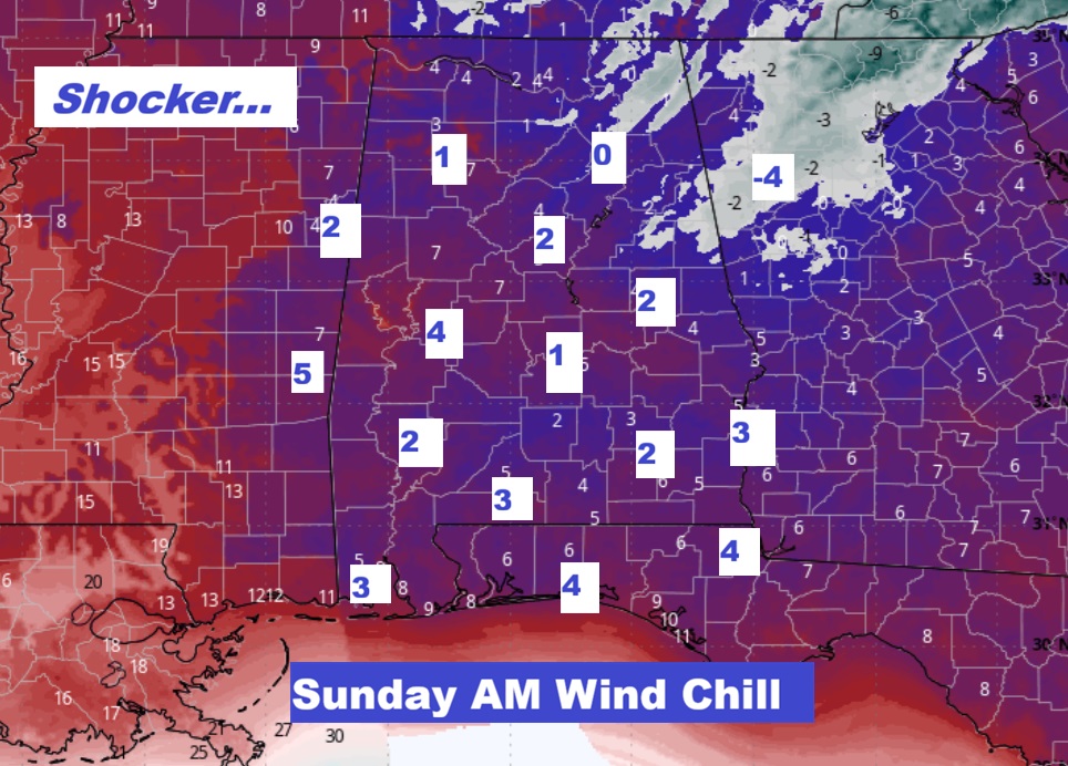
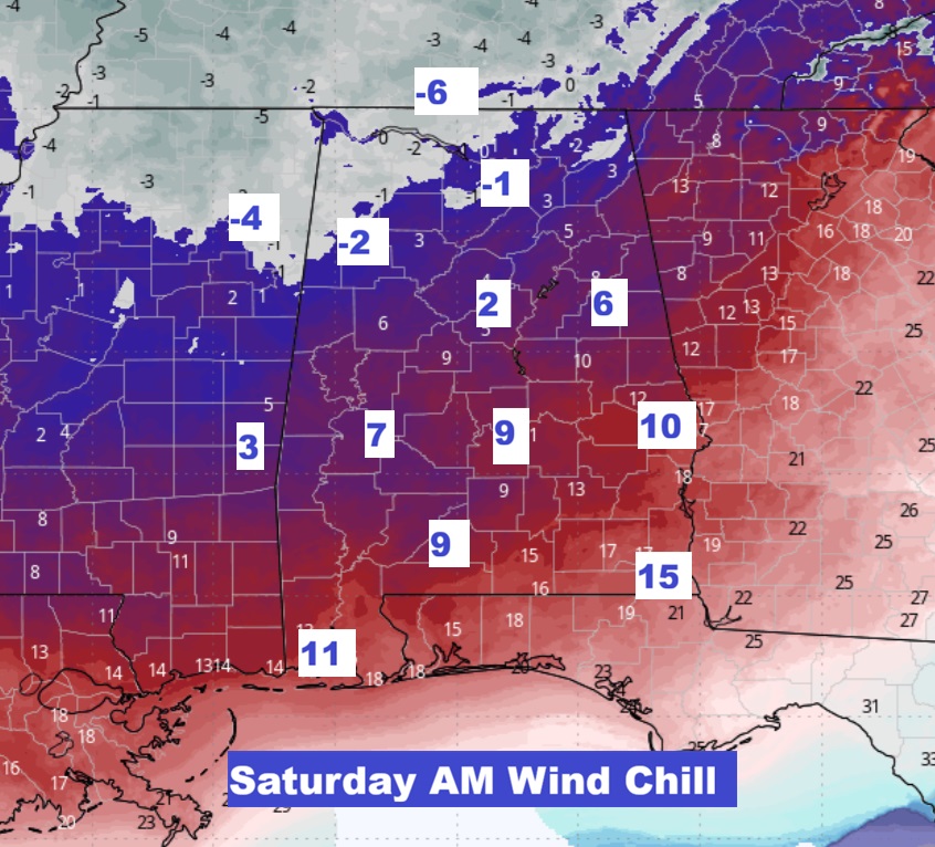
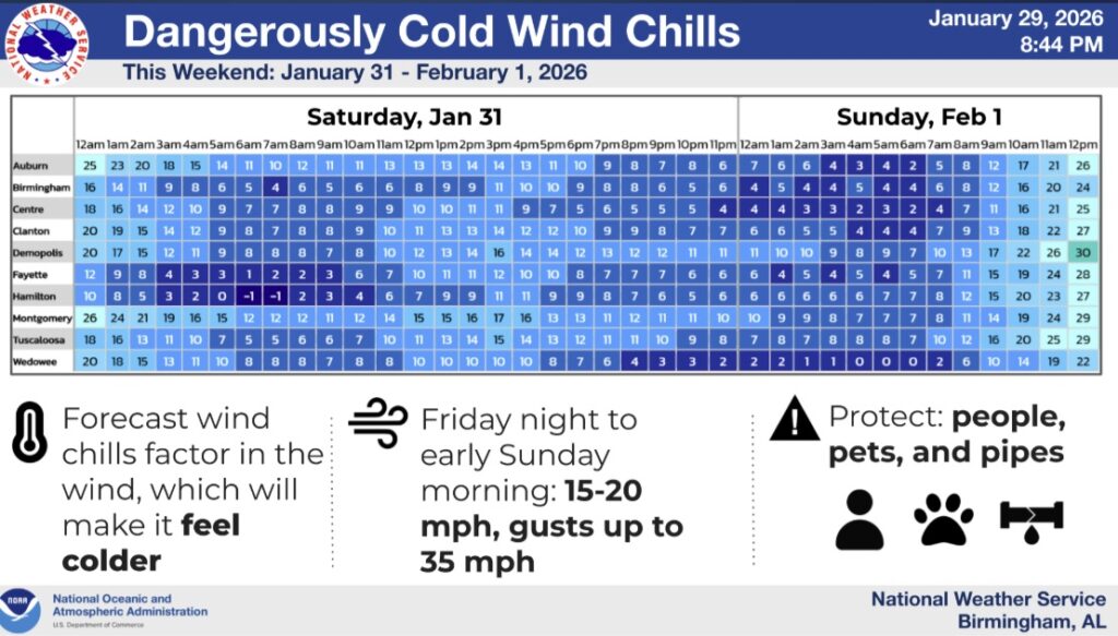
Bitter cold air will funnel into the state starting tonight. It will likely be the coldest yet. Saturday’s high may fail to reach the freeze mark, with winds gusting to 35-40 mph. Even the daytime wind chill will only be in the teens at best. Take all cold weather precautions. The coldest night will be middle teens on Saturday night. The biggest story this weekend will involve the extreme Wind Chill. Both Saturday and Sunday AM wind chill will fall to single digits. Perhaps near ZERO in spots.
Meaningful temperature moderation is a few days away. We’ll be near 60 on Tuesday. Rain moves in Wednesday. Here’s my video forecast discussion.
TODAY: Increasing clouds. High 54. Wind becoming NW 6 to 13 by afternoon.
TONIGHT: Extreme Cold Warning. Partly cloudy, windy and sharply colder. Low around 22. Northwest wind 5 to 15 mph, with gusts as high as 30 mph. Wind chill by morning in the single digits.
SATURDAY:
Mostly cloudy, then gradually becoming sunny, with a high near 31. Blustery, with a northwest wind 15 to 20 mph, with gusts as high as 40 mph.
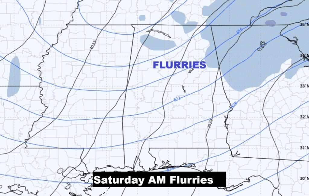
A few Saturday morning snow flurries especially in the northern counties.
NEXT FEW DAYS: The coldest night will be middle teens on Saturday night. The biggest story this weekend will involve the extreme Wind Chill. Both Saturday and Sunday AM wind chill will fall to single digits. Perhaps near ZERO in spots.
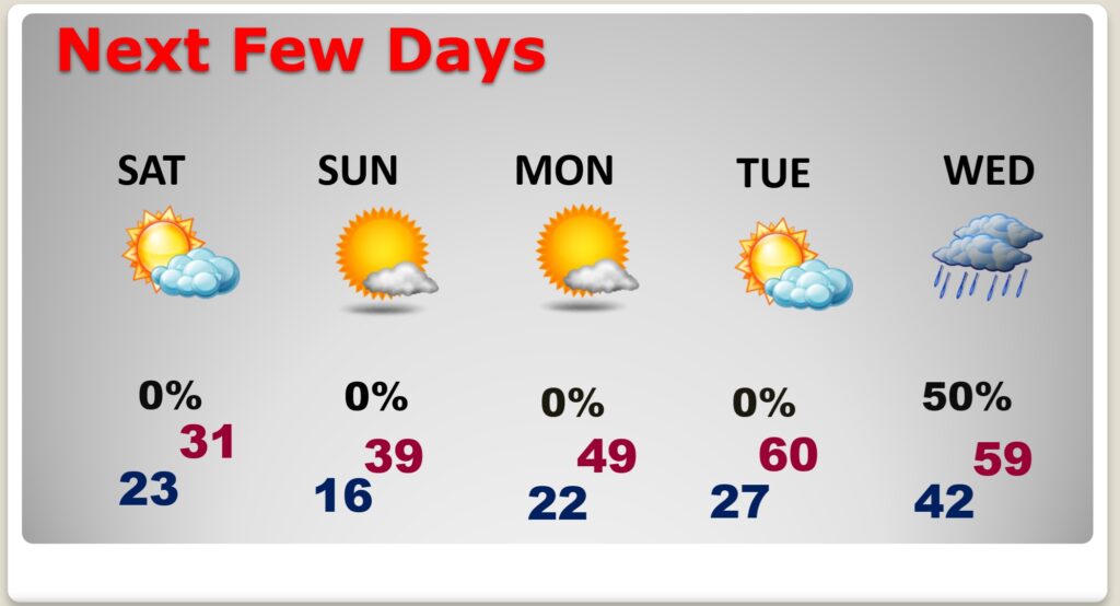
Meaningful temperature moderation is a few days away. We’ll be near 60 on Tuesday. Rain moves in Wednesday.
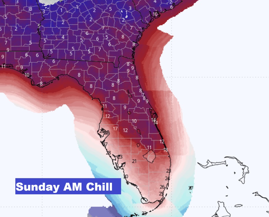
DANGEROUS WEEKEND WIND CHILL: Both Saturday and Sunday morning will be in the single digits. Perhaps near ZERO in spots Dress in layers.
Some models take the Wind Chill Numbers to extreme levels.
Sunday AM Florida Wind Chill numbers are beyond words. Maybe near 11 in Tampa and Orlando. Palm Beach 18.
The Big Story this weekend involves an east coast snowstorms that could bring more than a foot of snow to North Carolina

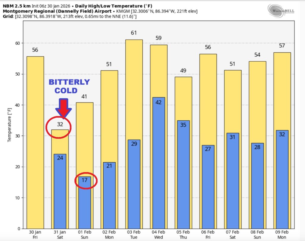
The 10 Day model Blend Temperature Trend. Temperatures will slowly start to moderate a bit next week with near 60 Tuesday.
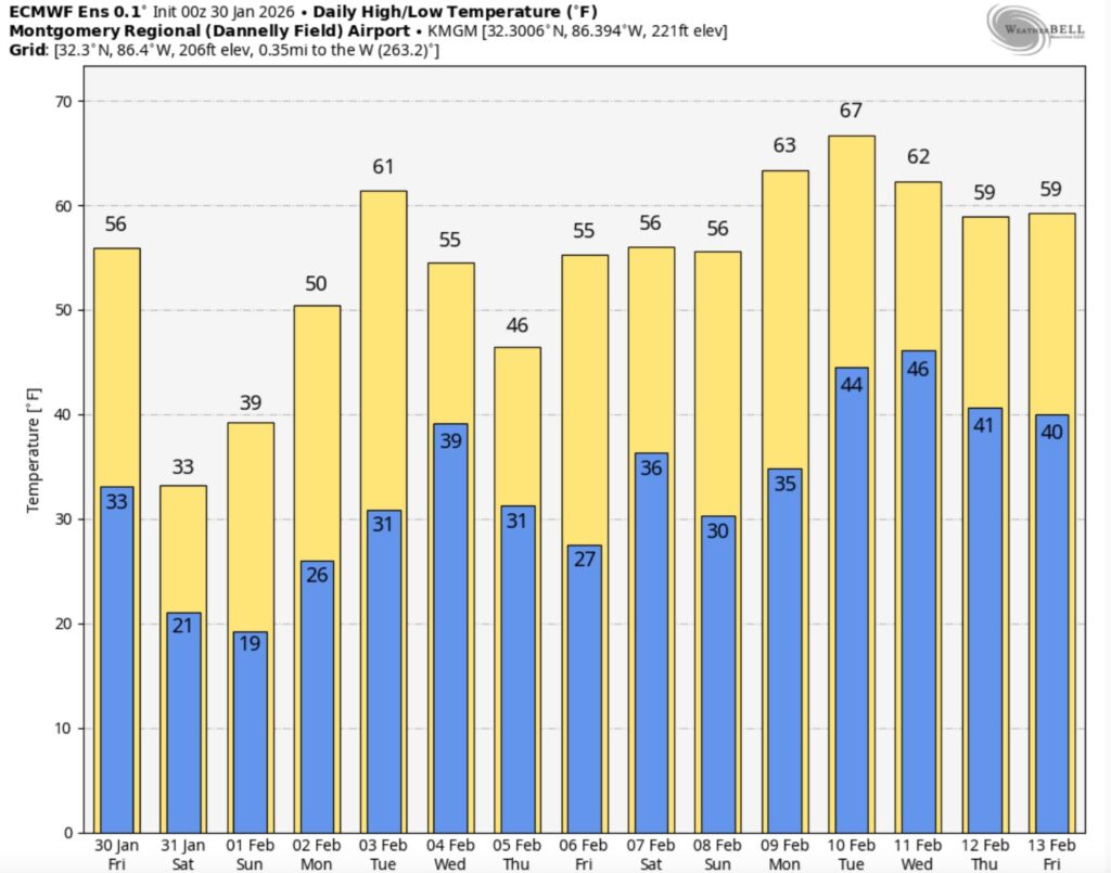
Here’s the EURO 16 day Ensemble temperature outlook. The numbers will get better eventually. Normal hi/lo 61/37.
.
DAYS TILL SPRING: 50 days!
Thanks for reading this Blog this morning. This morning we are LIVE on the radio from 6 to 9 on NewsTalk 93.1. I’ll have another update for you in the 4 o’clock hour tomorrow morning. Have a nice day.
–Rich