
Good Morning! The Arctic Cold is retreating. Yesterday’s high recovered to 57 after a morning low in the teens. Expect mid 60’s today, which sounds like a heatwave. Rain moves in tonight and into part of Wednesday. There will be another brief temperature set-back Thursday. But, on this blog update, you’ll see future signs that the brutal cold will leave us alone. There are much more comfortable days in the not too distant future. Finally. It’s been a tough winter. Here’s my brief video forecast discussion.
TODAY: Partly sunny, with a high near 65. Light south wind becoming southwest. Winds could gust as high as 20 mph.
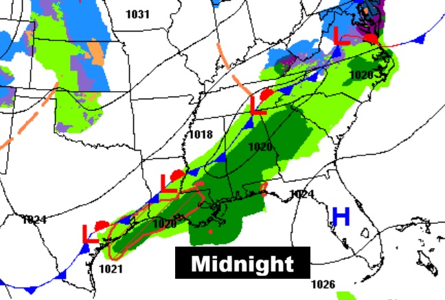
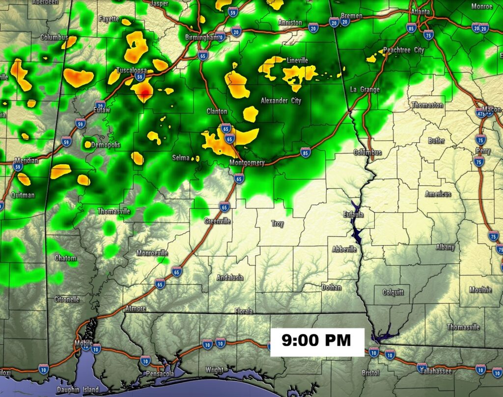
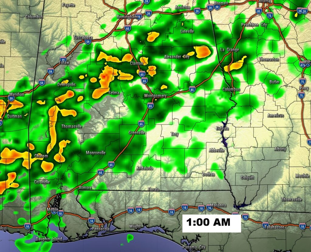
TONIGHT: Rain. Low around 49
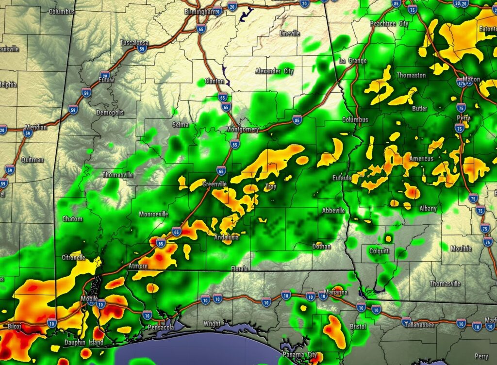
The rain will be tonight and Wednesday early. Then, a brief shot of cooler air moves in.
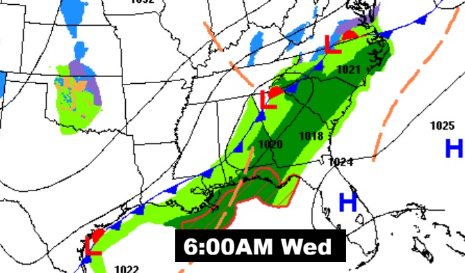
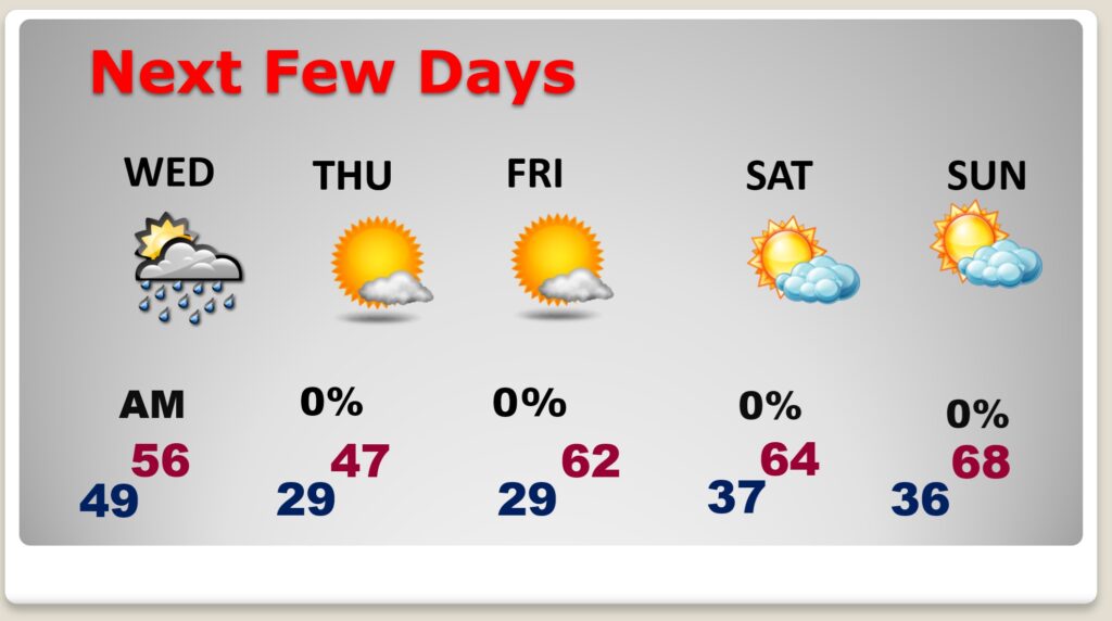
NEXT FEW DAYS: Rain ends early Wednesday. Briefly, Colder again Thursday with highs in the upper 40’s. Expect 20’s Thursday night. Then, look for a nice turn around this weekend. It’ll be the best weekend in quite some time. Highs will climb into the 60’s and, for a change, it’ll be storm-free.
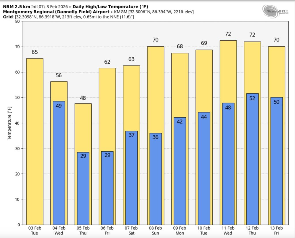
The 10 Day model Blend Temperature Trend. Hang on. Soon, there will be some much more reasonable temperatures.
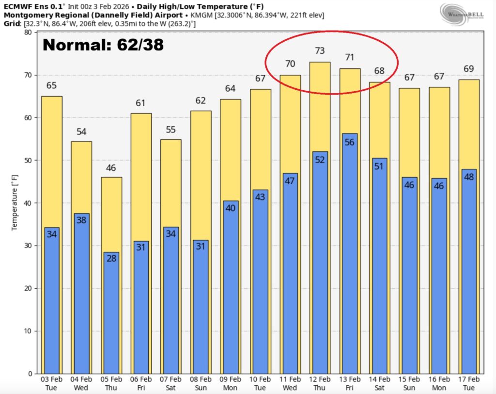
Here’s the EURO 16 day Ensemble temperature outlook. We have some better news in our future. At long last, temperatures will turn around.
.
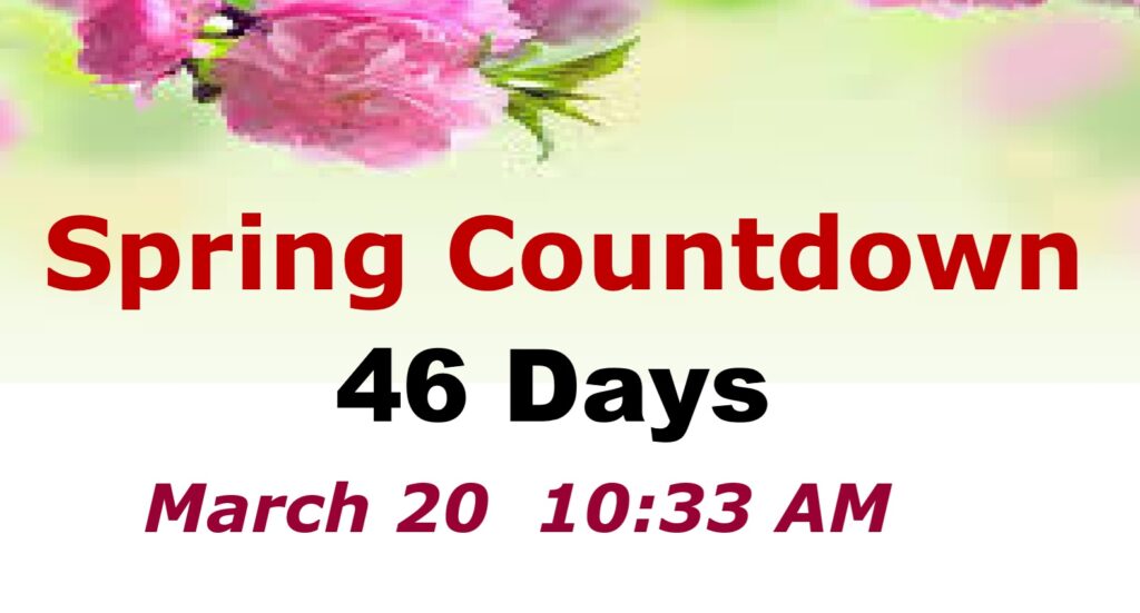
DAYS TILL SPRING: 46 days!
Thanks for reading this Blog this morning. This morning we are LIVE on the radio from 6 to 9 on NewsTalk 93.1. I’ll have another update for you in the 4 o’clock hour tomorrow morning. Have a nice day.
–Rich