
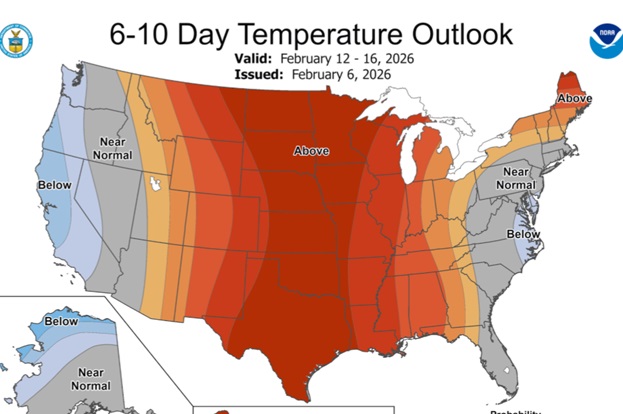
Good Morning! Yesterday’s high of 67 was nicer. Today will be a little cooler behind a weak cold front. High in the 50’s. We start to warm back up on Sunday with the warming trend continuing well through the work week. Are you ready for a touch of Spring Fever next week? Several days will be 70 or above. Risk of showers returns Tuesday night and Wednesday, with a lingering chance Thursday. Could we be dealing with a “bigger deal” storm system sometime around Valentine’s Day, next Saturday 2/14? Many global models are starting to agree. Perhaps a severe weather producer? Too early to say.
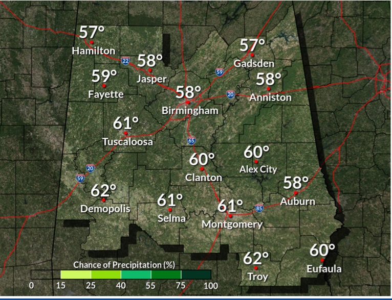
TODAY: Cool Sunshine. High 56. North wind 6 to 12 mph.
TONIGHT: Clear and cold. Low 28.
Sunday will be a few degrees warmer.
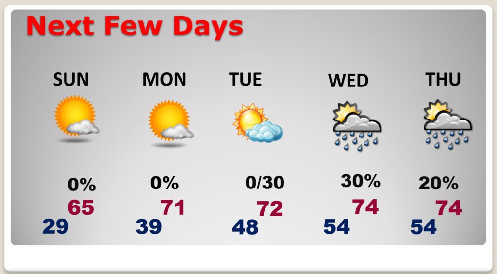
NEXT FEW DAYS: We start to warm back up on Sunday. Highs will reach the lower 60’s. Get ready for a major warming trend next week. Highs each day will be 70 or above. Risk of showers returns Tuesday night and Wednesday, with a lingering chance Thursday.
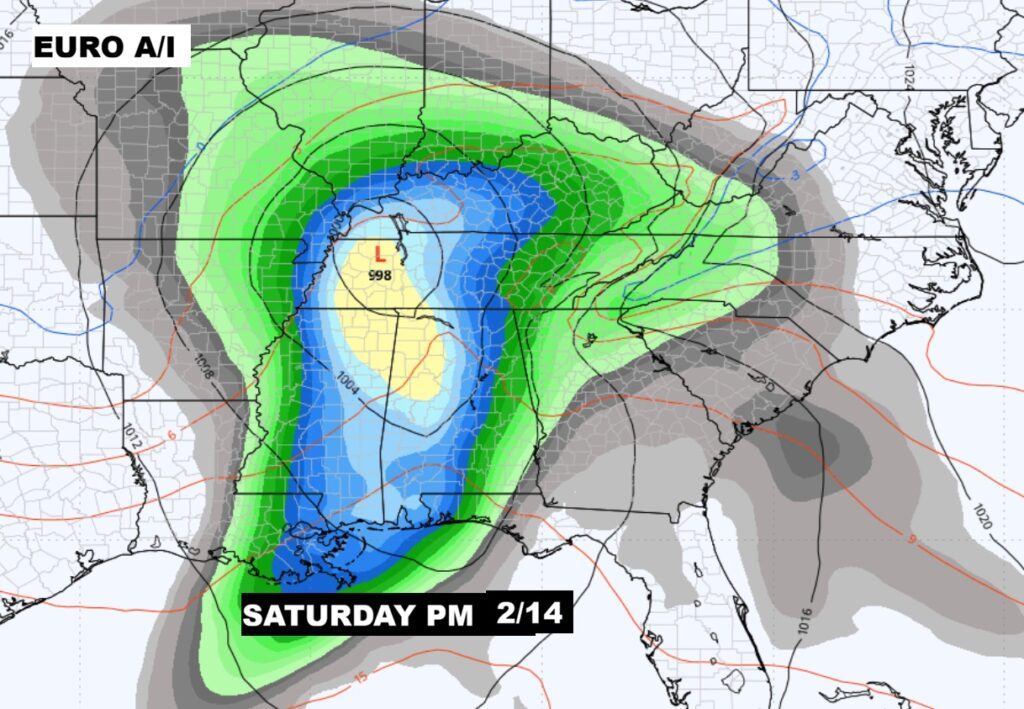
Could we be dealing with a “bigger deal” storm system sometime around Valentine’s Day, next Saturday 2/14? Many global models are starting to agree. Stay tuned. Severe Weather? We don’t know yet.
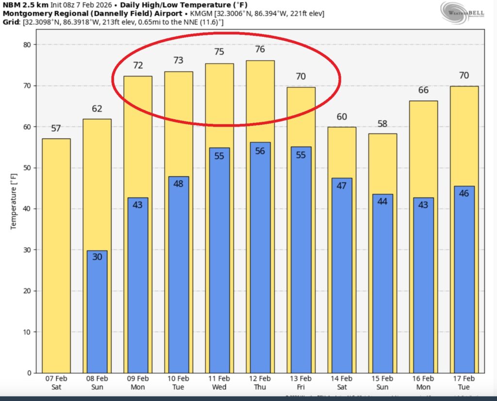
The 10 Day model Blend Temperature Trend. 70+ will seem very nice next week.
Widespread warmth is on the way. February thaw. Spring fever.
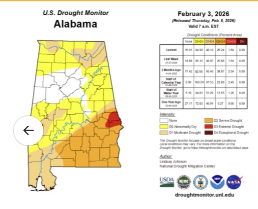
DROUGHT MONITOR: The latest Drought Montor Map is ugly and very disturbing. Most of the southeastern third of Alabama is now in a Severe Drought. Not good.
.
DAYS TILL SPRING: 43 days!
Thanks for reading this Blog this morning. The next scheduled complete Blog update and Video Forecast Discussion is scheduled for the 4 o’clock hour on Monday morning. Have a great weekend.
-Rich