
( 4:55 PM 2/15/26)
Officially- many of us in central and south Alabama are in a Level 1 Marginal Severe Risk from the Storm Prediction Center. But, honestly, the parameters for severe weather are almost completely non-existent – except in those 6 or so extreme southeast Alabama counties, in the Level 2 risk area. For many of us the main threat will be showers and possibly a thunderstorm, although as I type this , the only lightning showing up at this hour is well out in the Gulf. I’ll update you as needed. The next complete Blog update and video is in the morning.
SATURDAY UPDATE:
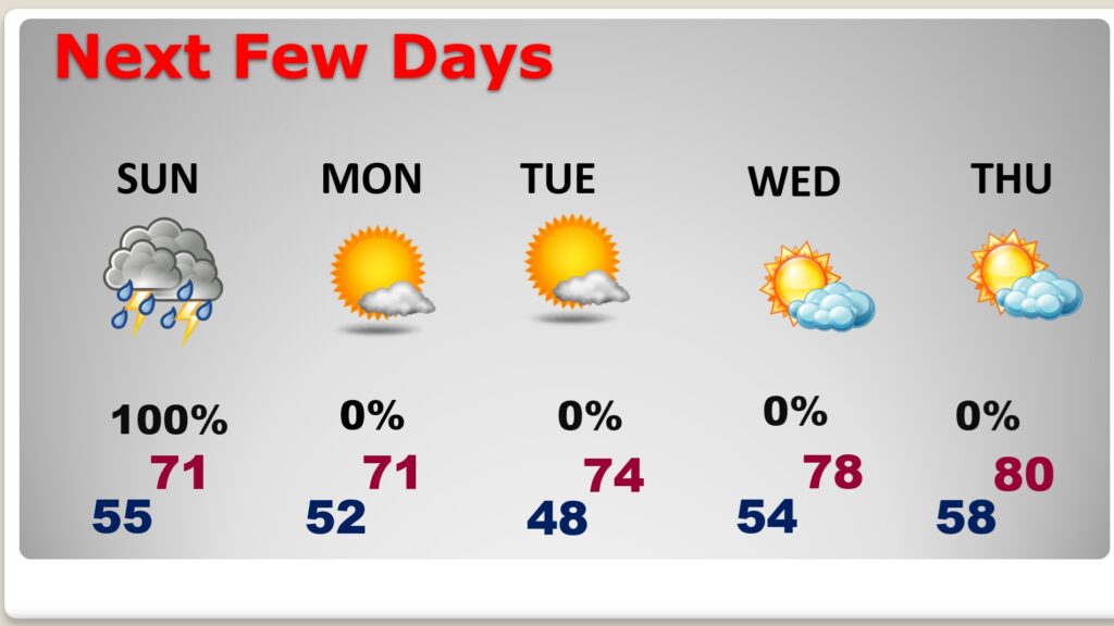
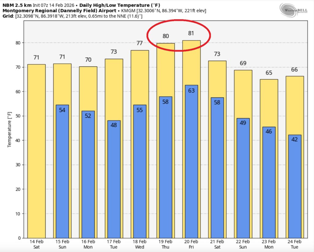
Happy Valentine’s Day! There’s a lot riding on today’s Valentine’s forecast, with lots of Mardi Gras parades and festivals in various cities and towns. The news is good for today and through the evening hours tonight. It should be mainly dry and comfortable. Highs will reach 70 or above. Showers and storms are most likely starting perhaps in the pre-dawn hours of Sunday. Strongest storms for many of us will be morning and mid-day. There is a Marginal Severe Risk Sunday. Damaging winds are the main threat, but a few brief tornadoes can’t be ruled out. Locally heavy rainfall is possible in spots. The above normal temperatures will continue for the next several days. We may be close to 80° by Thursday.
TODAY: Partial sunshine and very mild for February. High 71. Southwest wind 5 to 10 mph.
(Normal 64/39)
TONIGHT: Cloudy, but dry and mild through the evening hours. Evening temps. In the 60’s. Overnight low 57. Risk of rain and thunderstorms begin in the pre-dawn hours Sunday.
SUNDAY: Strongest storms for many of us will be morning and mid-day. There is a Marginal Severe Risk Sunday. Damaging winds are the main threat, but a few brief tornadoes can’t be ruled out. Locally heavy rainfall is possible in spots. High near 70. Low Sunday night 55.
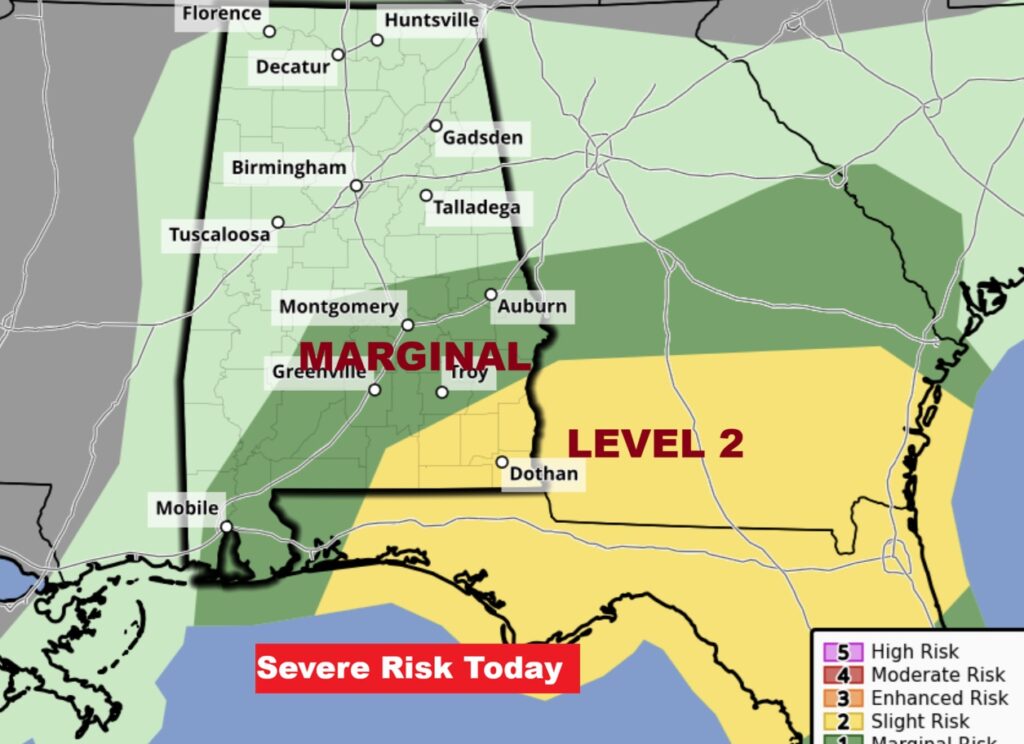
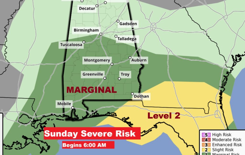
Here’s that Marginal Severe Risk outlook from SPC. Notice that SE Alabama and adjacent states are in a Level 2 category. Higher tornado risk.
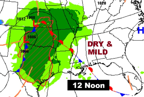
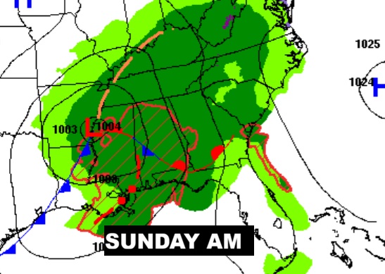
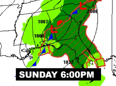
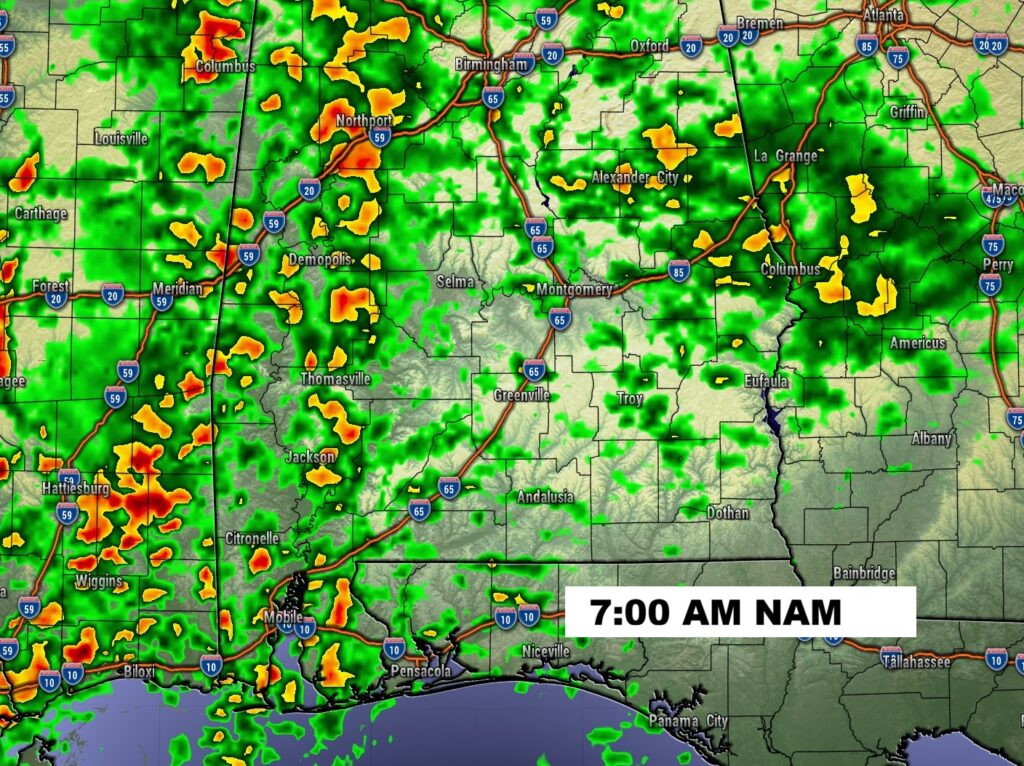
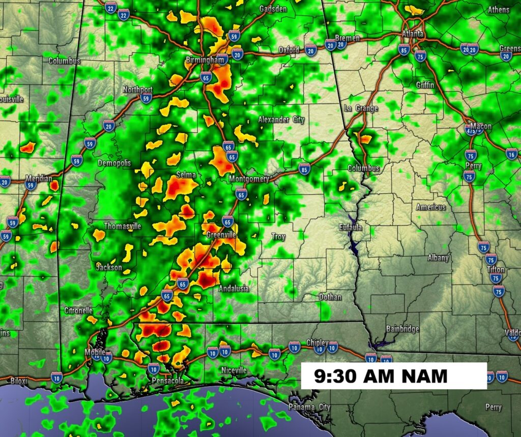
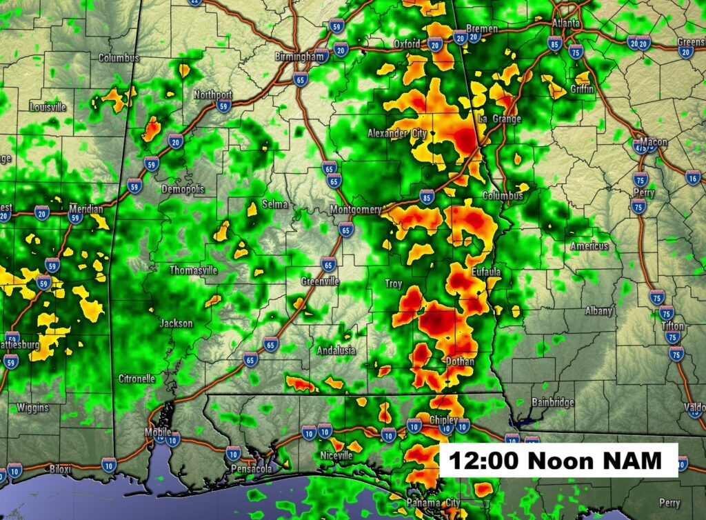
FUTURE RADAR SUNDAY: Notice the strong to severe storms entering the state near Dawn Sunday and marching eastward during the day. A broken squall line (QLCS), will be reaching the far eastern and southeast counties by about lunchtime. Damaging wind gusts are the main threat. Brief isolated tornadoes can’t be ruled out.
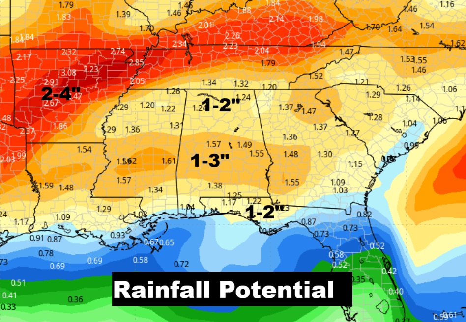
Hopefully we’ll see some very beneficial rainfall.
NEXT FEW DAYS: Following the Sunday storm system – President’s Day and Mardi Gras Fat Tuesday look very nice indeed. Highs mostly low 70’s both days. Dry at least through Thursday. Upper 70’s Wednesday and perhaps near 80 Thursday. A very nice week ahead.
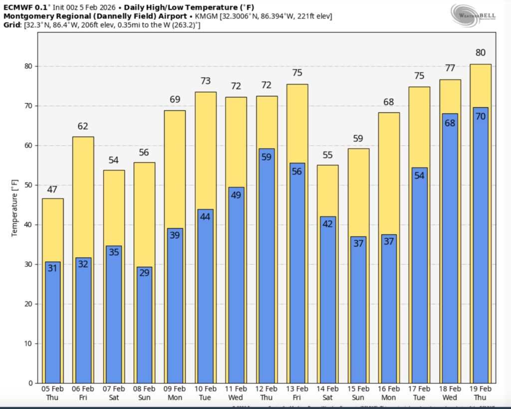
The 10 Day model Blend Temperature Trend. Winter is still on hold for now.
Here’s the EURO 16 day Ensemble temperature outlook. Still no arctic air in sight.
DAYS TILL SPRING: 34 days!
Thanks for reading this Blog this morning. Stay weather aware. I’ll have updates as needed this weekend. Have a nice Valentine’s Day today.
–Rich