
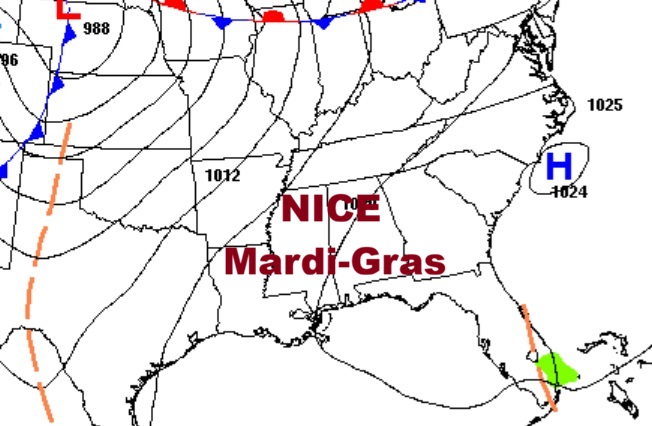
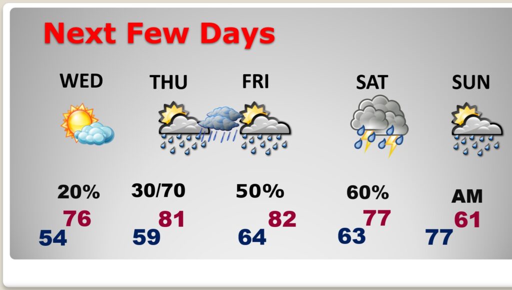
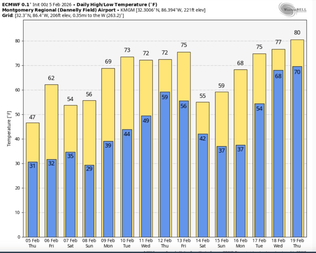
Good Morning! Have you got Spring Fever yet? You will. This will be the warmest week of 2026 so far, and we may be teasing record highs by Thursday and Friday. On this Mardi Gras Fat Tuesday, expect a beautiful day with highs in the low 70’s. By Thursday and Friday – we may be 80 or above.
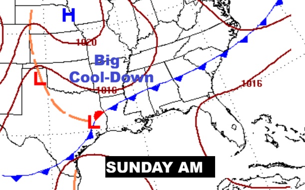
The risk for widely scattered showers begins Wednesday night, becoming more likely Thursday and Friday. Showers and thunderstorms are expected Saturday ahead of a cool front that will substantially lower temperatures by Sunday and especially Monday. Here’s my video forecast discussion.
TODAY: Mostly Sunny and nice. High 73. South wind 5 to 10.
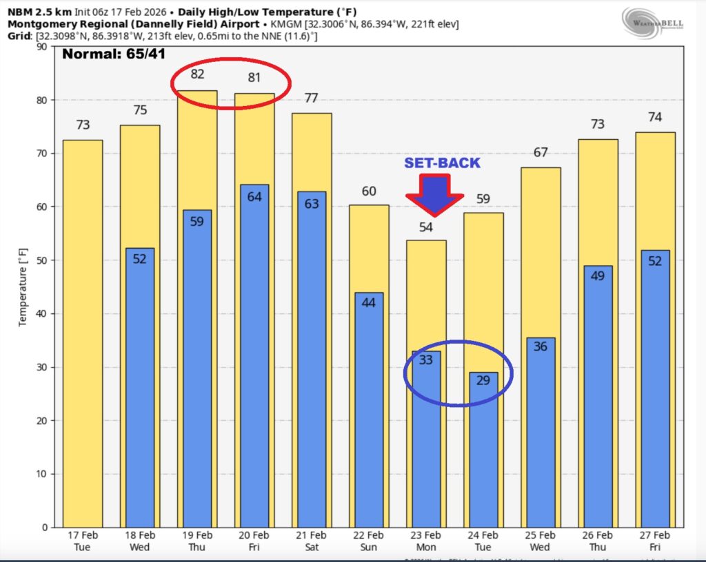
(Normal 65/41)
TONIGHT: Increasing clouds. Low 53.
NEXT FEW DAYS: Could we tease record highs by later this week. We’ll be in the upper 70’s Wednesday and 80 or above Thursday and Friday. Nights will be mild. Rish of showers begins Wednesday night. Scattered showers possible Thursday. A better chance of showers and possibly a thunderstorm or two Friday. Showers and thunderstorms are expected Saturday ahead of a cool front that will substantially lower temperatures by Sunday and especially Monday.
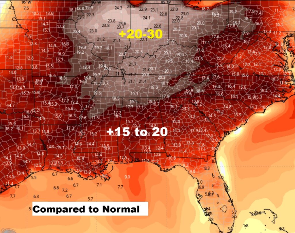
Highs will be running 15 to 20 degrees above normal later in the week. Even warmer than that in the Midwest and Great Lakes.
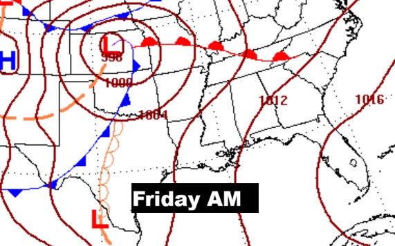
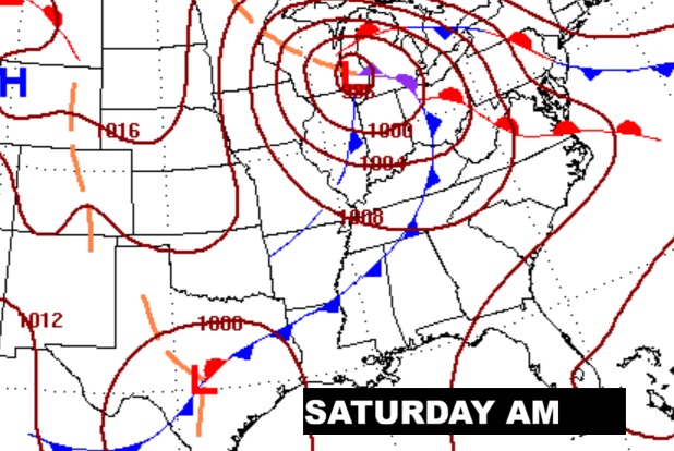
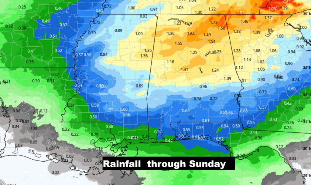
Here’s the expected rainfall through Sunday. Heaviest in North Alabama.
The 10 Day model Blend Temperature Trend. Big-cool down by Sunday/Monday. Cold nights Monday and Tuesday night.
Here’s the EURO 16 day Ensemble temperature outlook. After next week’s set-back, look for a nice rebound starting around the 26th.
DAYS TILL SPRING: 31 days!
Thanks for reading this Blog this morning. This morning we are LIVE on the radio from 6 to 9 on NewsTalk 93.1. I’ll have another update for you in the 4 o’clock hour tomorrow morning. Have a nice day.
–Rich