
UPDATE:
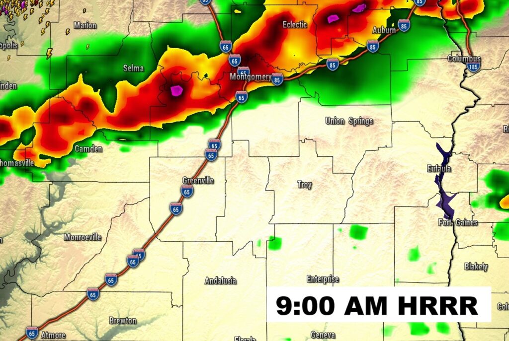
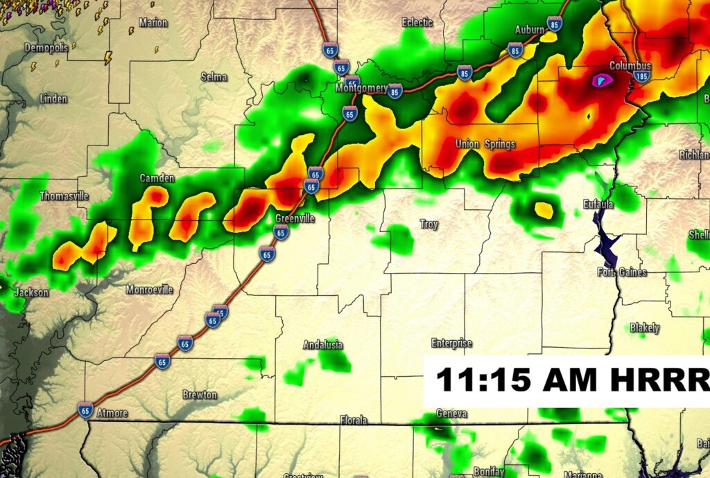
Hang on… Could get a little noisy this morning as a line of storms shifts southward toward the River Region by about the 9:00AM hour. Isolated Severe Storms with damaging winds can’t be ruled out.
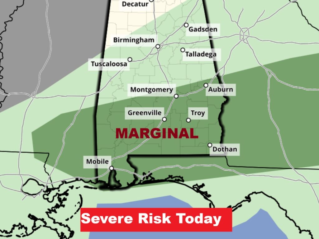
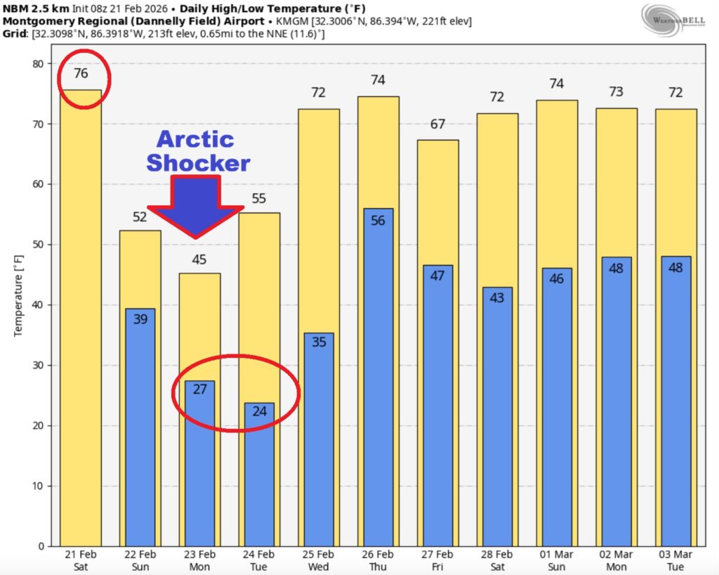
Good Morning! Get ready for yet another shocking Winter Blast. This will come as quite a gut punch following several days in the 70’s and low 80’s. A cold front will bring a risk of scattered showers and thunderstorms today. Highs will reach the low to mid 70’s by mid-day and then start to fall. The risk of showers ends before midnight. There is a Level 1 – Marginal Severe Risk now covering southeast Alabama, along and south of a Montgomery/Auburn line today. Damaging wind gusts are the main threat. Tonight it will turn windy and much colder. Wind gusts may exceed 25 mph Sunday with highs in the low 50’s. The Wind Chill by Monday morning will likely be in the teens. The coldest day will be Monday with low 40’s. The coldest night will be Monday night – low 24. Get ready for another rude visit from Old Man Winter. 27 Days till Spring.
TODAY: Scattered showers and thunderstorms today. Highs will reach the low to mid 70’s by mid-day and then start to fall.
(Normal 66/41)
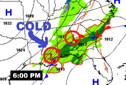
There is a Level 1 – Marginal Severe Risk now covering southeast Alabama, along and south of a Montgomery/Auburn line today. Damaging wind gusts are the main threat. Tornadoes can’t be ruled out.
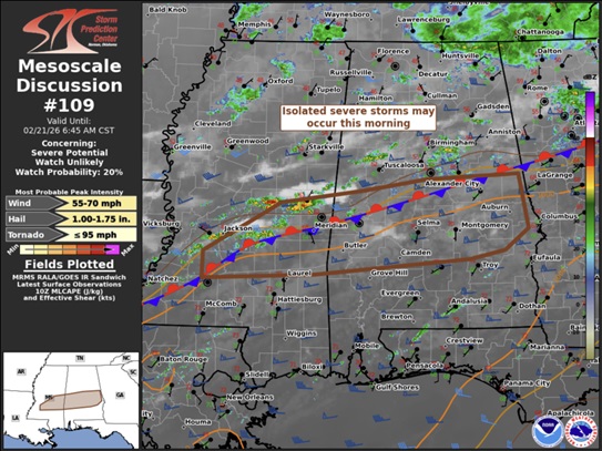
SPC says isolated severe storms in Mississippi this morning will move eastward into Alabama along and south of a stalled front. They say a Watch is unlikely. (20% chance). #alwx
TONIGHT: The risk of showers ends before midnight. Then, windy and colder. Low 39. Winds gusting to 25 mph. Morning wind chill near 20.
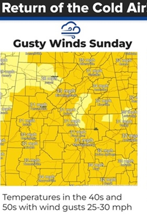
SUNDAY: Sunshine, windy and cold. High 54. Wind gusts could exceed 30 mph. Low Sunday night 28.
This will get your attention! Check out the projected wind chill Monday morning.
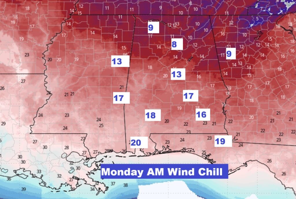
NEXT FEW DAYS: Sunshine, windy and cold Sunday. High 54. Wind gusts could exceed 30 mph. Low Sunday night 28. The Wind Chill by Monday morning will likely be in the teens. The coldest day will be Monday with low 40’s. The coldest night will be Monday night – low 24. We’ll be 70 or above by Wednesday.
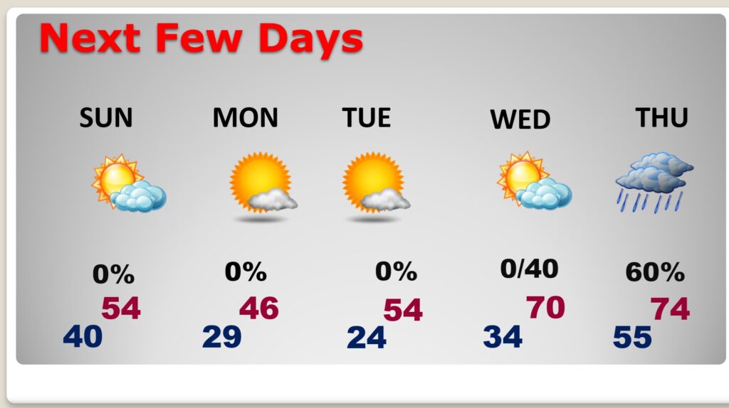
This graph says it all. After days of highs in the 70’s and low 80’s, we are about to see another Major Temperature Crash. And, much colder temperatures are only part of the story. Wind chill will be a big factor by late tonight, Sunday and Sunday night. Our Monday morning wind chill will likely fall to the teens! Get ready for another shocker. .
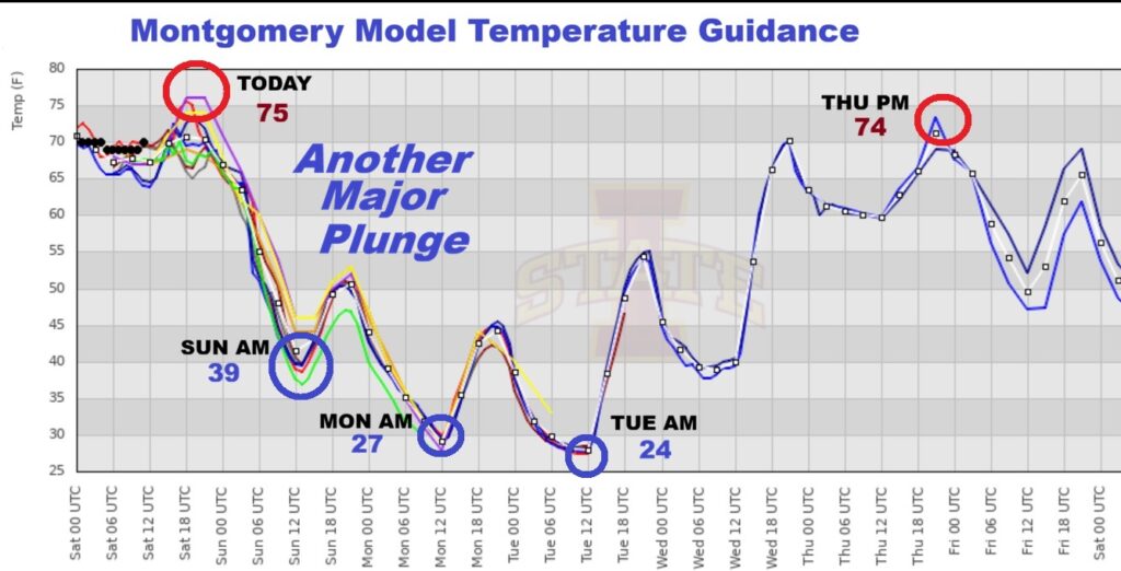
The 10 Day model Blend Temperature Trend. Expect a nice rebound in our temperatures again by late next week.
DAYS TILL SPRING: 27 days!
Thanks for reading this Blog this morning. morning. Stay weather aware. Have a nice weekend. Are you sick of Winter?
–Rich