
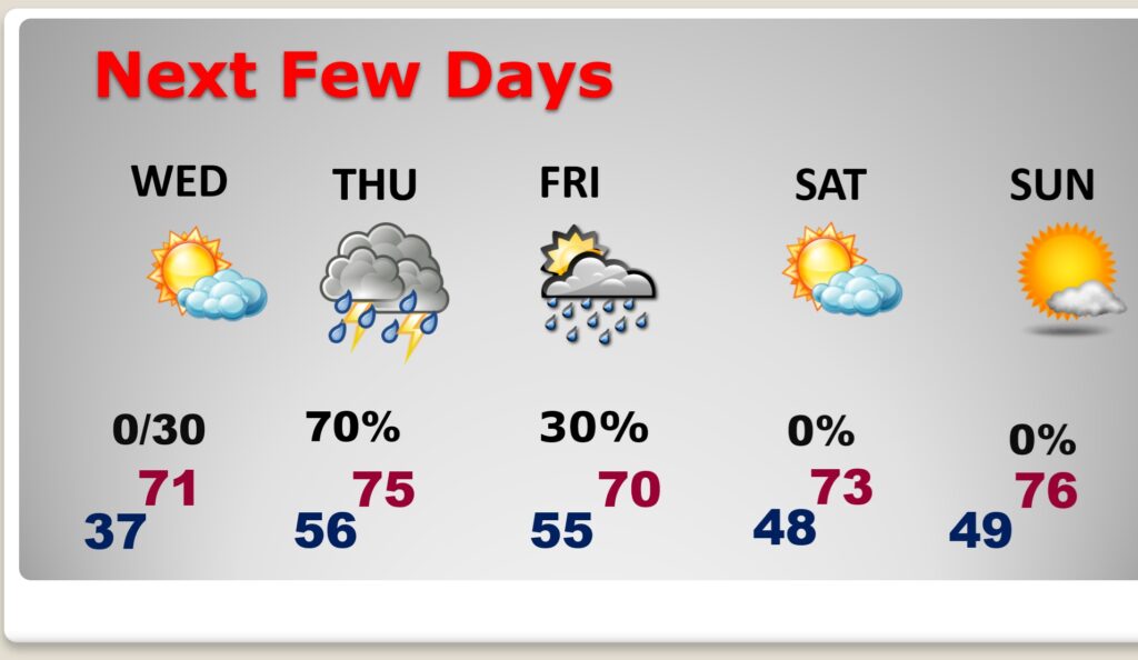
Good Morning! It has certainly been cold enough here, but at least we did not have to deal with a Historic Blizzard like our friends in the Northeast! (see the blog summary). We’ll be in the lower 20’s at Dawn. But, temperatures will start a recovery this afternoon as we aim for the middle 50’s. Then, expect 71 Wednesday and 75 Thursday. An approaching storm system could bring showers as early as pre-dawn Thursday with a better chance by Thursday afternoon and Thursday night. But, on today’s Blog, you’re going to like the 10 day and 16 day temperature guidance. I think it will make most of you smile!
Here’s my brief forecast discussion.
TODAY: Sunny, and not quite as cold. High near 56. SW wind 6 to 12 mph.
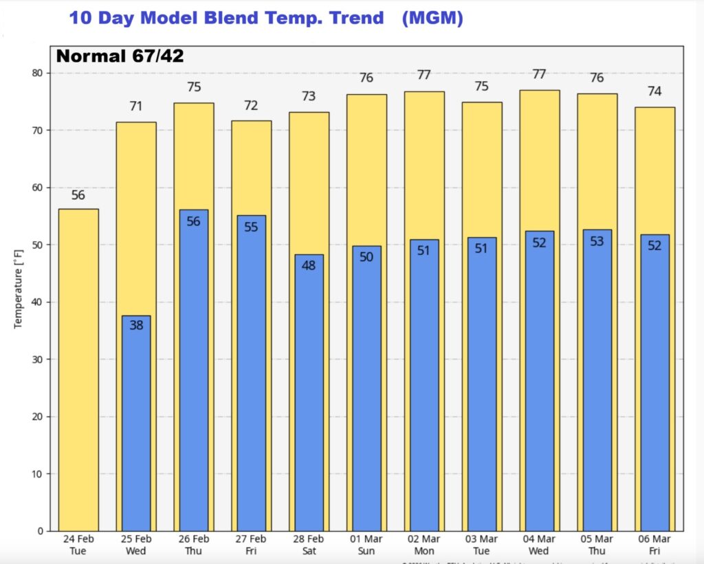
(Normal 67/42)
TONIGHT: Partly cloudy, not as cold. Low 37. Light wind.
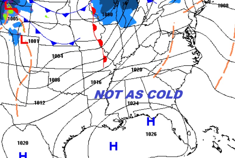
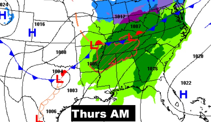
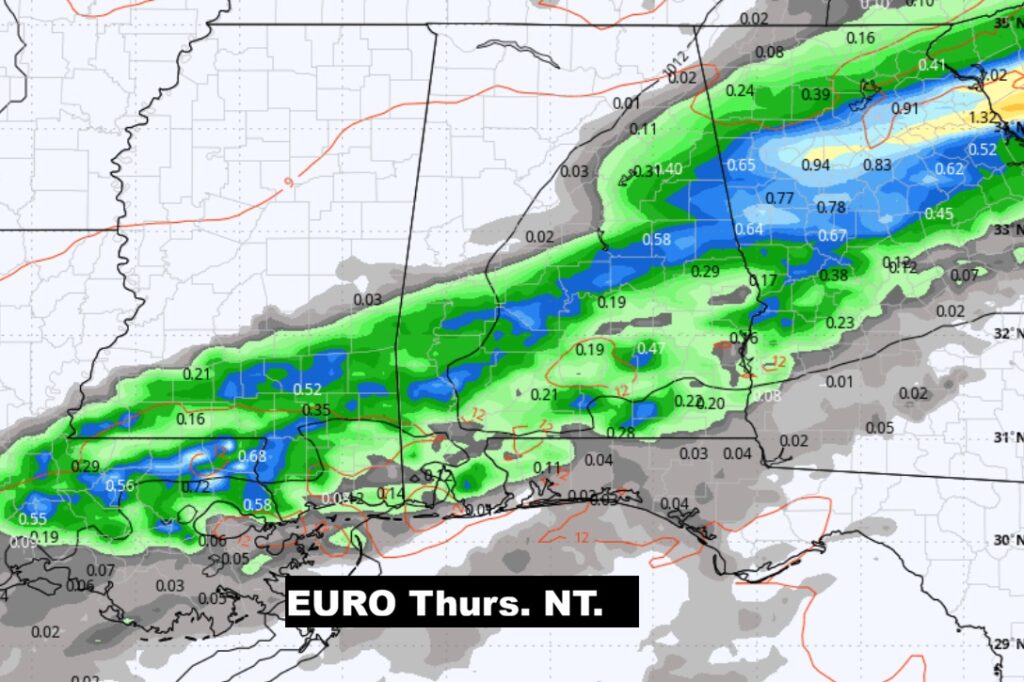
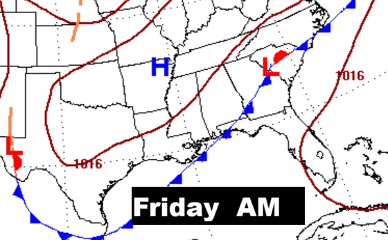
NEXT FEW DAYS: The warm-up continues. Expect 71 Wednesday and 75 Thursday. An approaching storm system could bring showers as early as pre-dawn Thursday with a better chance by Thursday afternoon and Thursday night. .
The 10 Day model Blend Temperature Trend. One word: YAY!
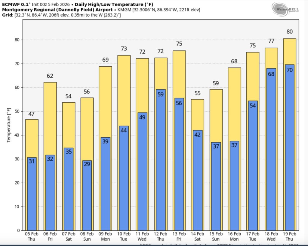
The Euro Ensemble 16 Day model temperature trend. Extended YAY!
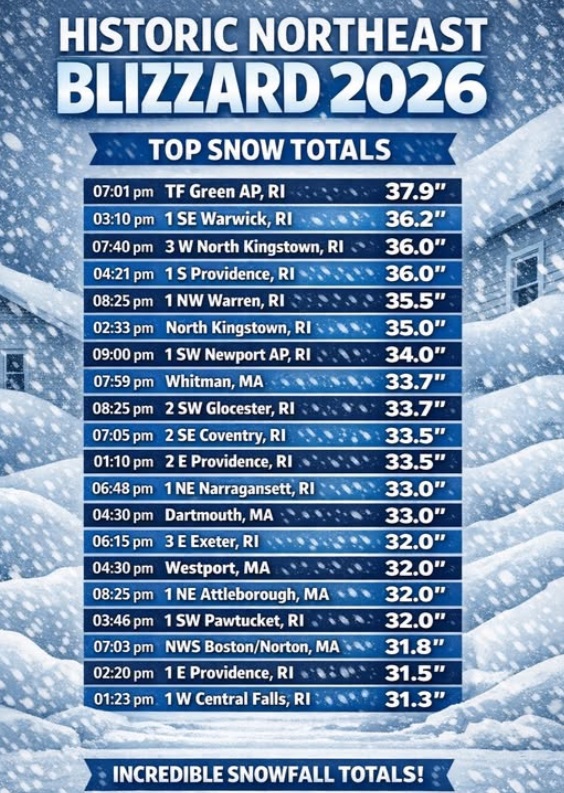
HISTORIC BLIZZARD OF 2026: What can I say. In the world of weather it was a historic 36 hours in the northeast – peaking Monday morning/PM. One of the worst winter storms on record. In some spots worse than the benchmark blizzard of 78. In Providence RI – highest snow total EVER (37.9″). Newark NJ – second highest ever. (27.9″)
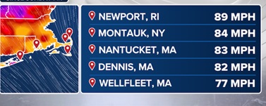
WIND Reports that go beyond all words 80-90 mph in spots.
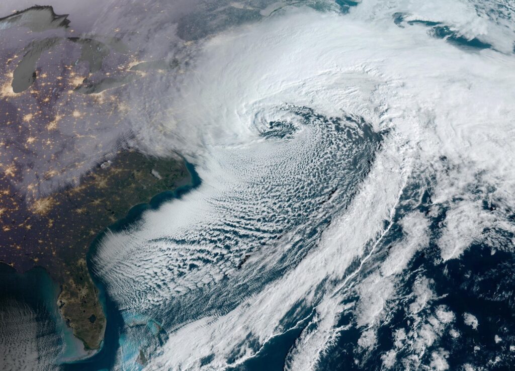
Here’s a satellite picture worth a thousand words.
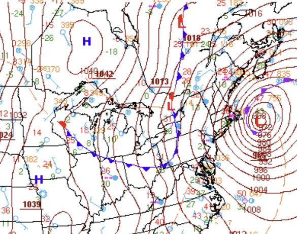
BOMBOGENESIS is when low pressure drops more than 24 mbs. In 24 hours. This low dropped 40 mbs. And bottomed out at 966 mbs. Incredible. Hurricane intensity.
The winter storm of a life-time. One for the history books.
DAYS TILL SPRING: 24 days!
Thanks for reading this Blog this morning. This morning we are LIVE on the radio from 6 to 9 on NewsTalk 93.1. I’ll have another update for you in the 4 o’clock hour tomorrow morning. Have a nice day.
–Rich