
7:30 AM UPDATE:
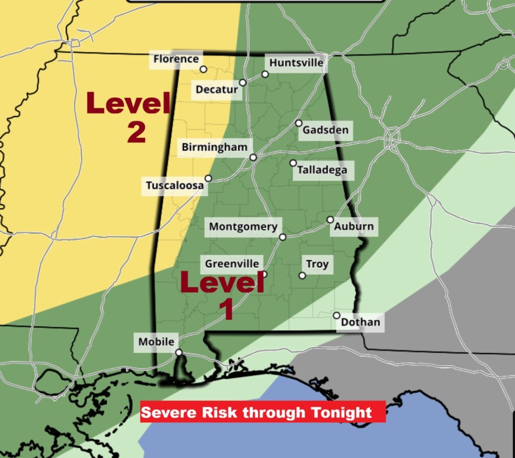
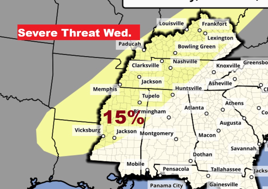
SPC has made minor adjustments to the Day 1 Severe Outlook through tonight. The Level 2 risk is along and west of a Decatur/Tuscaloosa line. The Level 1 risk extends as far southeast as Ozark.
Good Morning! This remarkably warm pattern continues. Yesterday Montgomery reached a high of 85 degrees for the second day in a row, just shy of a record. We’ll flirt with another record today. Scattered showers and storms will pop up again this afternoon and into tonight. There will be waves of showers and storms through the weekend. Some of the storms could be strong/severe especially from late afternoon through the overnight hours tonight. Damaging wind gusts are the main threat. 80+ degree weather continues Monday through Wednesday. A mid-week Storm System bears watching. I would not be surprised if we see another severe weather threat.
TODAY: Partly sunny. High 85. (Record 87/2023) Scattered showers and storms possible this afternoon and tonight. Low tonight 64. (Normal 70/45)
The now deadly storm system which has been assaulting the middle of the country is marching eastward. It will not be quite as potent here in Alabama. Still though there could be some Severe Warnings.
Level 1 – Marginal Severe Risk this afternoon and tonight – through 7AM CDT Sunday. Damaging winds are the main risk.
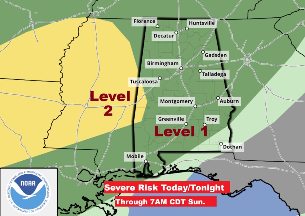
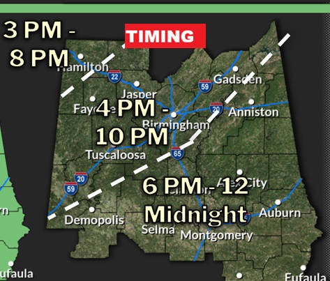
Helpful timing guidance from NWS on this evening’s Level 1 Marginal Severe Risk. NWS: The main threat will be damaging winds up to 60 mph and hail up to quarter size. Timing for central AL looks to be between 3 pm in the NW counties and midnight in SE Alabama. In addition, each storm should produce heavy rainfall, with localized flooding possible in those areas that don’t see breaks from storms. Heavy rain combined with gusting winds, even sub severe winds, could knock down plenty of trees.
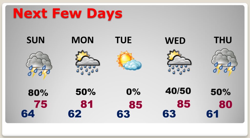
NEXT FEW DAYS: Scattered storms will continue Sunday. The highest probability of concentrated storms will be Sunday. There will be more scattered storms Monday. High near 80. Expect mid 80’s Tuesday and Wednesday. A mid-week Storm System could bring strong storms by Wednesday PM/Thursday.
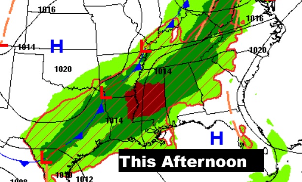
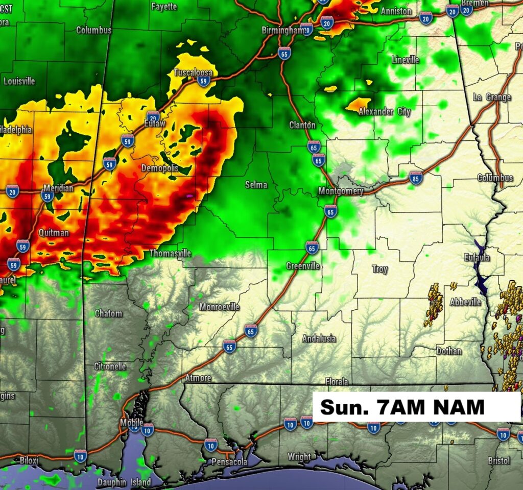
FUTURE RADAR: There will be waves of storms this weekend. Lets look at some model examples. The storms rolling in this evening and tonight could be severe. Our weather app will keep you on top of the action. Free in the App store. Search Rich Thomas Weather.
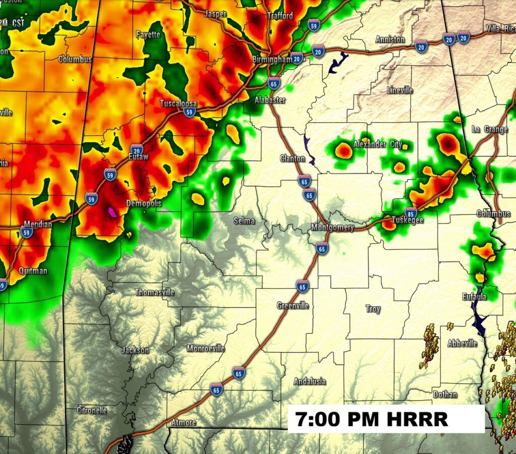
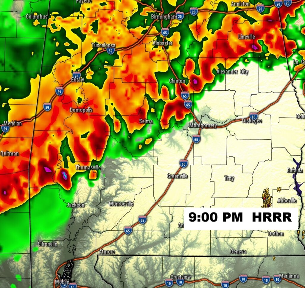
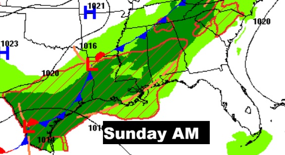
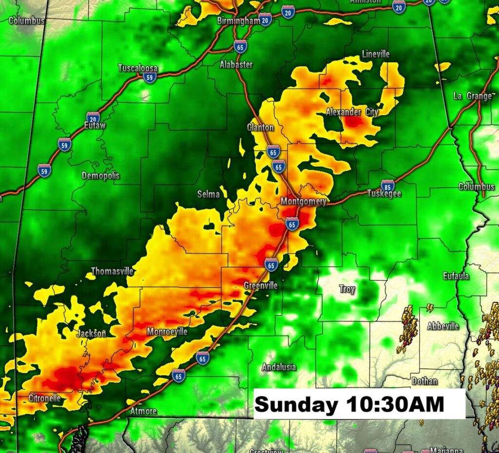
There will be another wave of storms Sunday morning.
Mid-week storm system bears watching. I would not be surprised if we see another severe weather threat.
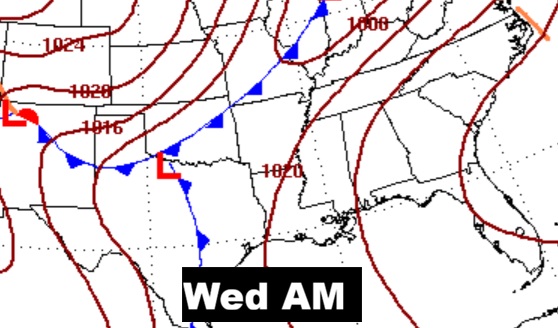
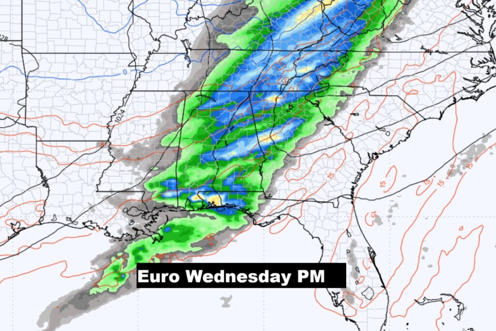
. I expect the Wednesday Severe Outlook will be expanded eastward.
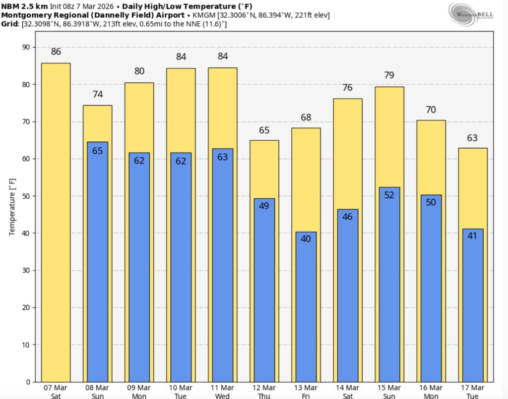
The 10 Day model Blend Temperature Trend. A big cool-down could start Thursday.
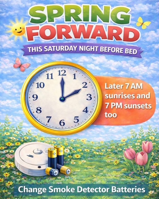
SPRING FORWARD late Tonight:
Thanks for reading this Blog this morning. Have a nice weekend.
–Rich