
Good Morning! Talk about a change of climate! After days in the mid 80’s – we’re in the 30’s this morning. And, get ready for more wild changes. A big weekend warm-up will be followed by another shocking arctic temperature crash Monday and Tuesday. A strong cold front will bring another round of showers and storms by Sunday night. Yet Another Severe weather Risk. Followed by that ridiculous Cold Blast Monday through Wednesday AM. It’s going to be quite a ride – reminding us on how March can be incredibly variable and harsh. Here’s my brief video forecast discussion.
TODAY: Sunny and not as cool. High 71. Close to normal.
(Normal 71/46)
TONIGHT: Clear skies. Chilly. Low 46. That’s normal.
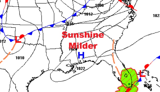
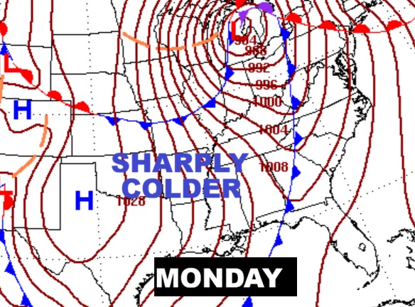
NEXT FEW DAYS: Our brief warm-up continues Sunday with a high of 81. A cold front will bring another round of showers and storms by Sunday night. Then, get ready for a late season shocker as artic air funnels into the state Monday. Highs Monday and Tuesday only in the 50’s. And, there’s a very good chance of a late season freeze by dawn on St. Patrick’s Day Tuesday and again Wednesday morning.

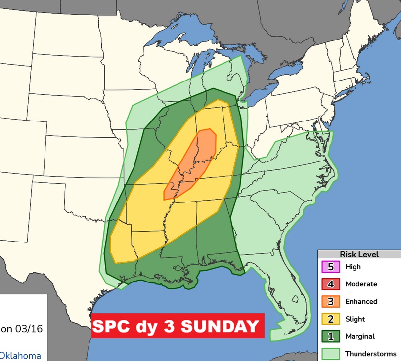
SUNDAY situation. While a blizzard rages in the Midwest. That strong cold front will bring showers and storms by Sunday night – followed by an Arctic shocker.


Severe weather Risk. Marginal threat. Damaging wind gusts is the main risk.

ATTENTION ALABAMA GROWERS: Late season freeze Tuesday and Wednesday mornings! Take precautions.
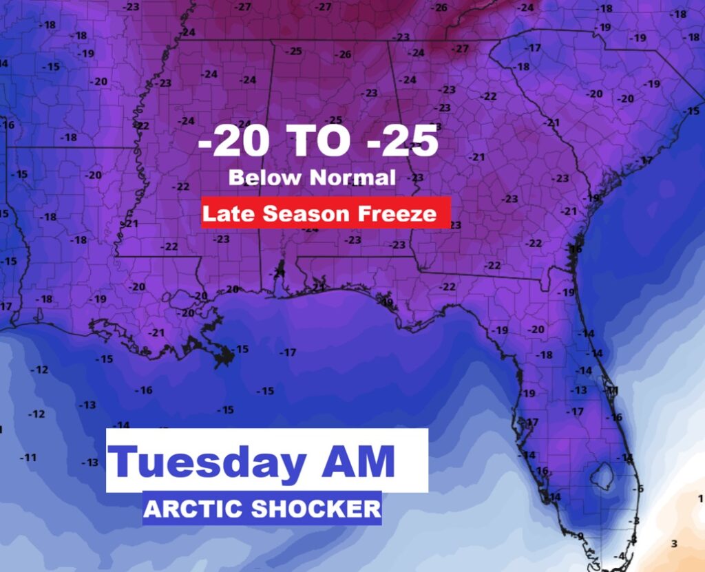
The 10 Day model Blend Temperature Trend. Wild temperature changes. After the big weekend warm-up, there will be an absolutely SHOCKING change to much colder Monday and Tuesday. Arctic temperature CRASH, Huge plunge. Two sub-freezing mornings next week. Look at the high on St. Patrick’s Day! Stupid cold.

Here’s the EURO Ensembles 16 day guidance.

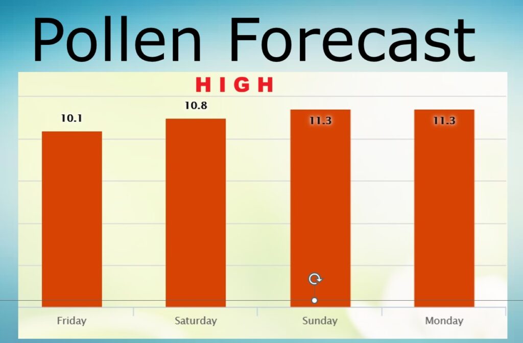
POLLEN FORECAST: Back to the high level for the weekend.
Thanks for reading this Blog this morning. This morning we are LIVE on the radio from 6 to 9 on NewsTalk 93.1. I’ll have another update for you in the 4 o’clock hour tomorrow morning. Have a nice day.
–Rich