
12 NOON UPDATE:
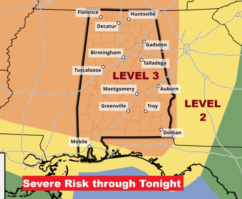
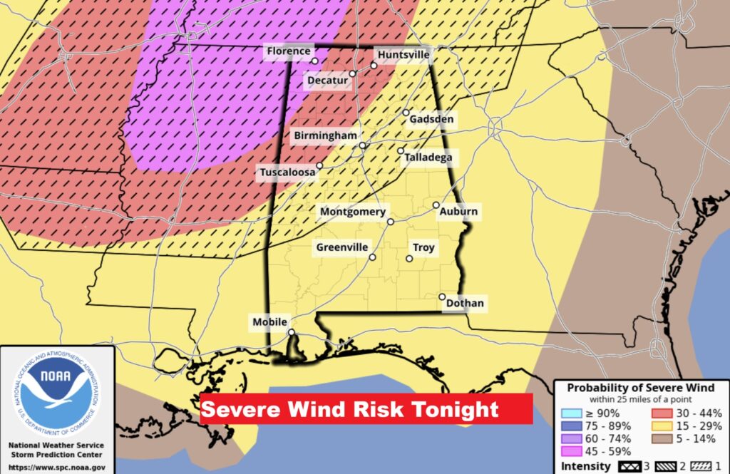
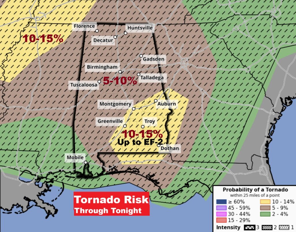
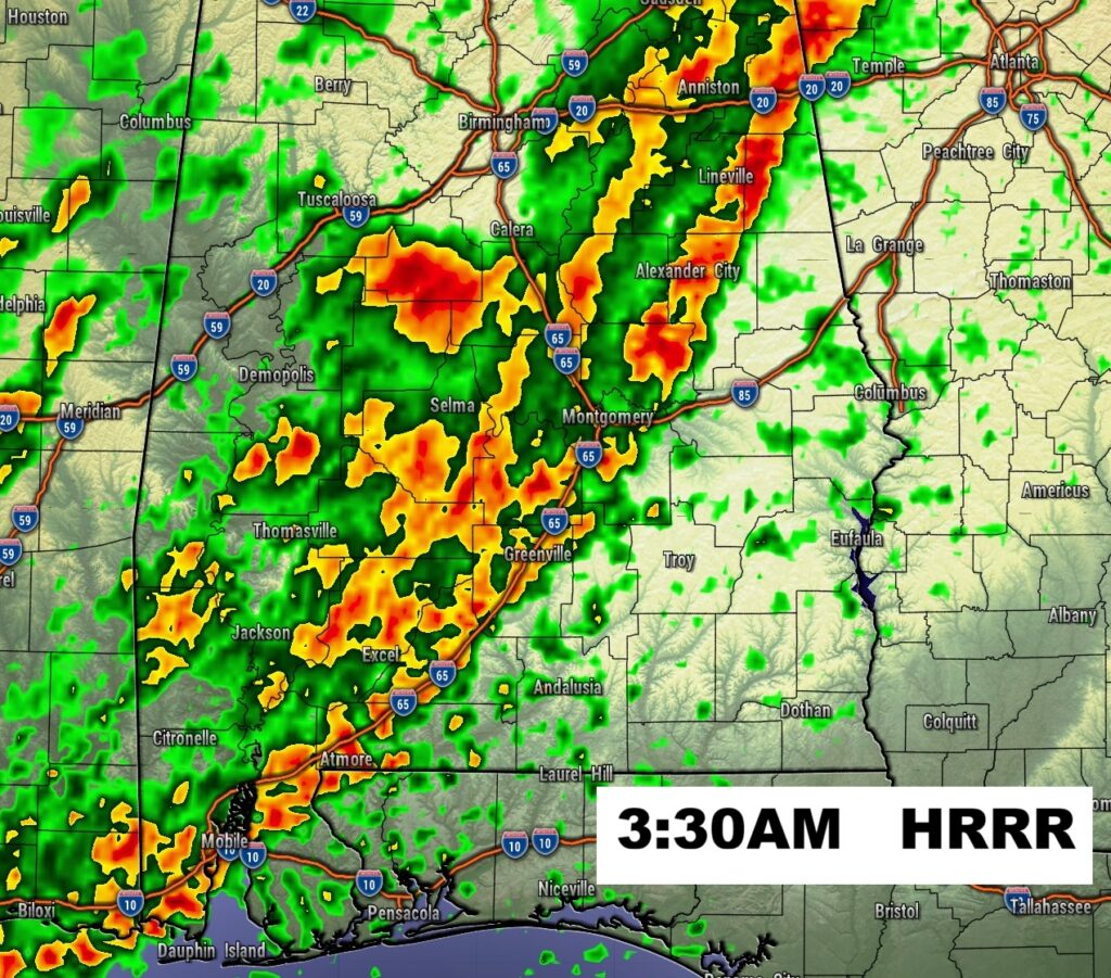
As expected SPC has now “filled in” all of Alabama into the Level 3 ENHANCED Severe Risk for tonight. In the northwest part of the state the primary risk is damaging wind gusts 70+ mph. However, from roughly I-85 southward, the main concern is discrete supercells capable of producing potentially strong tornadoes, EF-2 or stronger. Most disturbing is the overnight nature of this elevated risk.


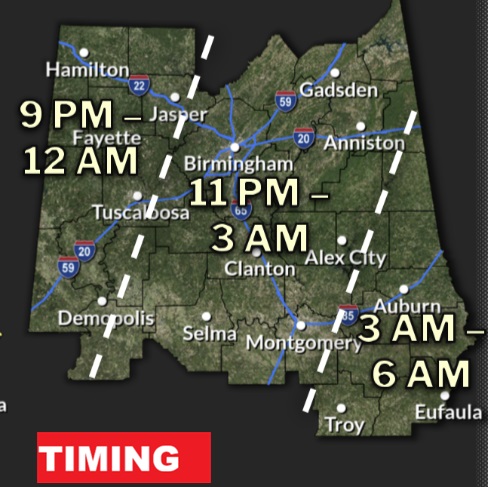
We have another Severe Weather Threat by late tonight in the overnight hours. All modes of Severe Weather are on the table – including tornadoes.
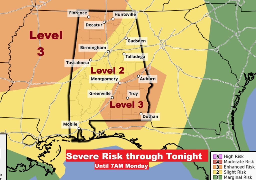
Most concerning is a Level 3 – Enhanced Severe Risk covering the southeastern third of the state, along and SE of a Auburn / Montgomery / Greenville line. In this zone, there is a risk of cellular supercells. Storms by themselves. Strong tornadoes (EF-2+) are not out of the question. Damaging wind gusts to 70+ mph are also possible. Large hail is less of a threat, but possible.

The dangerous overnight time frame is concerning. By Dawn, the threat will have shifted to the southeast counties. Level 3 out of 5 risk is concerning.
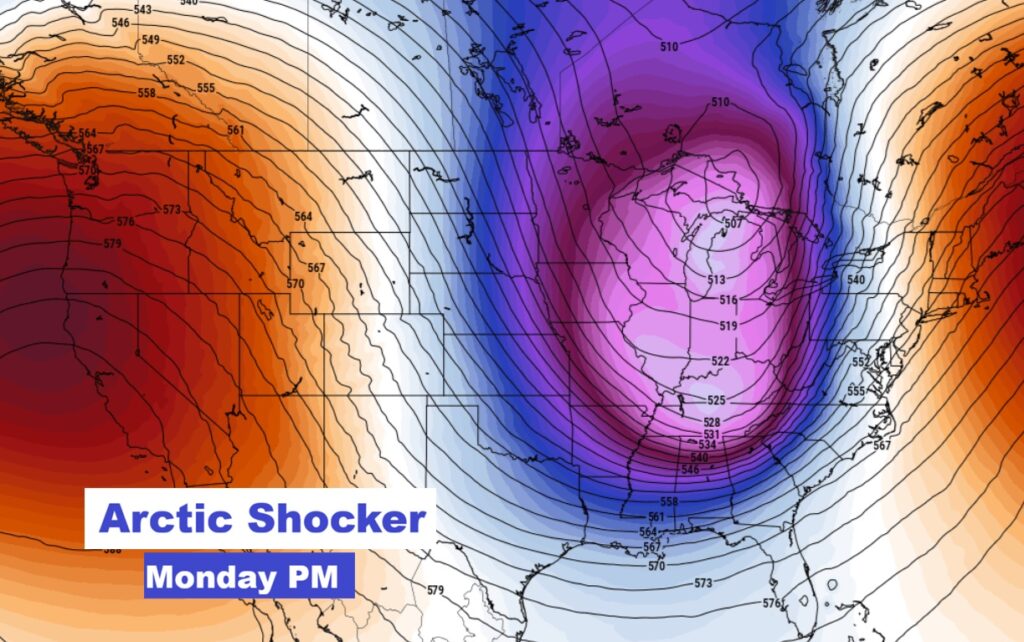
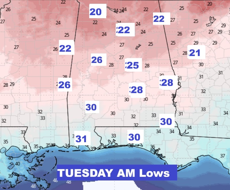
The Arctic Cold weather threat follows Monday through Wednesday will be very cold. Freeze warning will be in effect Monday and Tuesday night. The high on Tuesday may not reach 50 degrees. Alabama growers: take needed precautions.
I’ll update you as needed. I’m planning a FACEBOOK LIVE around 10:30 AM. I’ll have the latest Threat Levels, and Time line – plus I’ll do my best to answer some of your questions. Stay weather aware.
–Rich