
Good morning! Freeze Warning. Will this be the coldest St. Patrick’s Day since Montgomery records began in 1872? Quite possibly. Morning low record 29/1895. Coldest high 51/1928. There will be another freeze tonight. Will that be the last freeze of the season? The Arctic chill will retreat soon. We’ll be in the upper 70’s by Friday. And, likely into the 80’s by the weekend. It appears we will be in a dry/storm-free pattern for several days. No drama. Here’s my brief video forecast discussion.
TODAY: Widespread AM frost. (Record: 29/1895) Sunshine. High 51. NW wind 6 to 12 mph. (Coldest record 51/1928)
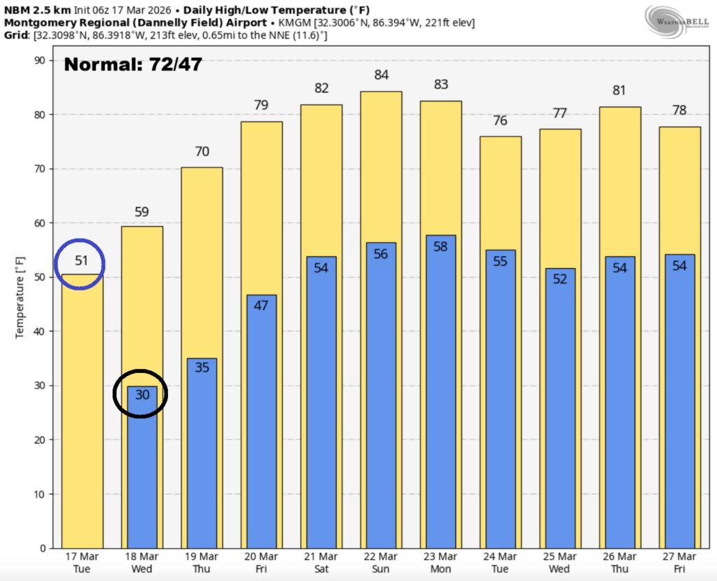
(Normal 72/47)
TONIGHT: Freeze warning. Clear and cold. Low 30. (Record 30/1941)
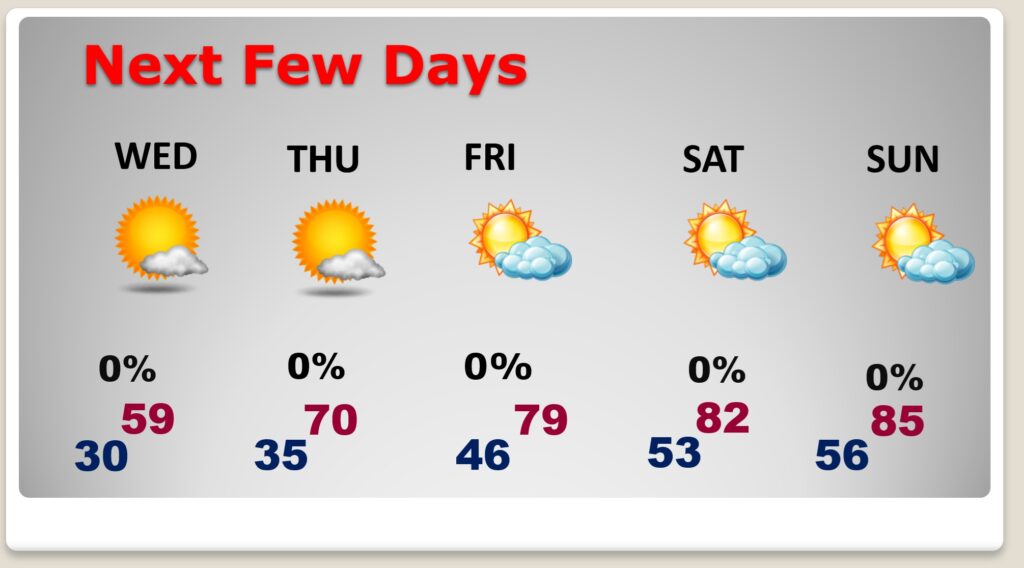
NEXT FEW DAYS: The Arctic cold will fade away. Sunshine, near 60 Wednesday. Near 70 Thursday. Upper 70’s Friday. More sun. Lower 80’s Saturday. Still storm-free and dry.
.
The 10 Day model Blend Temperature Trend. Evil Arctic Air will retreat.
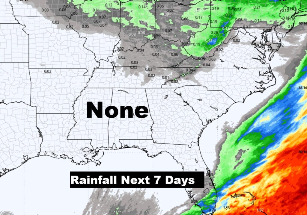
We’re in the midst of a worsening drought. But, there’s no rain in our forecast over the next seven days.
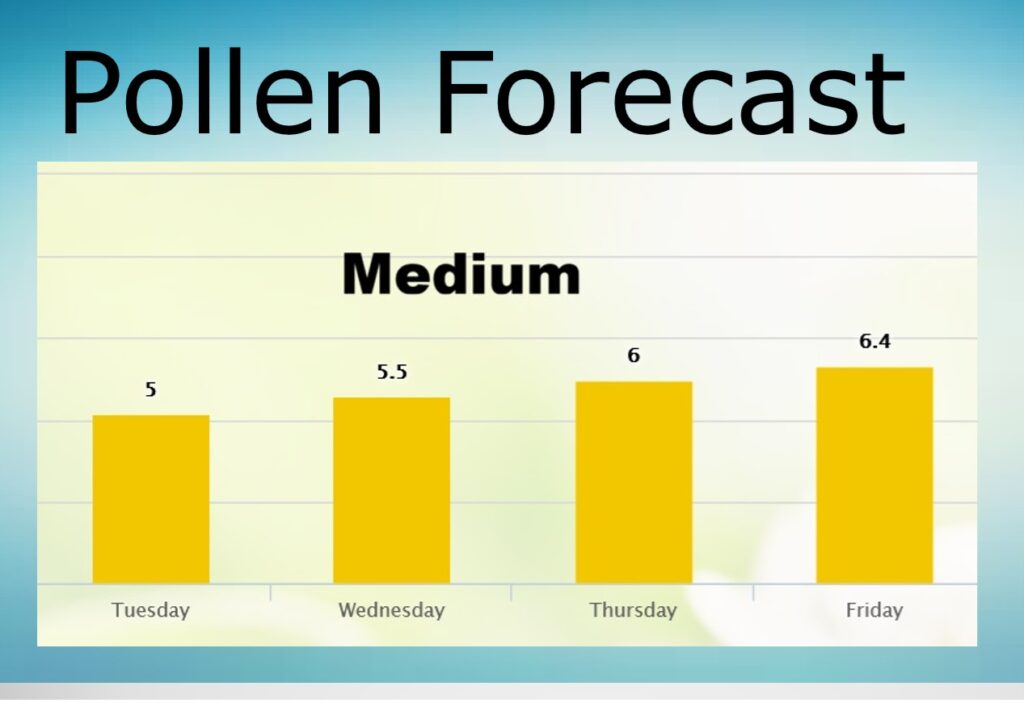
POLLEN FORECAST:
Temporarily – not as bad as last week. But, that’ll change.
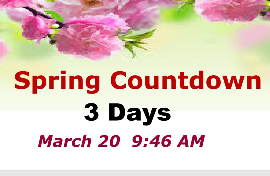
Spring officially begins Friday. The equinox is at 9:46 AM CDT.
Thanks for reading this Blog this morning. This morning we are LIVE on the radio from 6 to 9 on NewsTalk 93.1. I’ll have another update for you in the 4 o’clock hour tomorrow morning. Have a nice day.
–Rich