
Good morning! A cool front has swept through the state. After 86 Monday, we’ll be at least 12 degrees cooler today and Wednesday. There will be a rebound Thursday & Friday as highs recover into the low to mid 80’s.
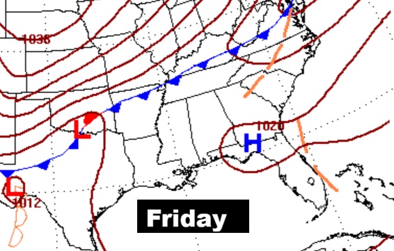
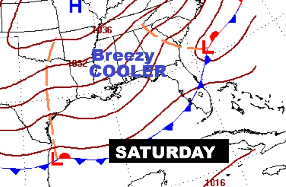
A second cool front will sweep through the state Friday. It looks like a dry front. The weekend will be much cooler but storm-free. Here’s my brief video forecast discussion.
TODAY: Mostly sunny. MUCH Cooler. High 73. East wind 10 to 15 gusting to 20 mph.
(Normal 74/48)
TONIGHT: Mostly cloudy. COOL. Low 53
NEXT FEW DAYS: Wednesday’s high will only be in the 70’s. There will be a rebound Thursday & Friday as highs recover into the low to mid 80’s.
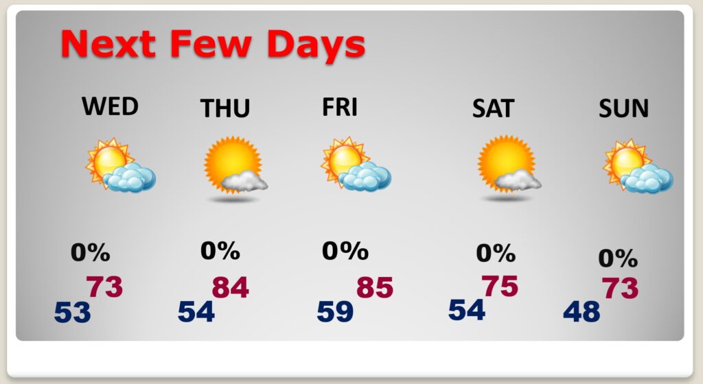
A second cool front will sweep through the state Friday. It looks like a dry front. The weekend will be cooler but storm-free.
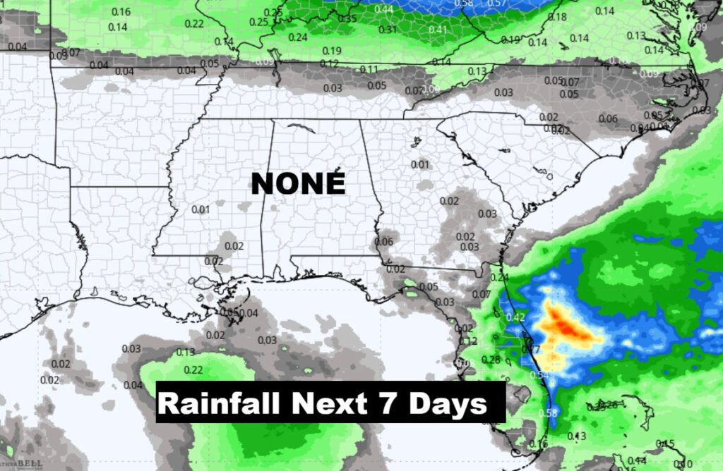
The drought grows worse. No rain for the next 7 days.
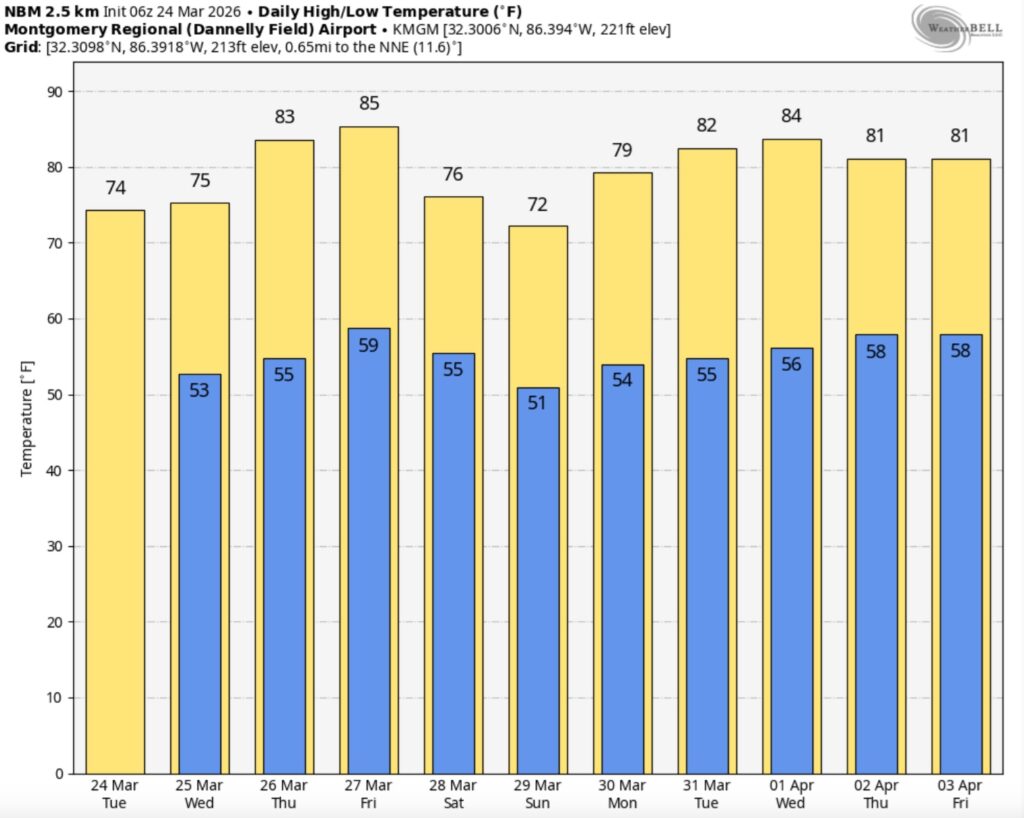
The 10 Day model Blend Temperature Trend. A couple of temperature set-backs this week: Today and Wednesday and again Saturday/Sunday.
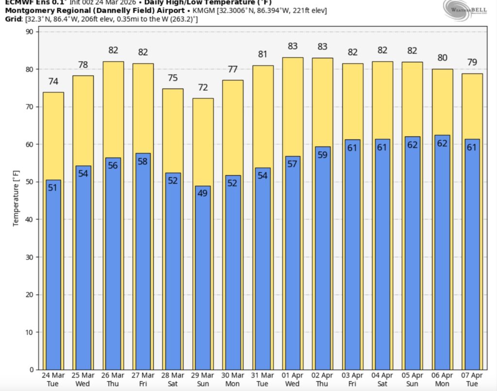
The 16 Day EURO Ensembles. Mostly comfortable temperatures. No Arctic air.
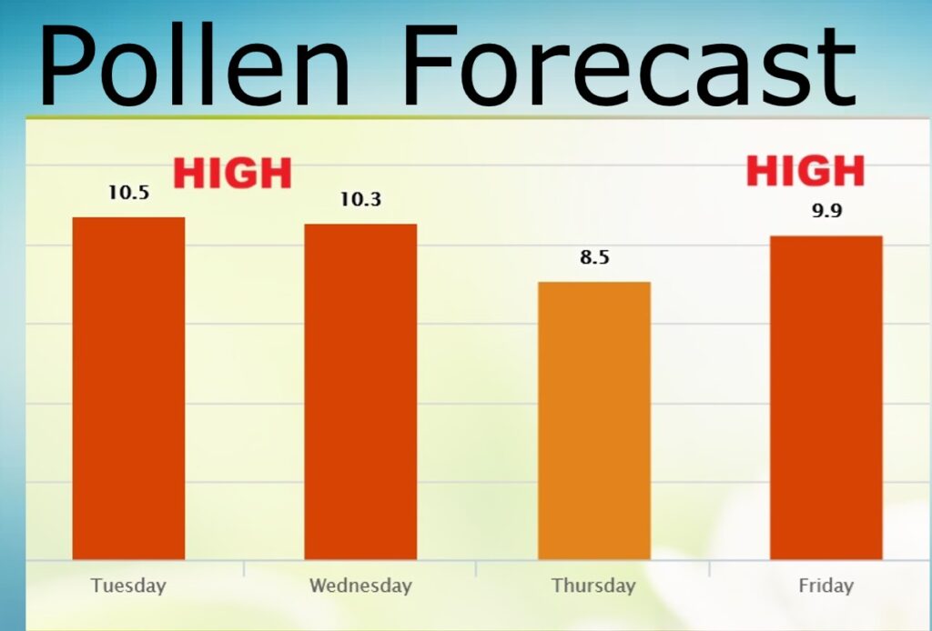
POLLEN FORECAST: Unfortunately, the pollen numbers are not good.
Thanks for reading this Blog this morning. The next scheduled complete Blog update and Video Forecast Discussion is scheduled for the 4 o’clock hour on Monday morning. Have a great weekend.
-Rich