
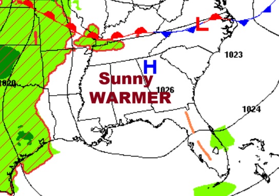
Good morning! Our extended string of storm-free of days continues. A significant warming trend is underway.
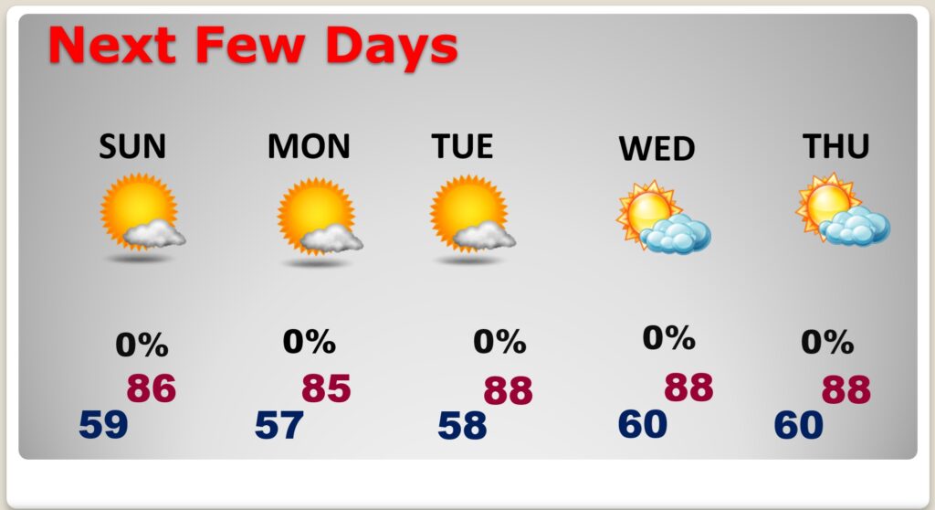
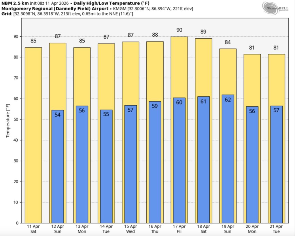
In fact, we’ll be in middle 80’s today and Sunday. Abundant sunshine will dominate for here and the Gulf coast. The very warm pattern continues all next week. Highs in the upper 80’s are expected Tuesday through Thursday – perhaps teasing some high temperature records. We could be 90 or above by Friday. The next frontal system with showers and storms will hold off until next weekend – April 24/25.
TODAY: Abundant sunshine. Warmer. High near 85. Light wind.
(Normal hi/lo 77/52)
TONIGHT: Clear and cool tonight. Low 56.
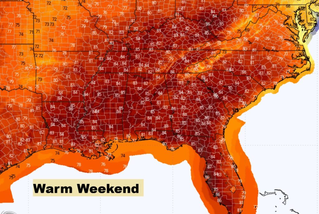
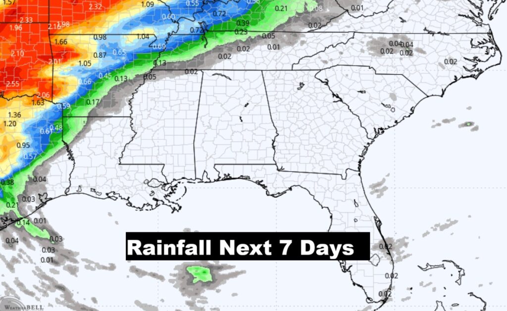
NEXT FEW DAYS: The forecast this week is uneventful. Storm-free/Dry days continue. Lots of sunshine. Highs in the upper 80’s are expected Tuesday through Thursday – perhaps teasing some high temperature records. We could be 90 or above by Friday. No rain in the outlook for the next 7 days. Storm-free.
Rainfall outlook for the next seven days.
The 10 Day model Blend Temperature Trend. Continued very warm.
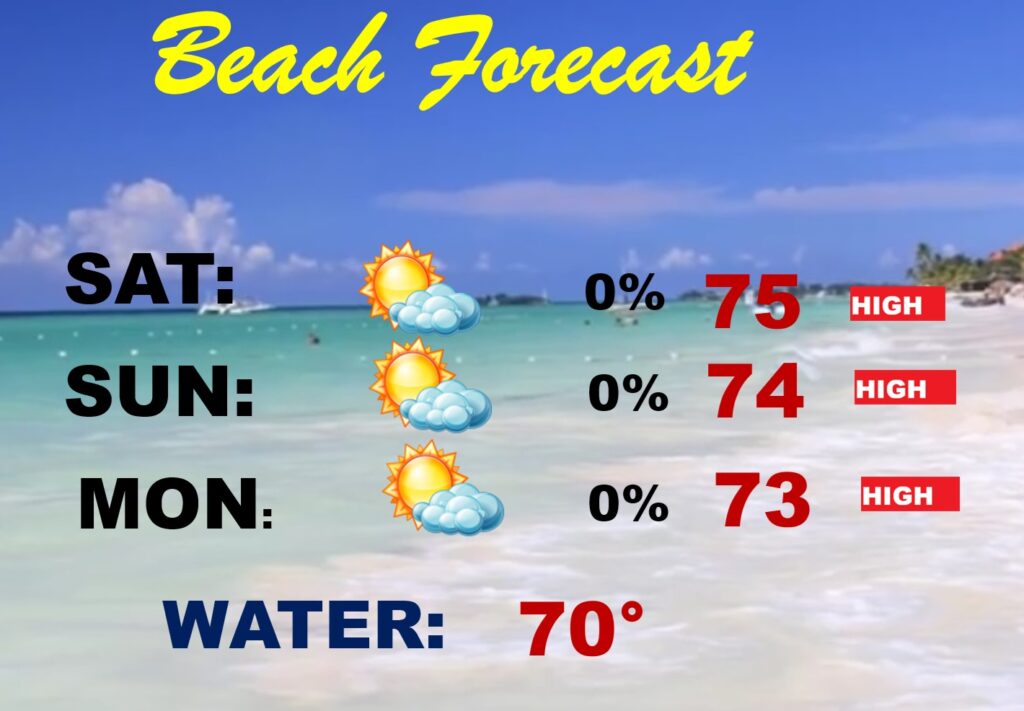
BEACH FORECAST: Nice forecast. Pleasant storm free pattern. Mostly sunny. Highs mostly in middle 70’s The Gulf water is now at 70. High rip current risk continues through Sunday, especially along the Florida panhandle. Red flags.
Thanks for reading this Blog this morning. Today is a travel day for me. The next scheduled complete Blog update and Video Forecast Discussion is scheduled for the 4 o’clock hour on Monday morning. Have a great weekend.
-Rich