
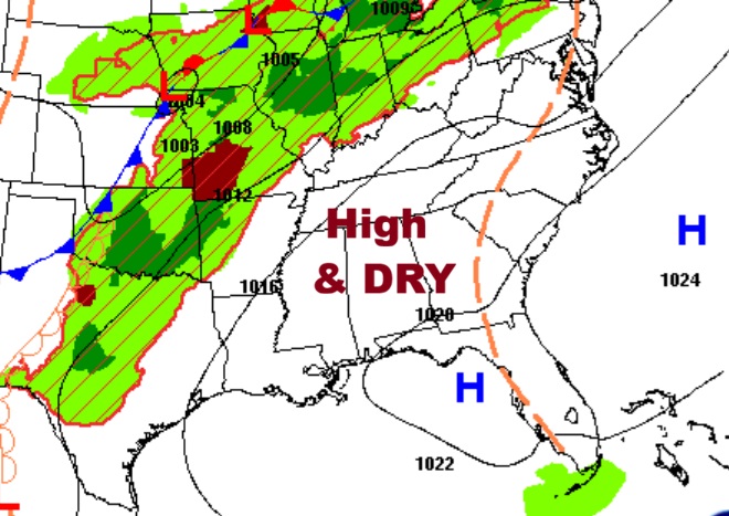
Good morning! Our very warm dry pattern continues. We’ve been in the 80’s for 5 days straight. Daily highs in the 80’s will continue through Thursday. We may be near record highs by late week. If we get to 90 Friday – that would tie the record. The drought continues to grow worse. A weekend Cool front could deliver some showers and thunderstorms by Saturday night or Sunday morning. Severe weather is not expected. Sunday will be significantly cooler by several degrees. Here’s my brief video forecast discussion.
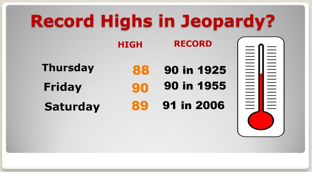
TODAY: Mostly sunny. Continued warm. High near 88. Light wind.
(Normal hi/lo 78/52) (Record 91 from 1972)
TONIGHT: Mostly clear. Low 59
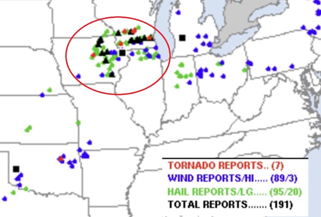
Storm Chasers were out in droves in the Midwest yesterday. Several impressive confirmed tornadoes. Hardest hit states were Iowa and Wisconsin.
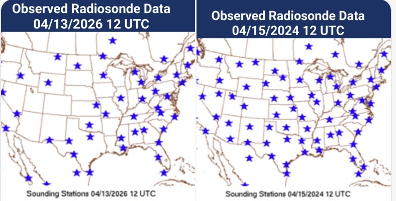
This is a trend the meteorological world is concerned about. NWS cutbacks have lead to far fewer critical upper air balloon launches. Will this degrade our forecasts? Check out the the comparison maps from launches this week in 2024 to this year.
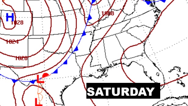
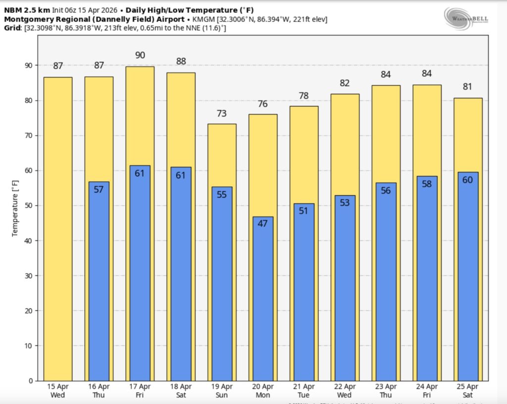
NEXT FEW DAYS: Our extended string of warm, storm-free days rolls on. Dry at least through the work week. Highs well into the 80’s will continue. Near or above 90 by Friday and Saturday. Overnight lows in the 50s and 60s. A weekend front could deliver some showers and thunderstorms by Saturday night or Sunday morning. Sunday will be significantly cooler by several degrees.
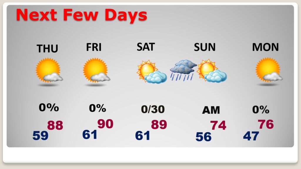
TEASING RECORD HIGHS?: Looks like we could flirt with records especially Thursday through Saturday.
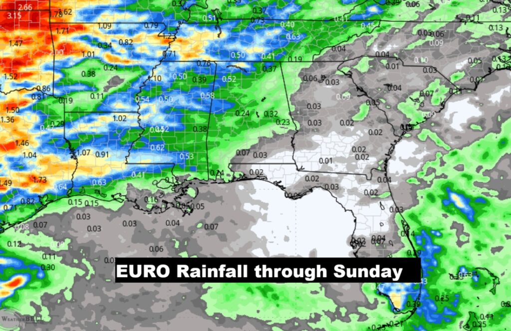
A weekend Cool frontal system bring the next chance of showers & storms. Best chance looks like overnight Saturday night into early Sunday AM.
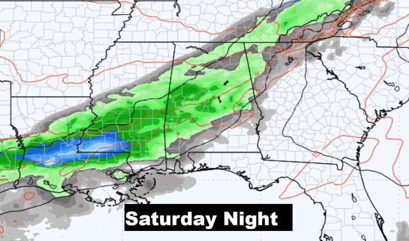
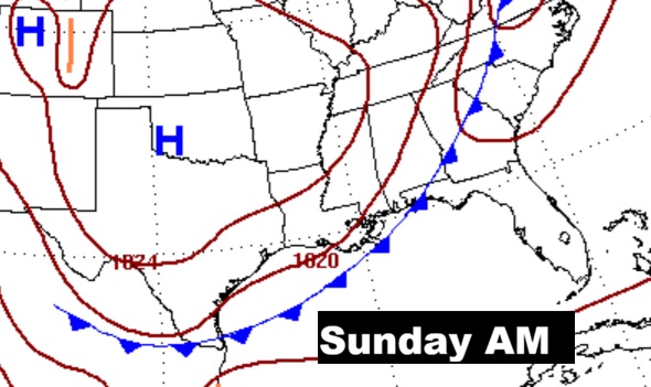
The EURO model is still the most optimistic model for the chance of showers and maybe some thunderstorms overnight Saturday and Sunday AM. Sunday will be quite a bit cooler.
The 10 Day model Blend Temperature Trend.
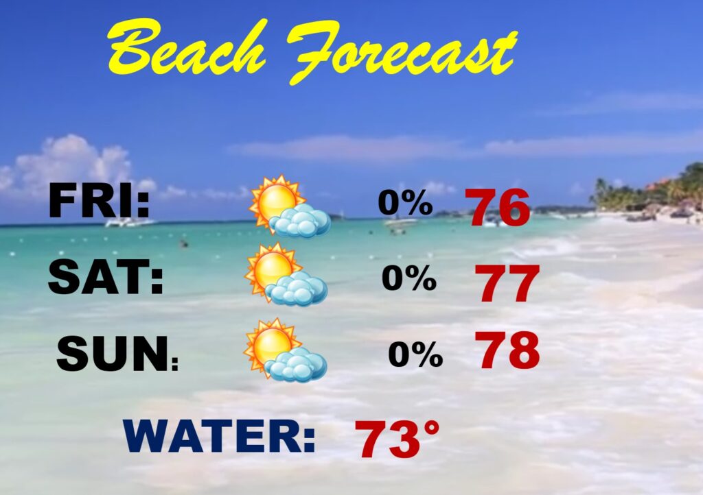
BEACH FORECAST: Can’t rule out a few showers by Sunday AM, but it’s a generally dry and nice forecast for the beaches from Gulf Shores to Panama City.
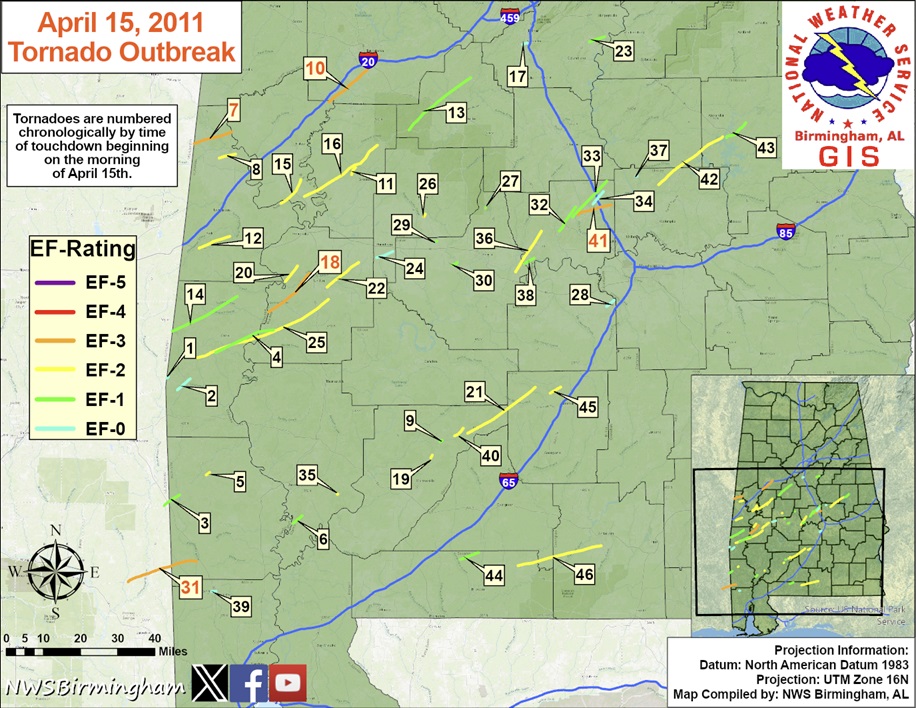
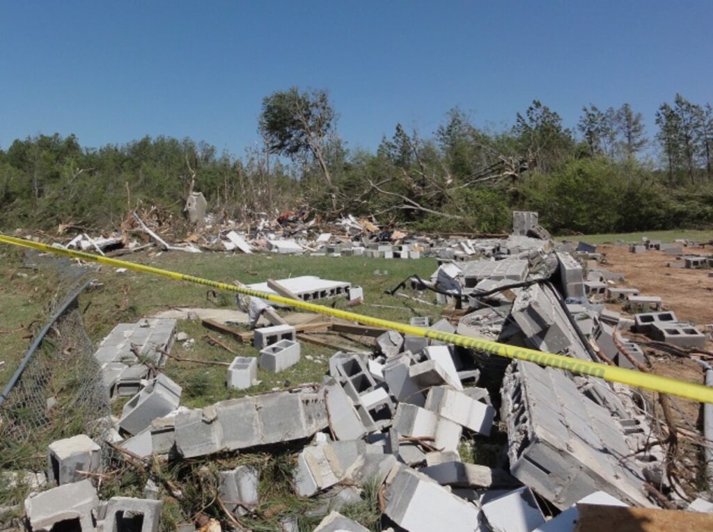
TORNADO OUTBREAK ANNIVERSARY: Sometimes called “The Forgotten Outbreak”. The April 15th, 2011 tornado outbreak broke records in Alabama. Twelve days later, April 27th would shatter them.
On April 15, 2011 – 46 tornadoes – 15 strong tornadoes. 4 deaths including 3 in Autauga county. The Boones Chapel tornado. An EF-3 at 10:47 PM. Tornadoes occurred for 12 hours straight – starting a little after 12 noon. April 2011 was a Record Alabama tornado month with 149 tornadoes.

Thanks for reading this Blog this morning. This morning we are LIVE on the radio from 6 to 9 on NewsTalk 93.1. I’ll have another update for you in the 4 o’clock hour tomorrow morning. You can also watch us during our morning show on You Tube and Facebook. Search Newstalk 93.1. Have a nice day.
–Rich