
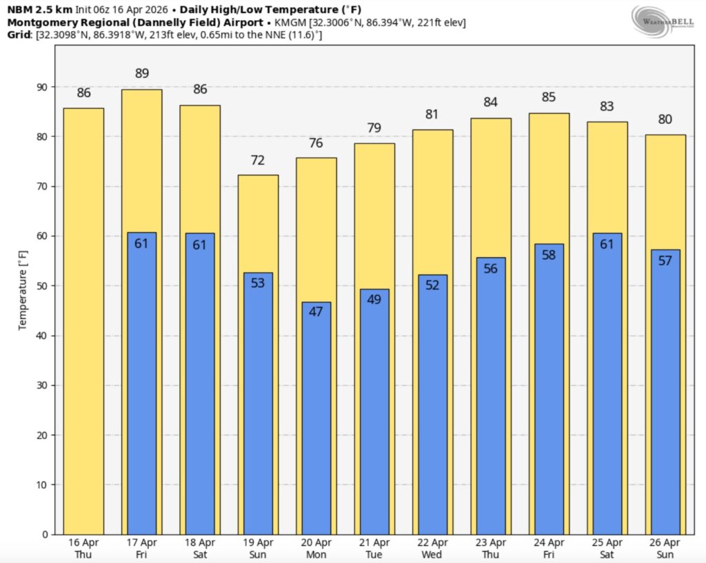
Good morning! We have been bone dry for 11 days straight. Daily highs in the 80’s reach day 7 today. We may be near record highs by late week. If we get to 90 tomorrow – that would tie the record. The drought continues to grow worse. A weekend Cool front could deliver scattered showers and thunderstorms by Saturday night into Sunday morning. Severe weather is not expected. Sunday will be significantly cooler by several degrees. Here’s my brief video forecast discussion.
TODAY: Mostly sunny. Continued warm. High near 88. West winds 5 to 10 mph.
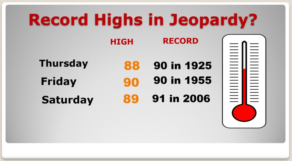
(Normal hi/lo 79/52) (Record 90 from 1925)
TONIGHT: Mostly clear. Low 62
NEXT FEW DAYS: Our extended string of warm, storm-free days rolls on. Dry at least through the work week. Highs well into the 80’s will continue. Near 90 by Friday and Saturday. Overnight lows in the lower 60s. A weekend front will bring scattered showers and thunderstorms by Saturday night or Sunday morning. Sunday will be significantly cooler by several degrees.
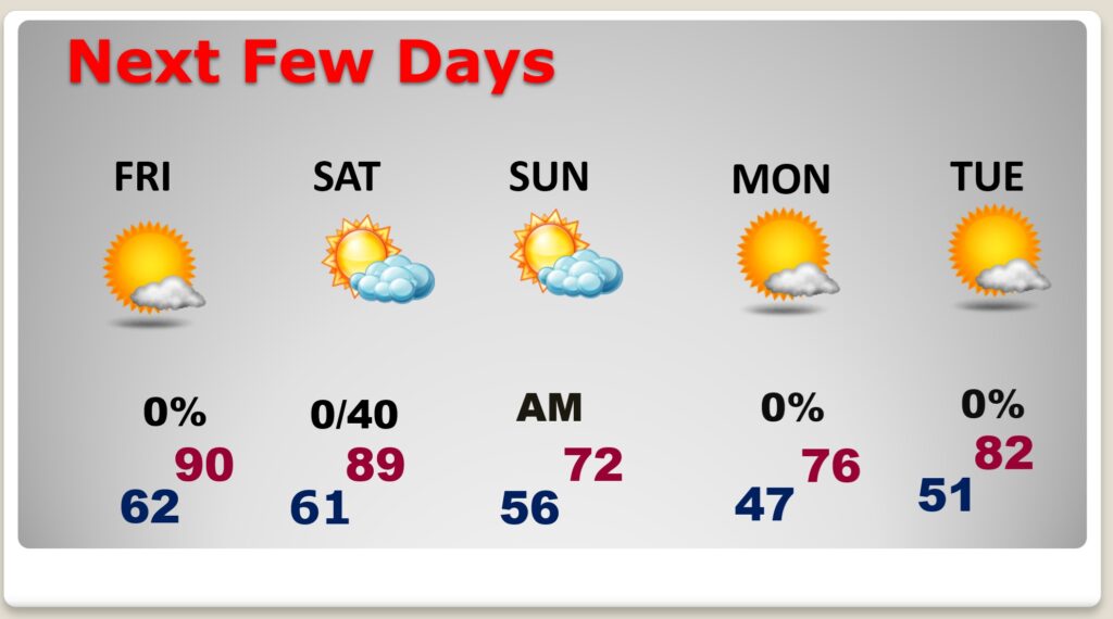
TEASING RECORD HIGHS?: Still flirting with records today through Saturday.
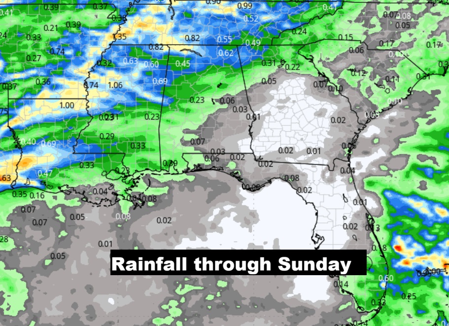
That weekend Cool frontal system bring the next chance of showers and a few thunderstorms. Best chance looks like overnight Saturday night into early Sunday AM.
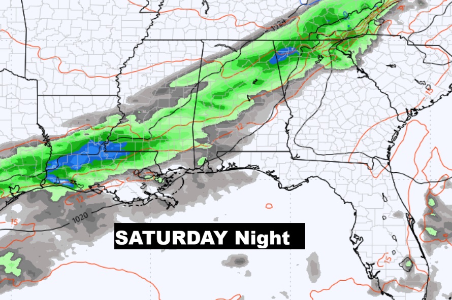
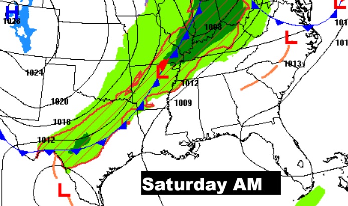
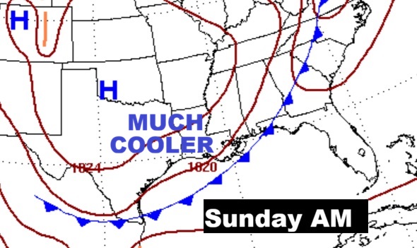
The EURO model is still the most optimistic model for the chance of showers and maybe some thunderstorms overnight Saturday and Sunday AM. Sunday will be quite a bit cooler.
The 10 Day model Blend Temperature Trend. Big cool down Sunday. 40’s on Sunday night.
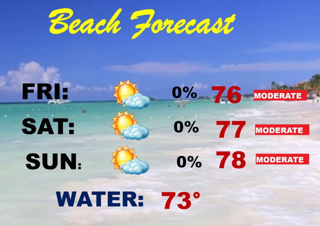
BEACH FORECAST: Can’t rule out a few showers by Sunday AM, but it’s a generally dry forecast for the beaches from Gulf Shores to Panama City. Moderate rip current risk.
Thanks for reading this Blog this morning. This morning we are LIVE on the radio from 6 to 9 on NewsTalk 93.1. I’ll have another update for you in the 4 o’clock hour tomorrow morning. You can also watch us during our morning show on You Tube and Facebook. Search Newstalk 93.1. Have a nice day.
–Rich