
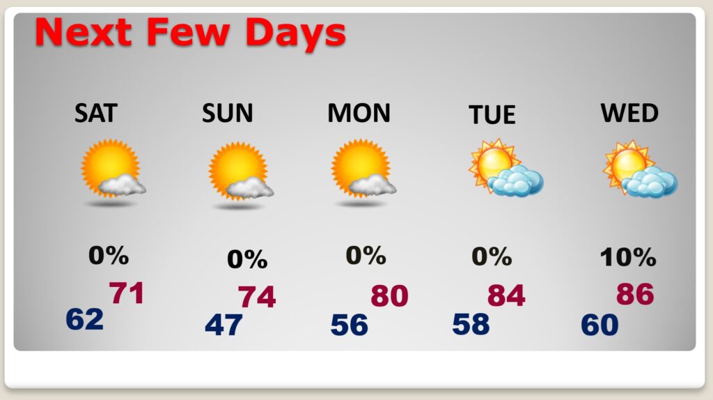
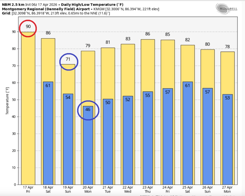
Good morning! Today will likely be the warmest day of the week. In fact, there’s chance we’ll see the first 90 degree day of the year. That would tie a 71 year old record. But, there are big changes on the way thanks to an approaching weekend Cols Front. Saturday will be the last warm day in this pattern. We should be dry through Saturday evening. Scattered showers and thunderstorms will sweep across the state in the overnight Saturday night through Sunday morning. Severe weather is unlikely.
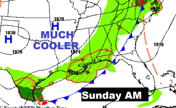
Sunday will be significantly cooler by several degrees, with highs barely past 70. We’ll be in the 40’s on Sunday night. The cool-snap will be brief. Looks like we’ll see a big warm-up again by mid-week. Here’s my brief video forecast discussion.
TODAY: Mostly sunny. Potential record warmth. High near 90. South winds 5 to 10 mph.
(Normal hi/lo 79/53) (Record 90 from 1925)
TONIGHT: Mostly clear. Mild. Low 62
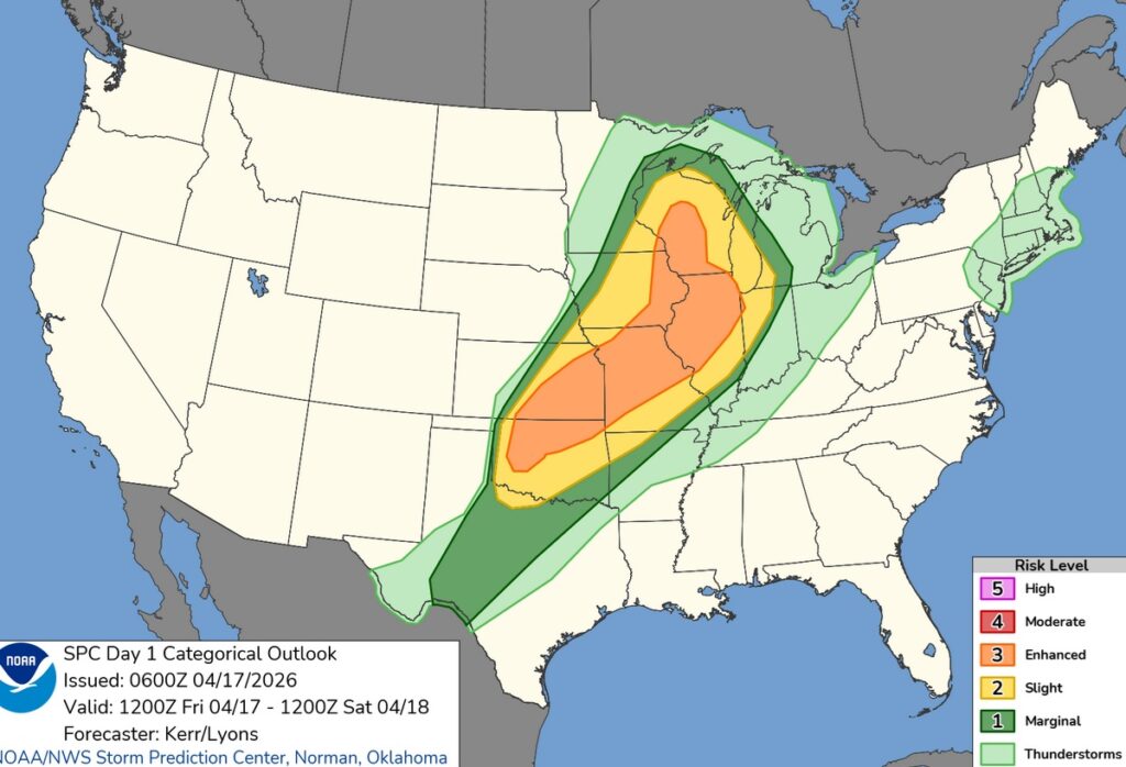
A big Severe Weather threat for mid America today, including the chance for strong tornadoes.
NEXT FEW DAYS:
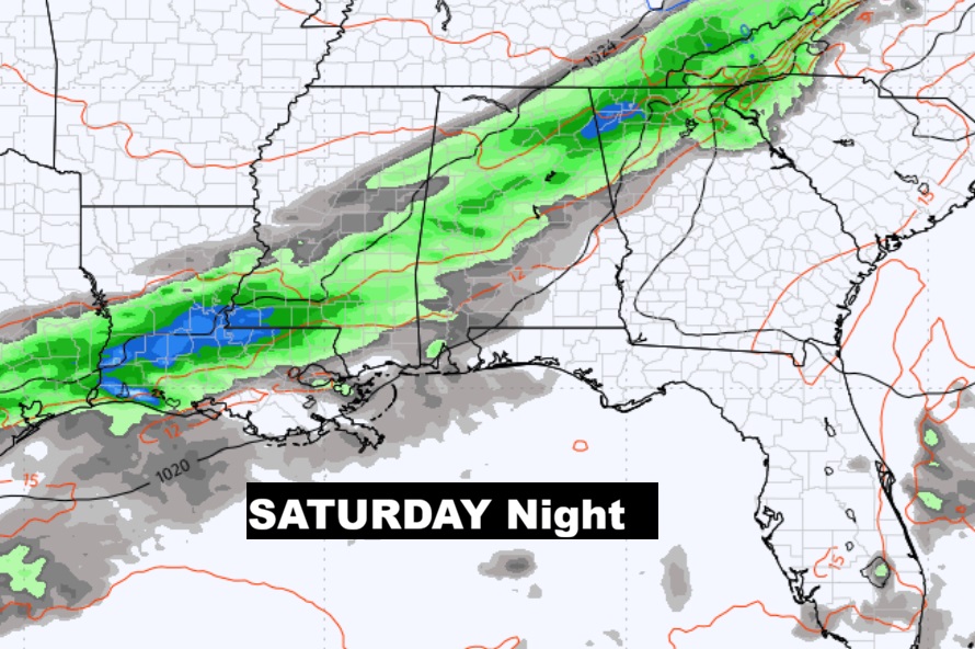
Saturday will be the last warm day in this pattern. We should be dry through Saturday evening. Scattered showers and thunderstorms will sweep across the state in the overnight Saturday night through Sunday morning. Severe weather is unlikely. Sunday will be significantly cooler by several degrees. We’ll be in the 40’s on Sunday night. Look for a big warm-up again by mid-week.
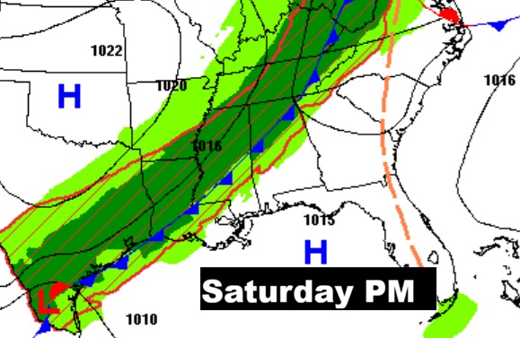
The weekend Cool frontal system bring the next chance of showers and a few thunderstorms. Best chance looks like overnight Saturday night into early Sunday AM.
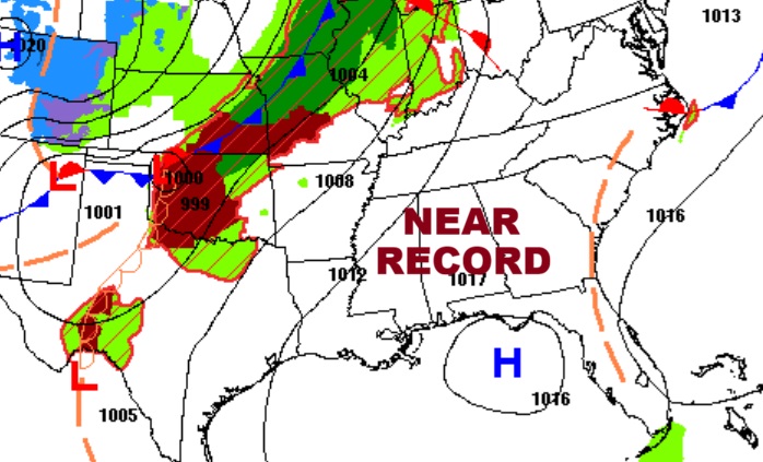
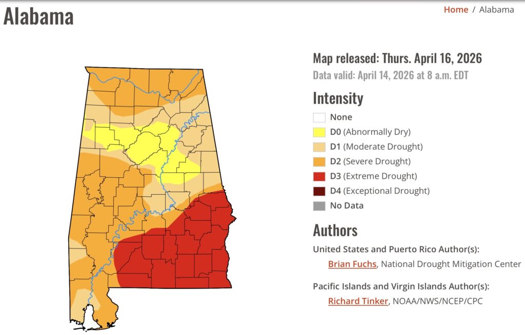
DROUGHT MONITOR: The new Drought Monitor map now shows 66%+ of the state in a Severe Drought status and 25% in an Extreme drought covering southeast and south central Alabama from Montgomery and Lee county southward. Alabama has been rain free for 11 days straight.
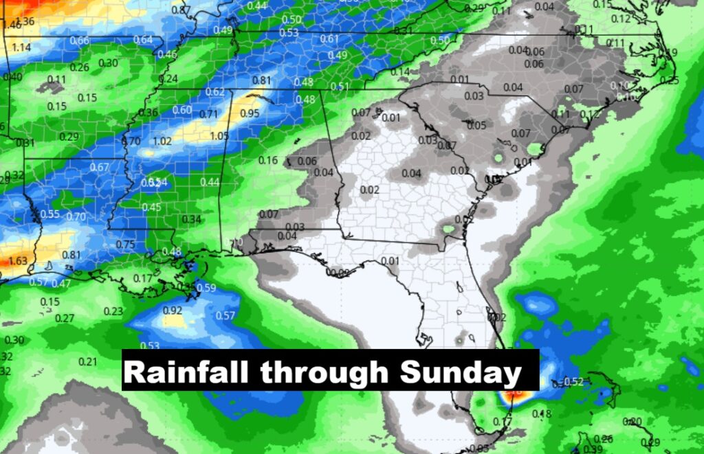
Rainfall through Sunday. Fingers crossed. But, I’m not too optimistic. Total rainfall amounts in central Alabama will likely be under .25”. Even less in south Alabama.
The 10 Day model Blend Temperature Trend. Big cool down Sunday. 40’s on Sunday night. But, expect another big warm-up by the middle of the week.
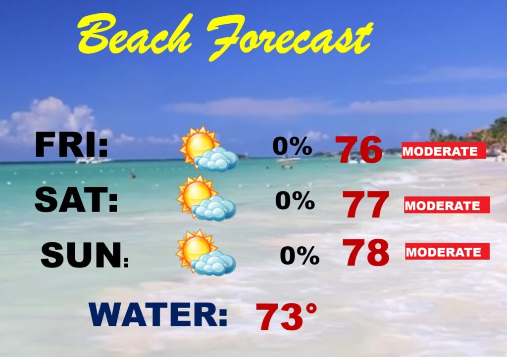
BEACH FORECAST: Can’t rule out a few showers by Sunday AM, but it’s a generally dry forecast for the beaches from Gulf Shores to Panama City. Moderate rip current risk.
Thanks for reading this Blog this morning. This morning we are LIVE on the radio from 6 to 9 on NewsTalk 93.1. I’ll have another update for you in the 4 o’clock hour tomorrow morning. You can also watch us during our morning show on You Tube and Facebook. Search Newstalk 93.1. Have a nice day.
–Rich