
Good morning! Today will be the last day in this current very warm pattern – with upper 80’s expected today. Dry with good amount of sunshine. Dry through the evening hours tonight.
But, there are big changes on the way thanks to an approaching Cold Front. Scattered showers and thunderstorms will sweep across the state in the overnight tonight and lingering into Sunday morning. Severe weather is not expected
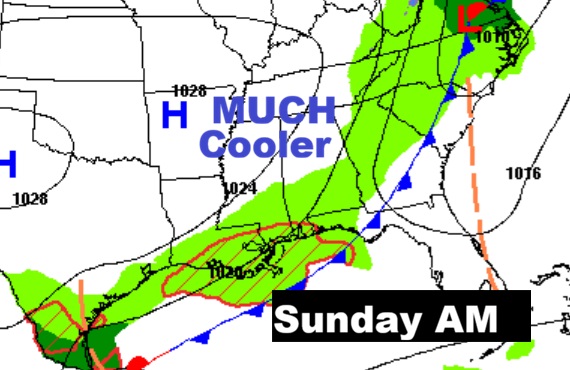
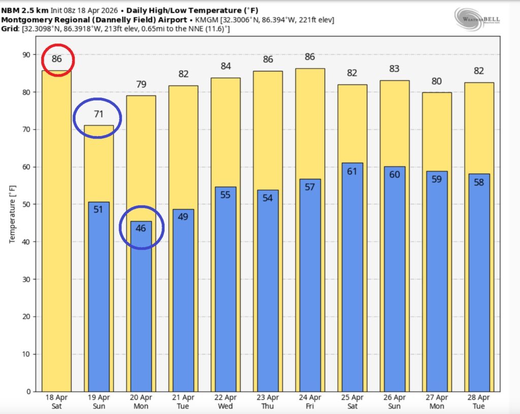
Sunday will be significantly cooler by several degrees, with highs barely into the lower 70’. We’ll be in the mid 40’s on Sunday night. The cool-snap will be brief. Looks like we’ll see a big warm-up again by mid-week.
CLIMATE: Friday’s High in Montgomery reached 88° — falling short of the record of 90° from 1955 and 1894. Last year the first 90° day was on May 15th. The average date of the first 90° day is June 10th. Today is the eighth day of temperatures 80 or above. Expect One more very warm day on Saturday in the upper 80s. Then, an approaching cold front will bring scattered showers and storms in the overnight hours Saturday night into Sunday morning, followed by a drastic cooldown. Sunday’s high will struggle to reach only 71°. By the way. I officially reached 90° for the first time this year here in East Montgomery on my Weather station Friday. (Normal 79/53)
Rainfall for the month at MGM .62 (Deficit: -1.77) Day 13 with no rain. Fingers crossed tonight. Deficit for the year so far -7.59)
TODAY: Mostly sunny. Potential record warmth. High near 90. South winds 5 to 10 mph.
(Normal hi/lo 79/53) (Record 90 from 1925)
TONIGHT: Mostly clear. Mild. Low 62
The Cold front moves through the state late tonight.
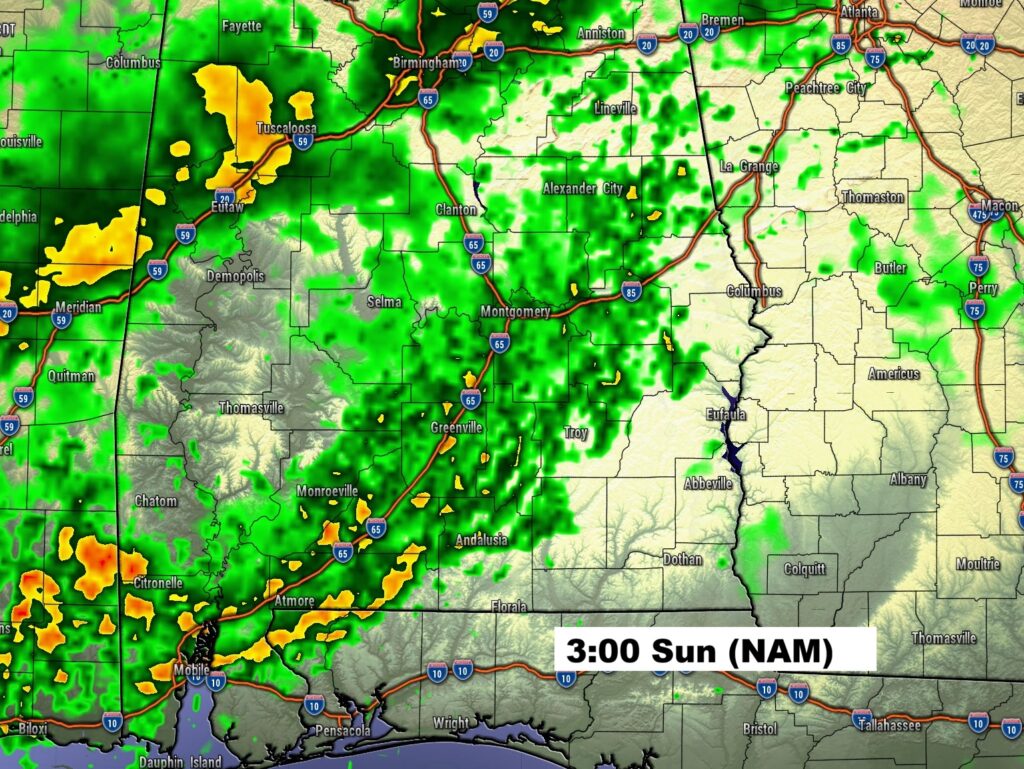
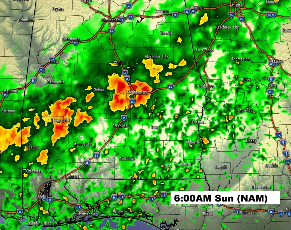
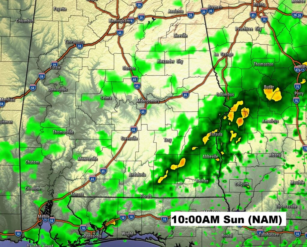
FUTURE RADAR: Rain holds off until the overnight hours. NAM future radar does a good job showing the rain arrival for many in central Alabama in the 3:00-4:00 time range. Peaking about 6:00AM, then into SE Alabama at 10:00AM.
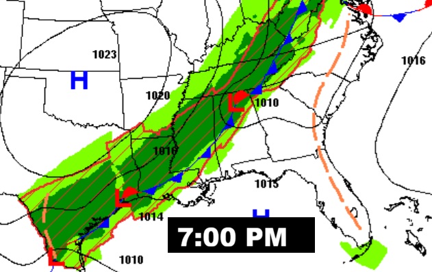
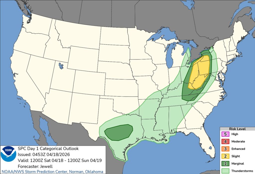
No severe weather threat expected in Alabama. Here’s the Severe outlook today through 7AM Sunday.
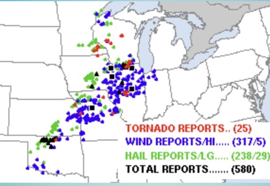
Monster severe weather day in the US Heartland yesterday – as expected. More than 2 dozen tornadoes which caused significant damage in a multi-state area. NWS issued 150 tornado warnings – Top 8 warnings for any April day on record. 350 Severe Thunderstorm Warnings were issued. This morning – more than 30, 000 customers are without power.
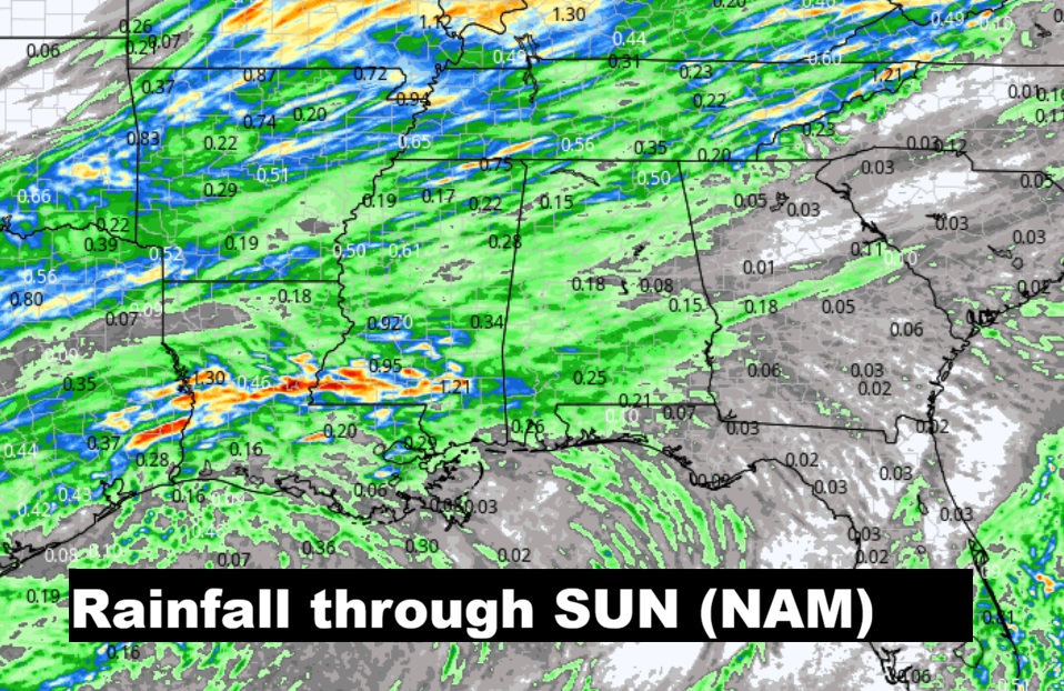
EXPECTED RAINFALL: Not enough. Here’s the NAM outlook.
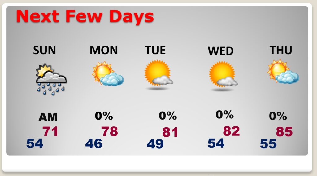
NEXT FEW DAYS:
Scattered showers and thunderstorms will sweep across the state in the overnight tonight through Sunday morning. Severe weather is unlikely. Sunday will be significantly cooler by several degrees. We’ll be in the 40’s on Sunday night. Look for a big warm-up again by mid-week.
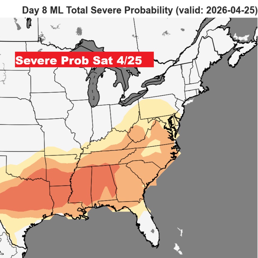
The next active period would be between April 25th and April 29th according to the global models. Some strong storms next Saturday 4/25?
The 10 Day model Blend Temperature Trend. Big cool down Sunday. 40’s on Sunday night. But, expect another big warm-up by the middle of the week.
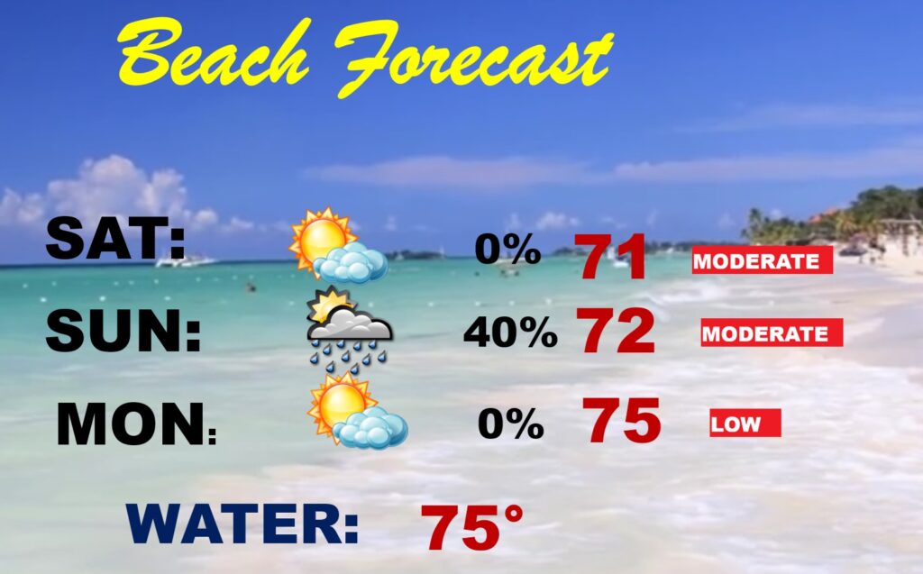
BEACH FORECAST: Can’t rule out a few showers by Sunday, but it’s a generally a storm-free forecast for the beaches from Gulf Shores to Panama City. Moderate rip current risk.
Thanks for reading this Blog this morning. The next scheduled complete Blog update and Video Forecast Discussion is scheduled for the 4 o’clock hour on Monday morning. Have a great weekend.
-Rich