
Good morning! The severe weather threat which has been battering much of the center of our country for several days is edging eastward. Strong to Severe storms could affect the state by late today and tonight. The main threat for many of us will be Damaging wind gusts. The primary tornado threat will be across far west and NW Alabama. On Wednesday, there will be a lingering Level 1 Marginal Severe Risk covering much of central and South Alabama.
A noticeable cooldown is in the cards Thursday & Friday behind the cold front. Storm system number two will bring the next round of showers and storms by Friday night into Saturday. Meanwhile, finally, the prospects for significant welcome rainfall totals appears very promising. Here’s my brief forecast discussion.
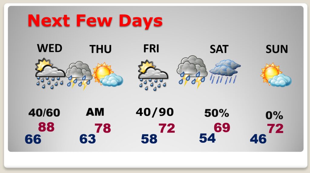
TODAY: Mostly cloudy and quite warm. High 86. Risk of spotty showers and storms by afternoon.
(Normal hi/lo 81/55)
TONIGHT: Showers and storms. Some storms could be severe with Damaging winds the main threat for most of us. Low 66.
SEVERE RISK: SPC’s Day 1 Severe outlook through tonight has been expanded and now shows a Level 2 Severe Threat as far east as an Auburn/Troy line.
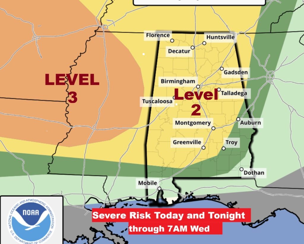
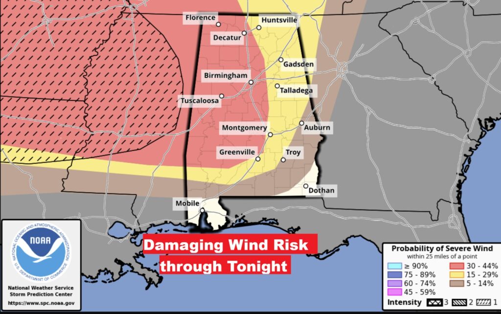
Notice the main threat for many of us will be a damaging wind threat.
The primary tornado threat will be across far west and NW Alabama.
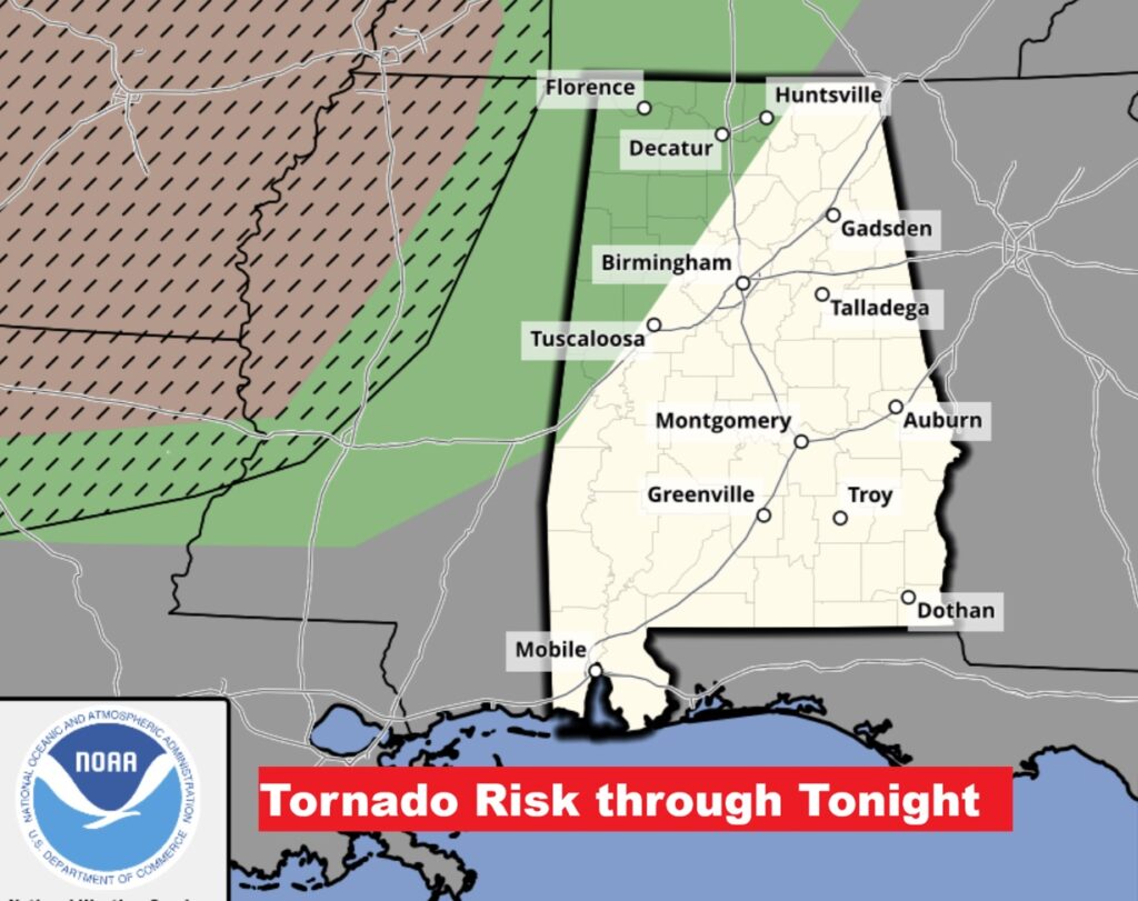
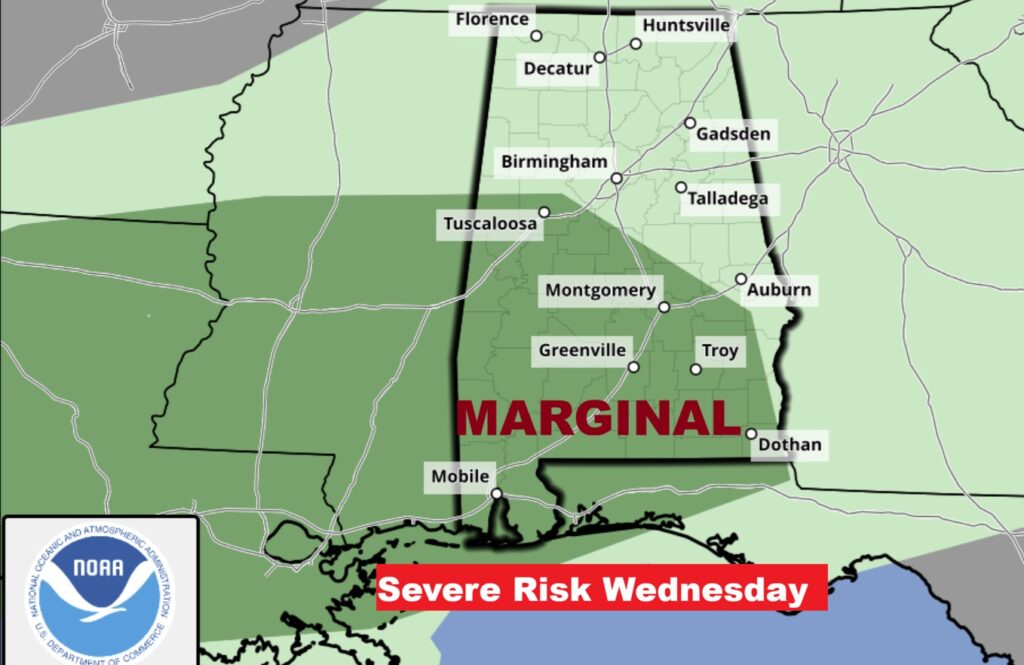
On Wednesday, there will be a lingering Level 1 Marginal Severe Risk covering much of central and South Alabama.
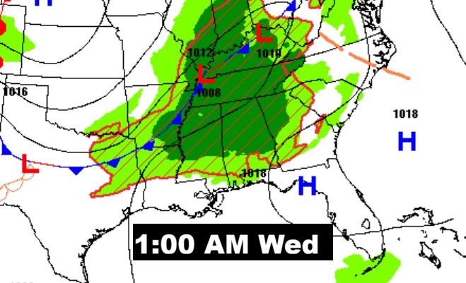
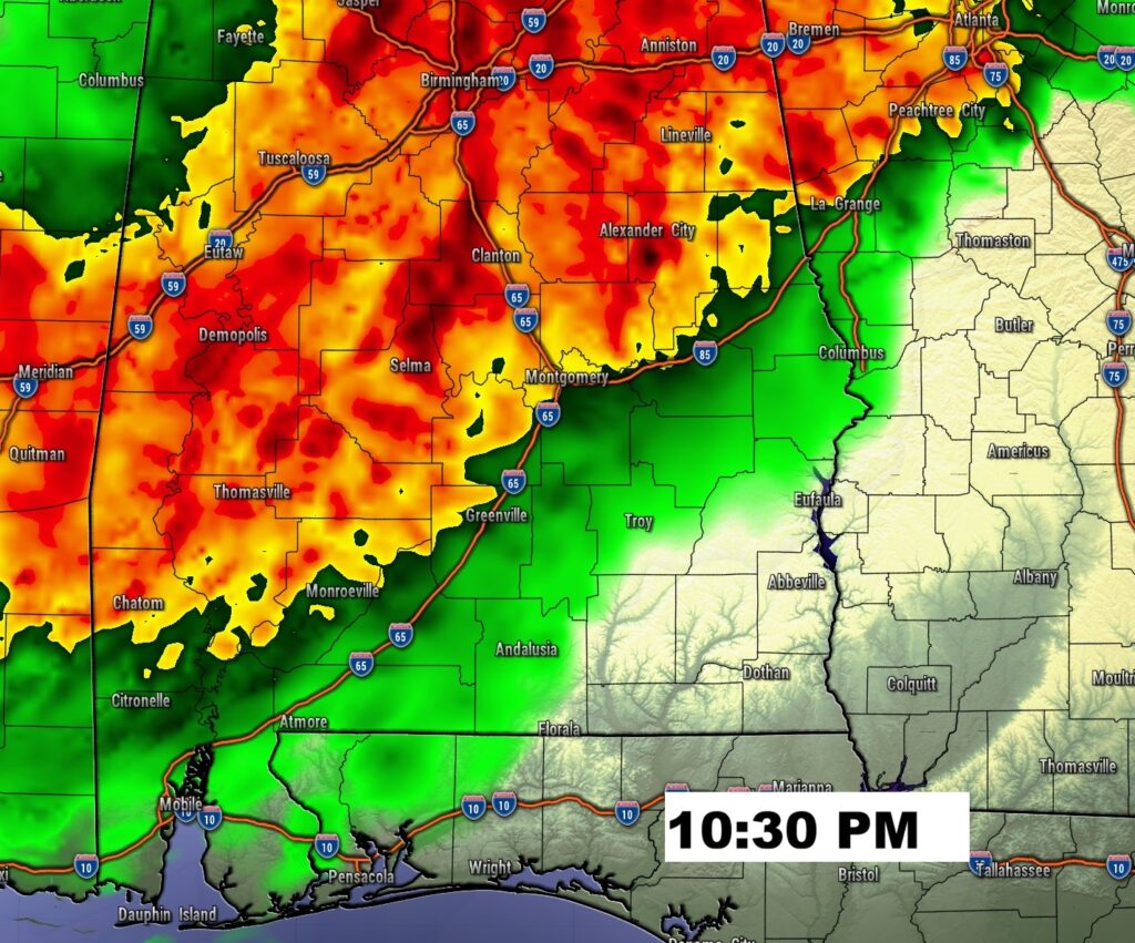
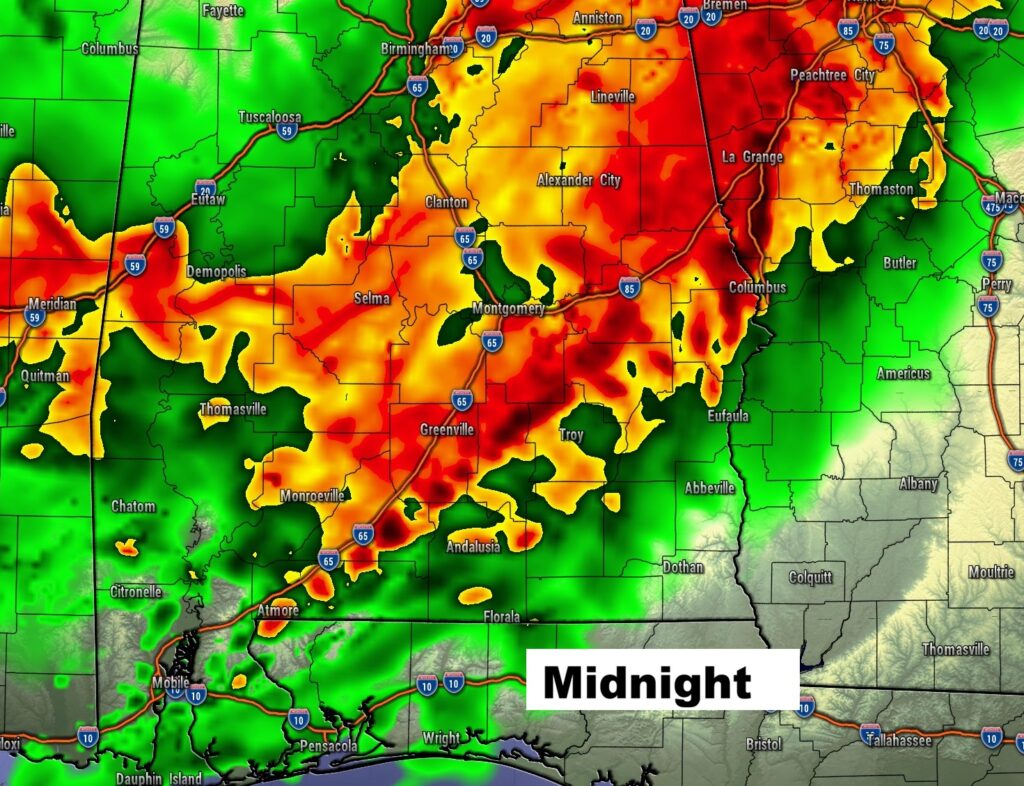
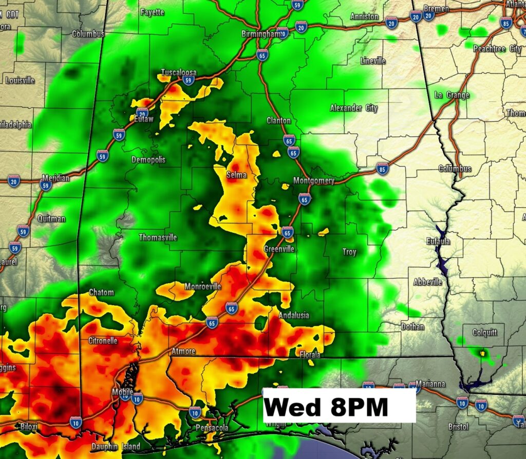
FUTURE RADAR: Here’s a sample of the hi-res HRRR model showing the advance of the Strong/Severe storms late tonight.
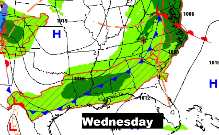
On Wednesday evening – there will be yet another round of strong/severe storms.
NEXT FEW DAYS: Locally the best chance of showers and storms appears to be Tuesday night and Wednesday. A noticeable cooldown is in the cards Thursday & Friday behind the cold front. Storm system number two will bring the next round of showers and storms by Friday night into Saturday.
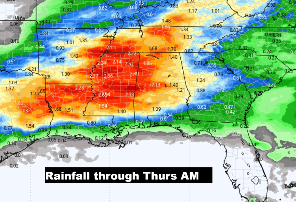
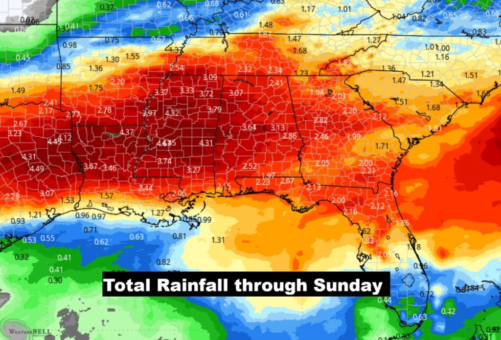
EXPECTED RAINFALL:. Two maps here. One shows the expected rainfall through Thursday AM from storm system #1. The second map shows the total rainfall including the second storm system Friday night/Saturday.
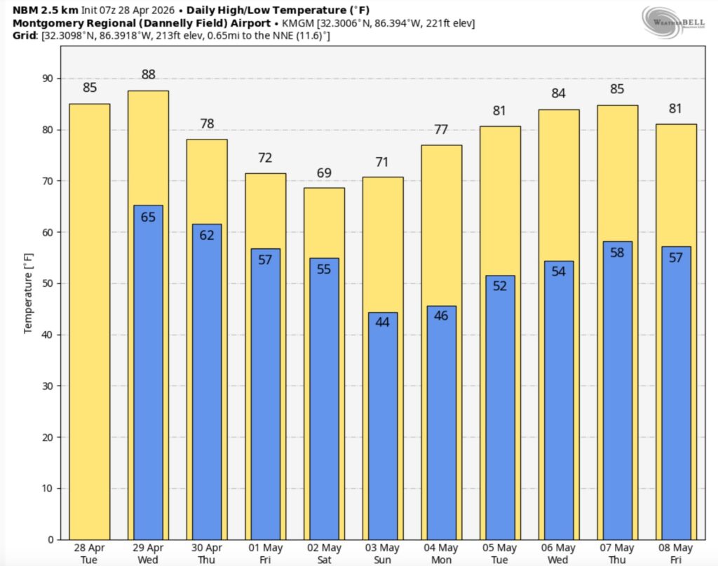
The 10 Day model Blend Temperature Trend. A noticeable cooldown is in the cards Thursday & Friday behind the second cold front. We could fall to the mid 40’s by Sunday and Monday mornings. .
Thanks for reading this Blog this morning. This morning we are LIVE on the radio from 6 to 9 on NewsTalk 93.1. I’ll have another update for you in the 4 o’clock hour tomorrow morning. You can also watch us during our morning show on You Tube and Facebook. Search Newstalk 93.1. Have a nice day.
–Rich