
Good morning! The BEST news about the last 24 hours – Severe weather was minimal and rainfall was plentiful. Rainfall which dominates the radar early this morning continues to move southeastward and will end. Then, the next round of showers and storms moves in this evening and tonight. Some storms could be Severe. There is a Level 1 Marginal Severe Risk with Damaging wind gusts the main risk. Another Gulf coast storm system will deliver yet another round of rain and storms Friday night into Saturday. Much cooler air is on the way. Highs Friday and Saturday will likely only be in the 60’s. Very chilly Jacket Weather nights are expected Saturday and Sunday nights with lows in the middle 40’s. A big change from the 80’s. Here’s my brief forecast discussion.
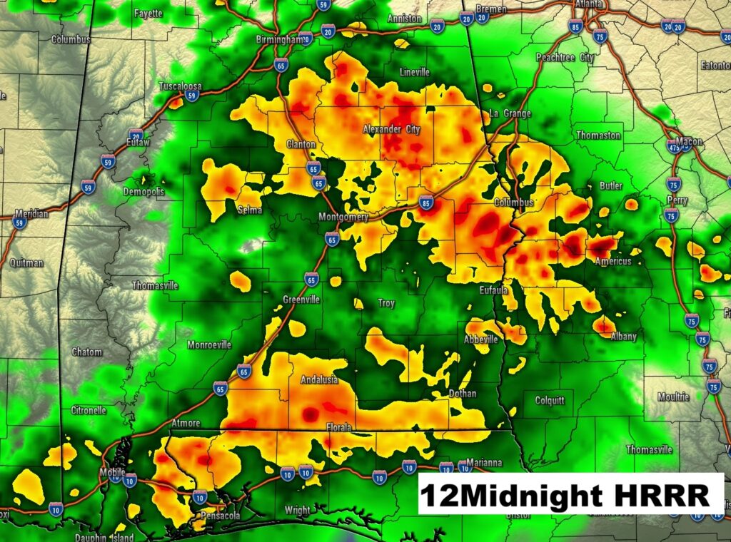
EARLY RAIN TOTALS: Just in the Montgomery area, as of 4AM. Dannelly field (MGM) 1.75″ Maxwell AFB 1.86″ East Montgomery 1.65″
TODAY: Partial sunshine. High 86. Risk of spotty showers, possible thunderstorms by late afternoon/evening.
(Normal hi/lo 82/56)
TONIGHT: Showers and thunderstorms. Some storms could be severe with Damaging winds the main threat for most of us. Low 64.
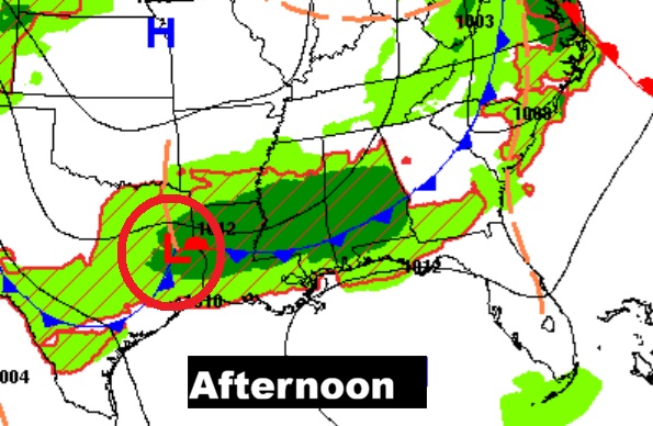
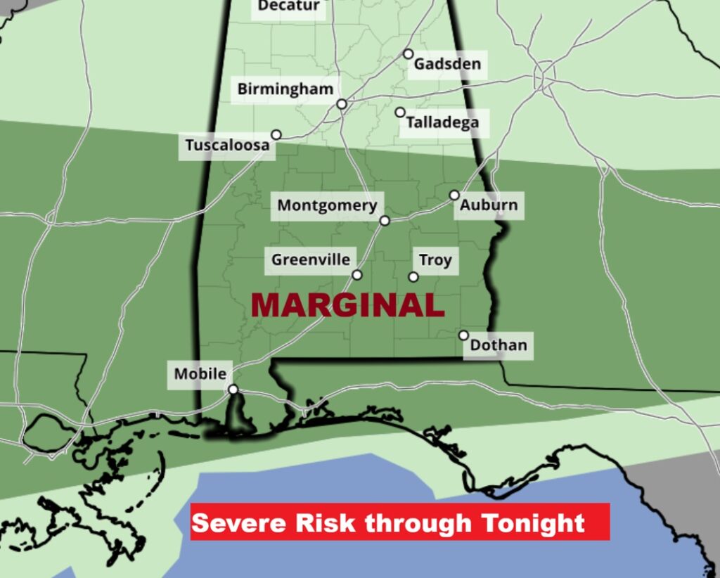
SEVERE RISK: SPC’s Day 1 Severe outlook through tonight has been includes a Marginal Level 1 Severe Risk covering most of the southern half of the state. The primary threat would be damaging wind gusts this evening and tonight.
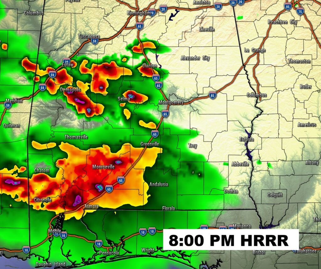
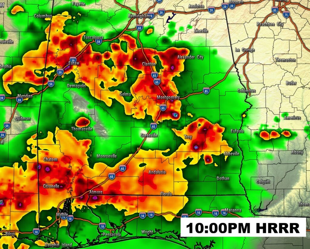
FUTURE RADAR: Strongest storms expected in a window from about 6 or 7PM to Midnight. Damaging wind gusts possible.
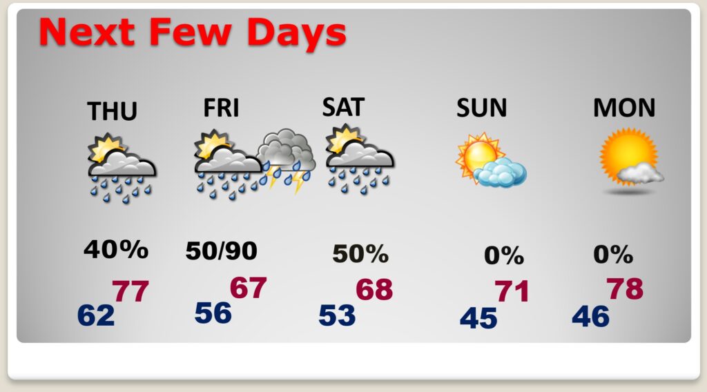
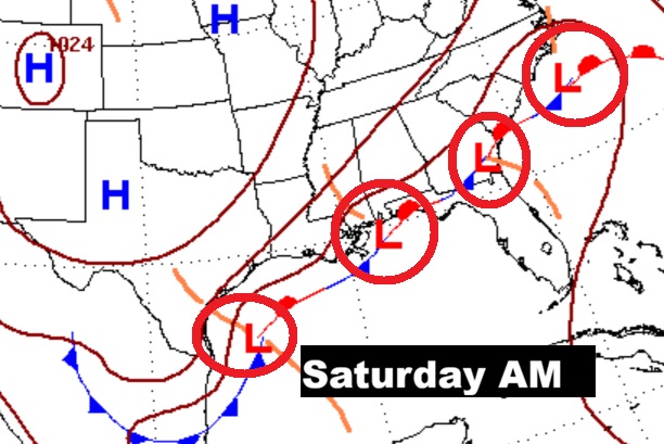
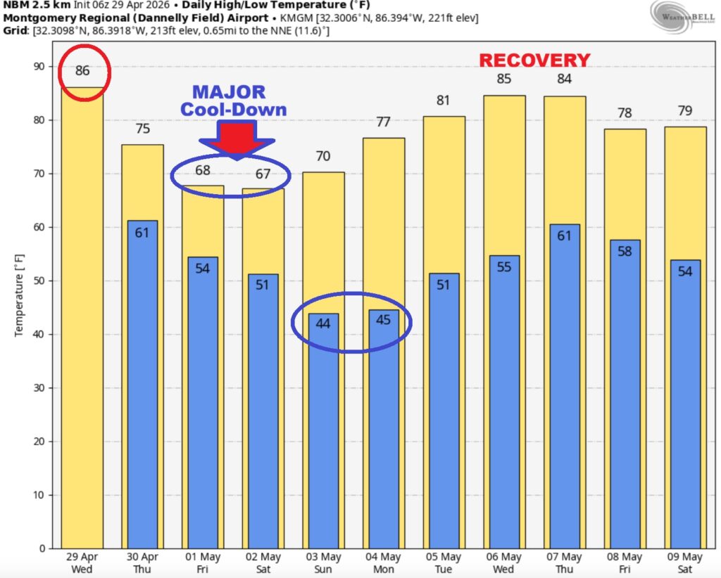
NEXT FEW DAYS: Storm system number two will bring the next round of showers and storms by Friday night into Saturday, as low pressure tracks along the Gulf Coast. Expect a major late season cool-down. Highs Friday and Saturday only in the 60’s. Mid 40s are likely Saturday and Sunday night.
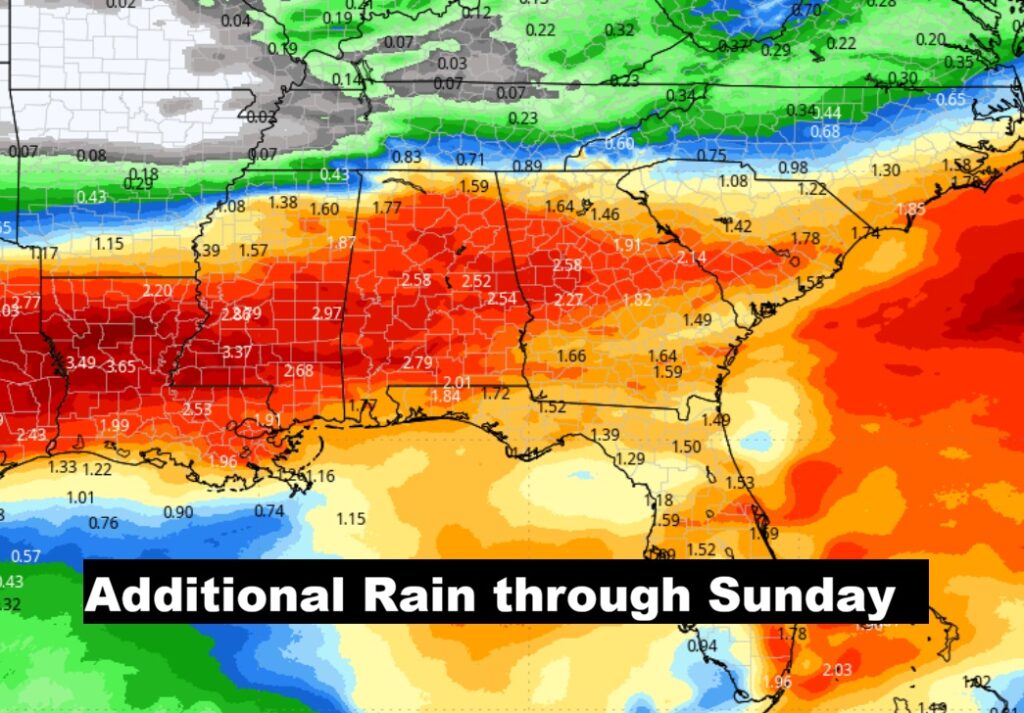
EXPECTED RAINFALL:. So far, we’re batting a thousand on much needed raindrops – after yesterday and last night. And, it looks like we may add quite a bit to those totals with the rainfall tonight and again Friday night. This will help the extreme drought situation.
The 10 Day model Blend Temperature Trend. A late season slap in the face is in the cards. Expect a major late season cool-down. Highs Friday and Saturday only in the 60’s. Mid 40s are likely Saturday and Sunday night.
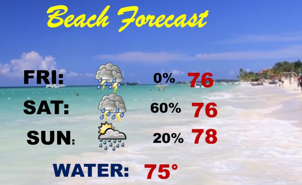
BEACH FORECAST: What can I say? It’s not a bright and sunny Beach outlook. Be flexible. Have a plan B. The probability of showers and storms with heavy downpours is highest from Friday through Saturday.
Thanks for reading this Blog this morning. This morning we are LIVE on the radio from 6 to 9 on NewsTalk 93.1. I’ll have another update for you in the 4 o’clock hour tomorrow morning. You can also watch us during our morning show on You Tube and Facebook. Search Newstalk 93.1. Have a nice day.
–Rich