
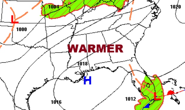
Good morning! It’s another chilly morning, but temperatures will turn around quickly. Yesterday morning’s 43 at MGM broke a 150 year old record of 46 from 1876. By afternoon we’ll be near 80 today and lower 80’s on Tuesday. A mid-week storm system will bring a severe weather threat to Alabama by late Wednesday night and the pre-dawn hours of Thursday. At least a small risk of showers and thunderstorms will hang around late week and into the weekend. Looks like an active pattern the following week. Here’s my brief forecast discussion.
TODAY: Sunny and warmer. High near 80. South wind at 5 to 10.
(Normal hi/lo 83/57)
TONIGHT: Clear and not quite as chilly. Low 51.
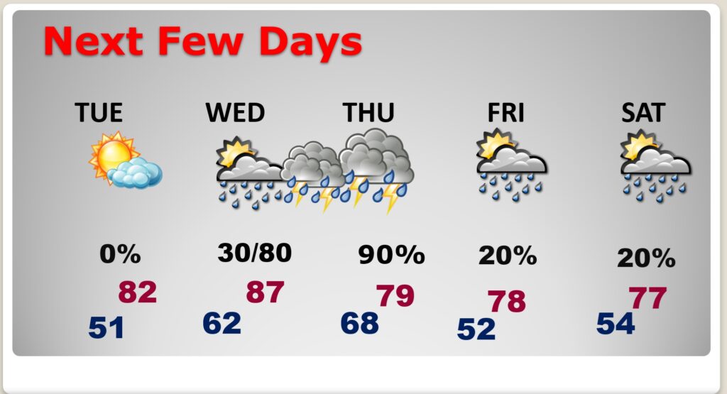
NEXT FEW DAYS: The warming trend continues. Wednesday will be the warmest day with mid to upper 80’s. A mid-week storm system will bring a severe weather threat to Alabama by late Wednesday night and the pre-dawn hours of Thursday. At least a small risk of showers and thunderstorms will hang around late week and into the weekend.
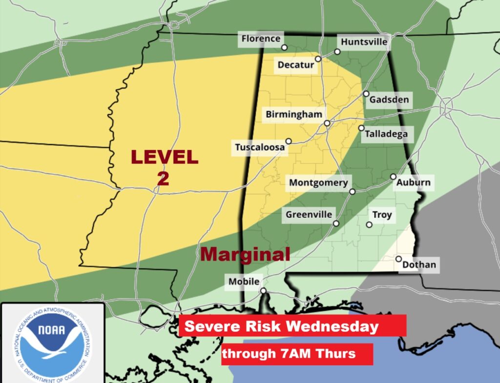
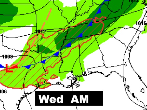
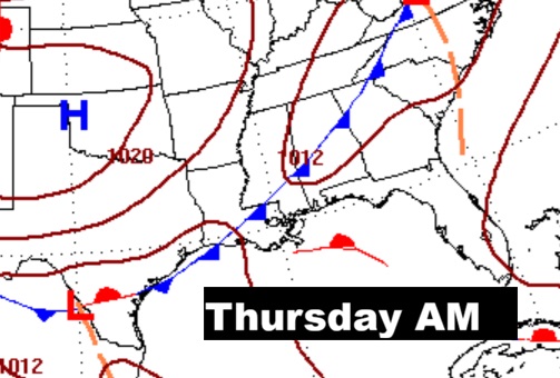
MID-WEEK SEVERE THREAT: The greatest threat for Severe Weather will be in the pre-dawn hours of Thursday morning. Including the risk of damaging winds and tornadoes. There is a level 2 threat over the northwest half of the state.
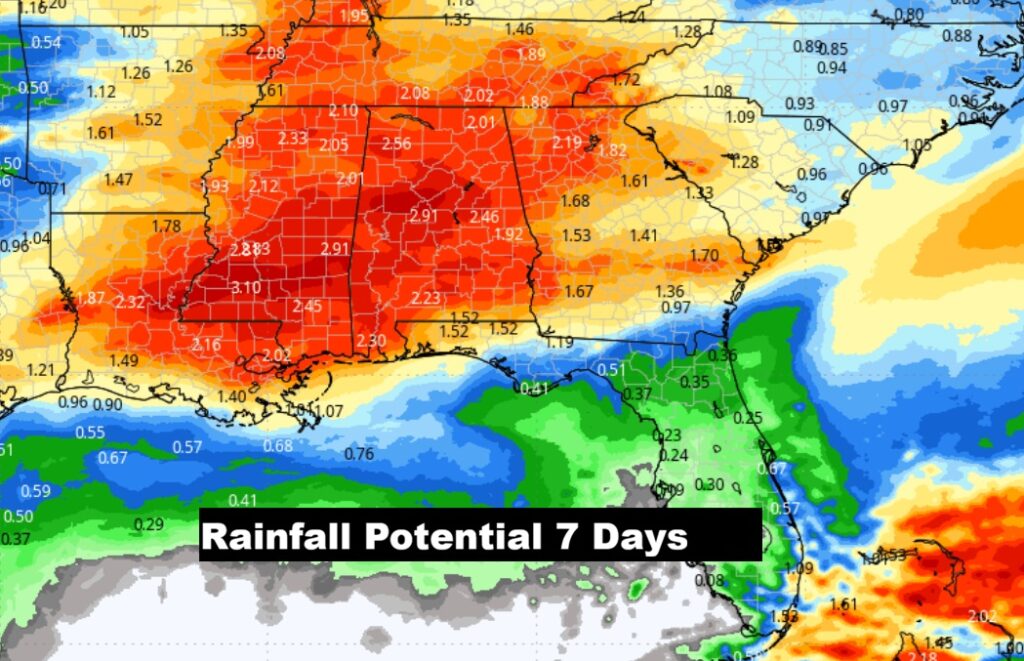
EXPECTED RAINFALL: The models are bullish and optimistic of generous potential rainfall amounts over the next 7 days.
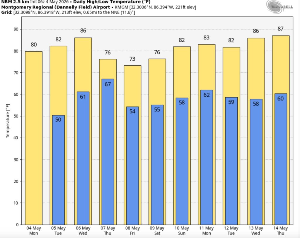
The 10 Day model Blend Temperature Trend..
.
Thanks for reading this Blog this morning. This morning we are LIVE on the radio from 6 to 9 on NewsTalk 93.1. I’ll have another update for you in the 4 o’clock hour tomorrow morning. You can also watch us during our morning show on You Tube and Facebook. Search Newstalk 93.1. Have a nice day.
–Rich