
Wednesday we tied the record with 80. Yesterday’s 81 was a new 109 year old record, and if we get to 80 today we tie another record. The incredible warmth remains through the weekend and beyond.
DENSE FOG ADVISORY: Once again this morning, much of the state is under a dense fog advisory until 9AM. Visibility under a quarter of a mile in spots. But sunshine will break through and dominate. High upper 70’s to near 80.
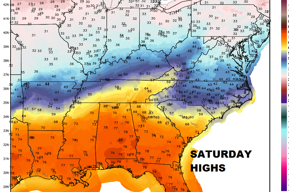
On the high temperature map, look at the cold air just north of Alabama!
SUNDAY: Lots of sunshine. Another warm day. AM low 50. Afternoon high 76.
MONDAY: For the Martin Luther King holiday, it should be partly sunny with a high in the mid 70’s.
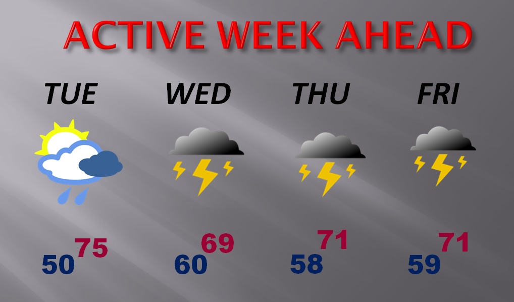
ACTIVE WEEK AHEAD: Spotty showers are back on Tuesday, but showers and thunderstorms become likely Wednesday through Friday, as a front enters the state and stalls. Still too warm for January.
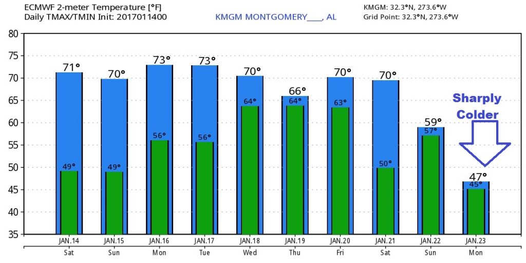
COLDER AIR ON THE HORIZON: Hang on cold weather fans. The Global models continue to hint at some much colder air, possibly arriving by Monday of the following week. (about 10 days away) Stay tuned for more details.
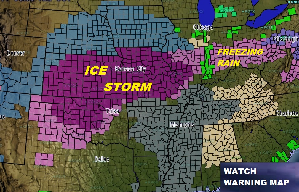
TRAVELERS BEWARE – MAJOR ICE STORM: A terrible, and crippling ice storm is affecting a huge part of the nation’s heartland, from the plains states to the Midwest and even east toward the Ohio valley. This will have a severe affect on travel, including air travel. It will also cause massive power outages, too. Ice accumulation up to half an inch in spots. A very serious situation.
We can be thankful in Alabama that we are enjoying such and epic weekend weather pattern while others are suffering. I hope you have a wonderful weekend. Weather posts will continue through the weekend, from my getaway here on the Alabama coast. Videos return on Tuesday AM at 5.