Happy Mardi Gras Day, Fat Tuesday! Dense fog will slow you down in spots this morning. Take it easy. We are in-between storm systems today. But, we are looking ahead to a strong cold front which will spark some severe storms across the state Wednesday afternoon/evening, as March comes in “like a lion”. I’ll have the latest on what to expect and when. Looks another sharp cool-down for late week and the weekend, before another storm system at the start of next week. Here’s your Tuesday morning weather briefing with your toast and coffee this morning.
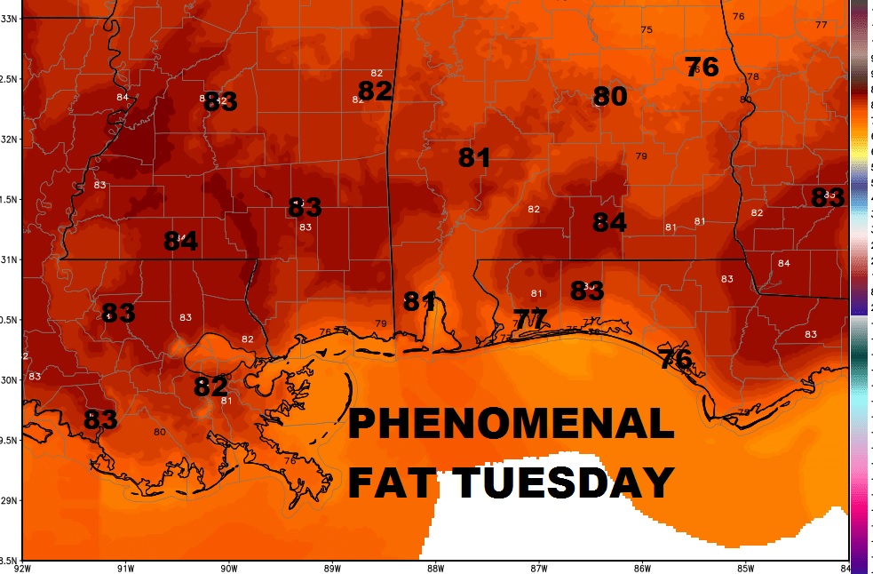
How about this for a rather phenomenal Fat Tuesday – Mardi Gras forecast. Lower 80’s expected today in Mobile and New Orleans. Let the good times roll.

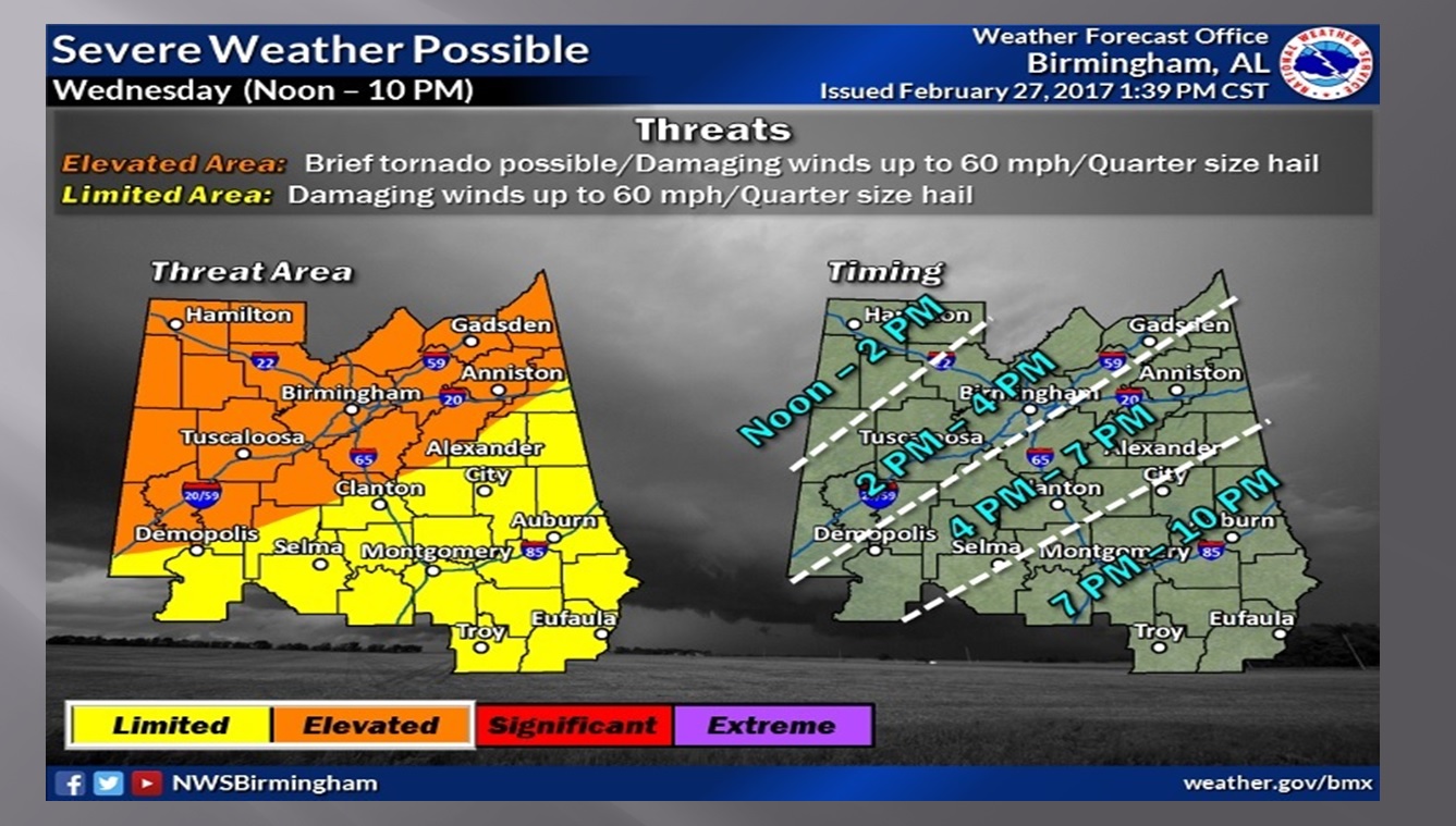
The greatest threat for moist of us tomorrow will be damaging wind gusts as a squall line marches across the state. For many of us the highest threat will be late afternoon into the early evening. Across the state, the threat begins around Noon in the northwest counties until about 10PM in southeast Alabama. While the tornado threat is low, it is not zero. Best chance for a spin up tornado is north of a Demopolis – Clanton line.

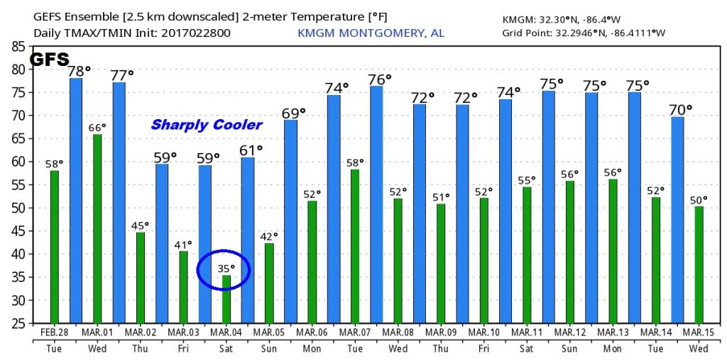
Sharply cooler weather ahead for late week and into the weekend. Lows in the 30’s Friday and Saturday morning. Here’s a peek at raw model numbers from the US GFS model for the next 16 days.

Download out new weather App if you haven’t already. It will really come in handy tomorrow during our severe weather threat. It’s one stop shopping for all the weather you need. No longer do you need to keep 3 or 4 weather apps on your phone. It;s free… Search Rich Thomas Weather in the App store.

