Good Morning! We are in for an active weather week with round 1 today and a second round by mid-week. It appears March will come in Like a Lion. Severe weather is a good bet for much of the state on Wednesday. I’ll walk you through the details of a “bumpy” forecast for the next few days. More wild temperature swings, too. It’s all covered in 2 minutes on an important Monday weather briefing.
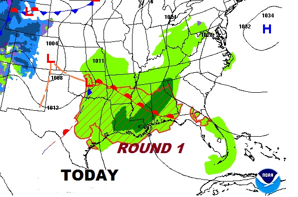
Very active weather week ahead with Round 1 today. A band of showers and thunderstorms will cross the state through the afternoon and into SE Alabama this evening.
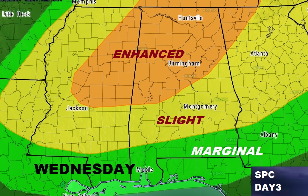
Storm Prediction center updated Severe Weather Outlook for Wednesday. Enhanced risk for much of the northern third of the state. Slight Risk as far south as Troy.
What to expect:

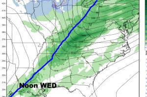
Cold front enters the state by mid day Wednesday and reaches south central Alabama by evening.
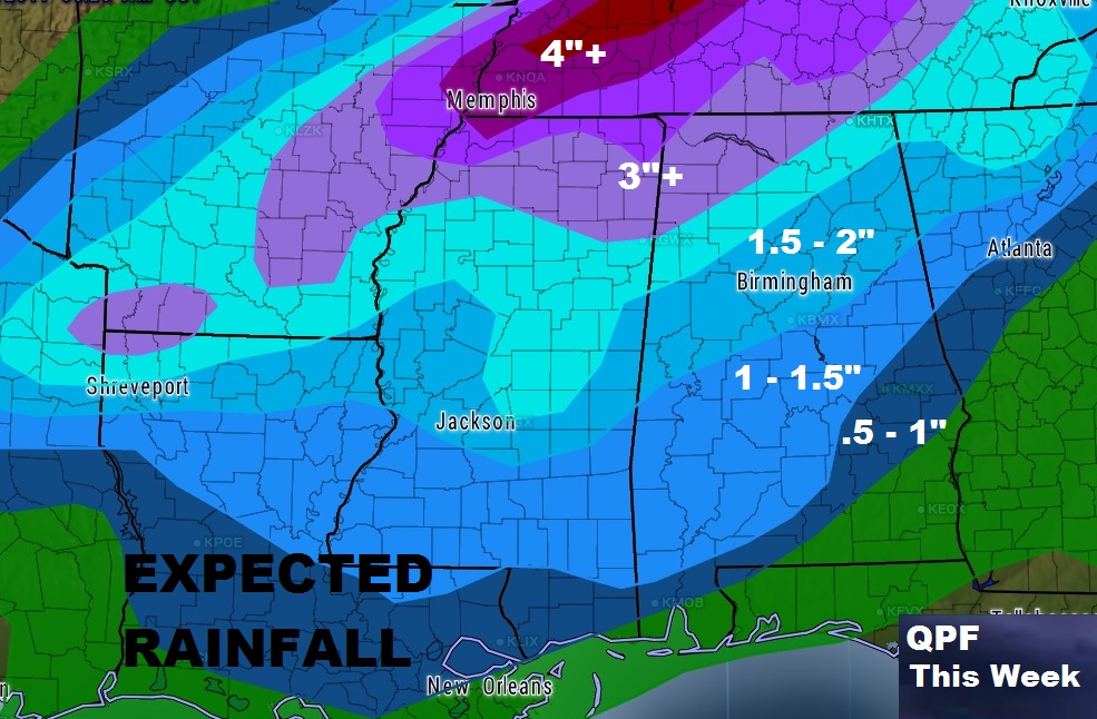
Rainfall amounts will be heaviest across the northern counties. Lighter amounts farther south.
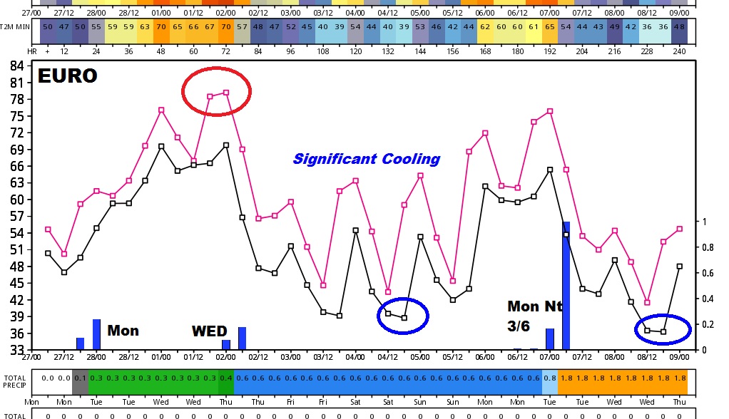
More wild temperature swings next several days. Here’s the Euro graph out 10 days.