
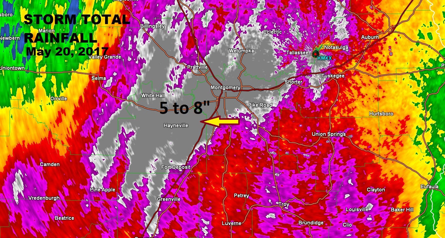
Widespread prolific rainfall caused widespread flooding across at least a 5 county area Saturday evening. The Montgomery airport has received 8.31” in the past 24 hours. Look at the map below. The gray area is where rainfall starts at 5 inches. So, the totals were off this scale. 5 to 8” based on reports, especially in Elmore, Autauga, Montgomery, and Lowndes, where the rainfall was heaviest. Also, Macon, Dallas, Tallapoosa to a lesser extent.
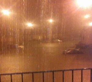
A FEW SNAPSHOTS AROUND MONTGOMERY SATURDAY NIGHT: Montgomery County, roads are closed at Narrow Lane Road and Fairview Avenue according to the Montgomery Fire Department. No other roads are blocked at this time, MFR Sgt. O.J. Whiting said. The Flash Flood Warning for Montgomery and Lowndes will expire at 7AM.


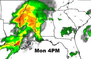
MORE RAIN AHEAD: Today we will not see the concentrated heavy rainfall like yesterday. The atmosphere is re-charging. Scattered showers and thunderstorms will be around today and tonight. Most places will average perhaps half and inch of rainfall. But, hang on. There’s more rain on the way. Here’s a peak at Today’s future Radar through 10PM tonight. We note that rain in Mississippi which could arrive in the overnight hours and the wee hours of Monday morning.
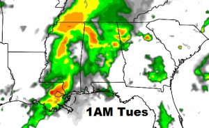
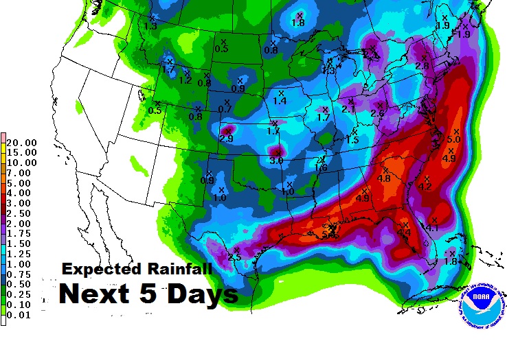
RAINFALL NEXT 3-4 DAYS: Another strong surge of moisture from the next disturbance arrives Monday. The rain will be heaviest from Monday Evening /Monday night into Tuesday.
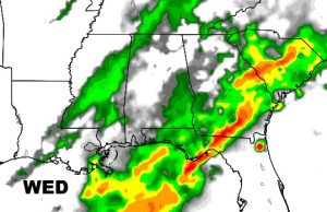
The final in a series of disturbances drift in Wednesday before we dry out late week.
EXPECTED ADDITIONAL RAINFALL: Total additional rainfall could total at least 4 inches and perhaps 5+ inches across central Alabama. On top of what we have had, that’s significant. Kiss the moderate drought goodbye.
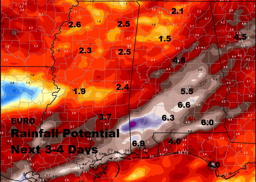
We laughed on Friday when the Euro model had a strip of 6.5″ rainfall over central Alabama. It was RIGHT. Great respect for the new Euro QPF forecast. Check out the numbers! wow…
Our Weather App will continue to be great to have over the next few days, with future radar, radar, hourly forecasts plus notifications on watches and warnings, which really came in handy Saturday night. Plus, you will have instant access to all my blogs and weather videos. It’s free in the app store for IOS or android. Search Rich Thomas Weather.
I can’t help but remember the last prolific May flooding event here in Montgomery. May 7, 2009. I had 10.64″ at my house. Arrowhead had a Foot of rain. Airport had something like .79. https://www.youtube.com/watch?v=n78ubEMeaVg
Your next video will be online Monday morning by 5AM. Try to have a good Sunday.