
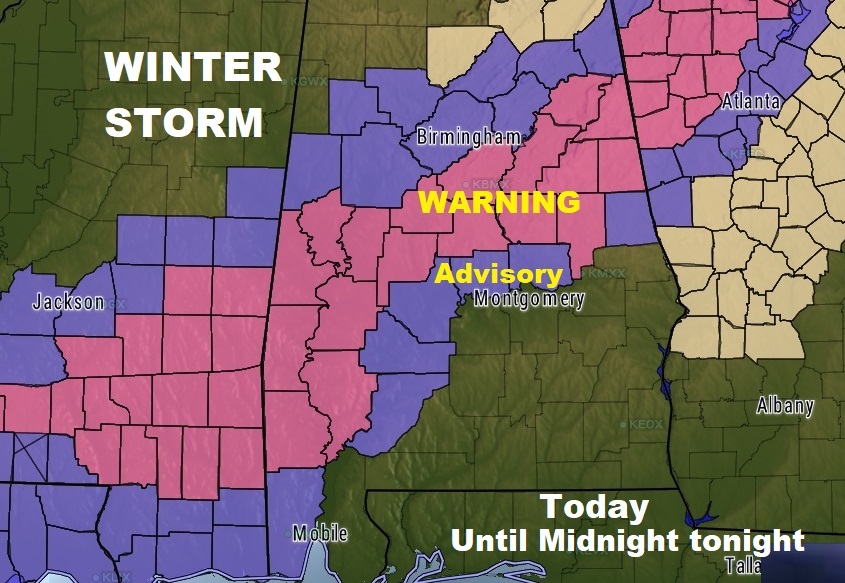
UPDATE: Winter Storm WARNING has been expanded across west and north central AL. and now includes the Metro Birmingham and Anniston areas. Snow accumulations of 1 to 3″ expected. #alwx
COMPLETE VIDEO UPDATE ONLINE BY 4:45 am.
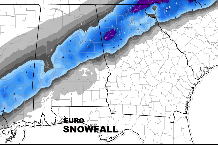
SOUTH OF THE ADVISORY AREA: Rain mixed with at least a little bit of light now is possible even outside the advisory area in places like Auburn, Tuskegee, Montgomery, Union Springs, Troy and Greenville. No accumulation is expected. Temperatures across the area will hover mostly in the mid and upper 30’s
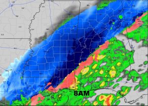
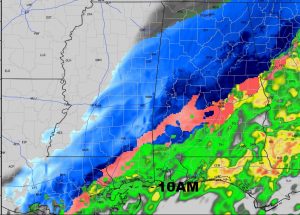
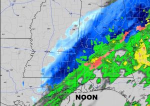
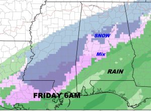
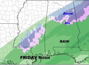
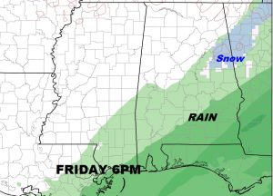
TIMELINE: The main timeline for the Wintry mix would be from about 3AM to around 6PM. After 6PM, the greatest threat of a Winter Mix will shift eastward into Georgia. Precipitation will taper off, then end. Some clearing is likely before Saturday morning, with lows falling to about 28.
I’ll have some brand new information for you first thing in the morning on your next video at 4:45AM. Have a good evening!
–Rich