
Good Morning! With Santa’s visit now just hours away, Colder air continues to flow into the state, on this Christmas Eve. After mid 70’s yesterday, we will be about 20 degrees colder today and even colder tonight and Christmas Day.
TODAY: It will be cloudy at first sunny. Cool, but dry with a high of 56°. Tonight, another surge of colder air arrives. It will be breezy & cold, for Santa’s arrival.
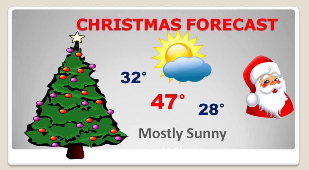
CHRISTMAS DAY: The pre-dawn hours on Christmas morning will be breezy & cold. The forecast numbers haven’t changed much. I have us near freezing at dawn Christmas morning. Highs in the 40’s, and the low Christmas night will reach the upper 20’s.
This Christmas will be a far cry from last year’s record warmth. In fact, lets look back…
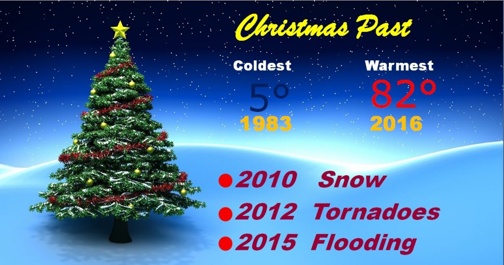
CHRISTMAS PAST: In the 40 years I have been covering your Christmas Forecast, we have had the coldest Christmas and the warmest Christmas. That’s pretty amazing when you consider that records began in Montgomery back in 1872. In the last seven years, we snow in 2010, a swarm of tornadoes in 2012. And, do you remember the flooding just two years ago on Christmas Eve and Christmas Day? Hard to believe we made it to 82° last year!
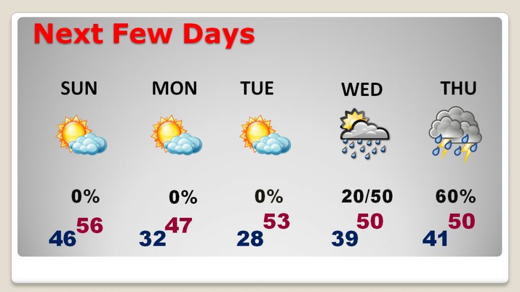
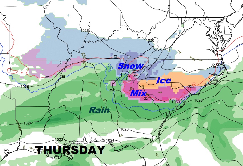
NEXT FEW DAYS: Are cold pattern is locked in for the next few days. The coldest day will be Monday. The coldest morning will be Tuesday. Rain returns later in the week. The best chance will be Wednesday night & Thusday.
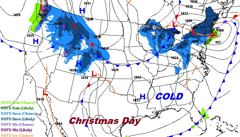
CHRISTMAS TRAVEL: Two storm systems will be moving eastward across the northern US, but, things are relatively quiet across the southern half of the country. Colder than normal air for Christmas covers about 70% of the US. The next storm system which will affect holiday travel this week will be later this week by Wednesday night into Thursday.
- –
I hope you have a wonderful Christmas. It has been a pleasure and an honor to serve you for 4 decades now with your Christmas forecast. All my BEST to your family and friends.
Merry Christmas!

–Rich (and Bailey)