
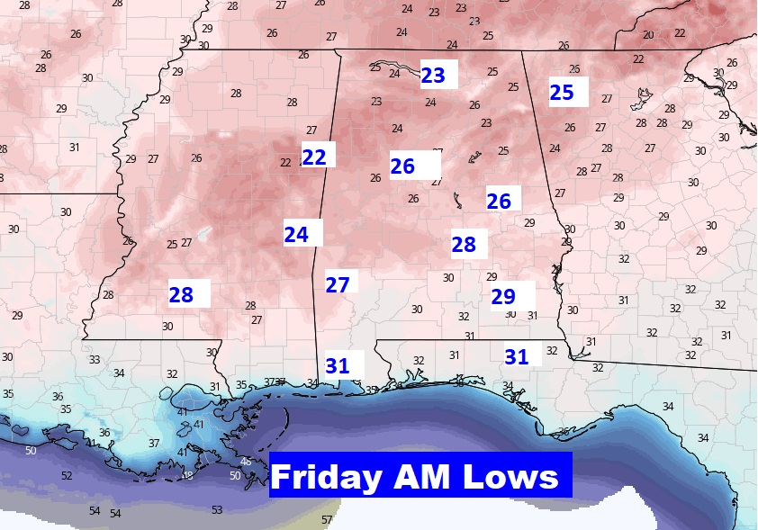
Good Morning! We are in between storms systems for a couple of days. Today will be quite chilly. Tonight we are headed for the 20’s…coldest night of the week.
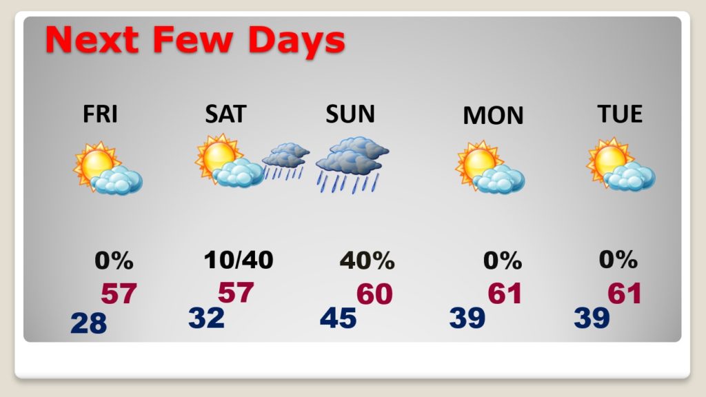
Friday is another quiet day. Most of Saturday is dry. But, there’s another Gulf Coast storm system on the way. More rain will move in Saturday night and Sunday.
Another storm system by Christmas eve, and perhaps windy & dramatically colder behind the system for Christmas Day.
TODAY: A cold day. High only 48. A brisk northwest breeze at 10 to 18 mph will add quite a bite to the chill. Cloudy this morning, but I think we will work into sunshine this afternoon.
Tonight will be clear and cold. We are headed for the 20’s.
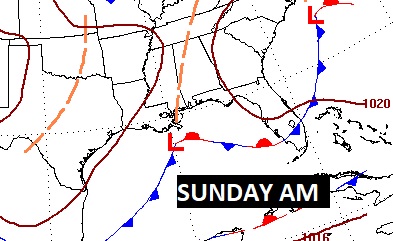
WEEKEND STORM SYSTEM: Daytime Saturday is dry. But a storm system will spread rain across the area Saturday Night into Sunday.
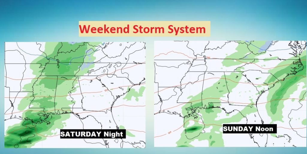
The Low will track close to the Gulf coast, so no severe weather is expected.
NEXT FEW DAYS: After the weekend storm system, Monday through Wednesday look quiet, with a gradual warming trend. Highs will be 60 or above each day.
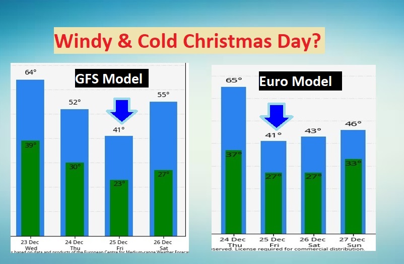
CHRISTMAS EVE STORM SYSTEM: Details are still a little fuzzy. The models disagree on the arrival time of this storm system. The GFS is a little faster. It shows rain and maybe some thunderstorms in the state by mid-day on Christmas. The EURO model is roughly 9 hours slower.
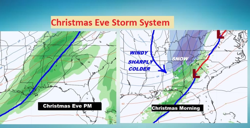
But, the models do agree that windy and sharply colder weather is a good bet on Christmas Day. Attention Santa. Stay tuned. We’ll continue to tweak the details as we get into Christmas week.
- –
I’m just a tad under the weather this morning. It was easier to do a blog update rather than a full-blown video. I will have another update for you bright and early in the morning. Have a Nice day.
–Rich