
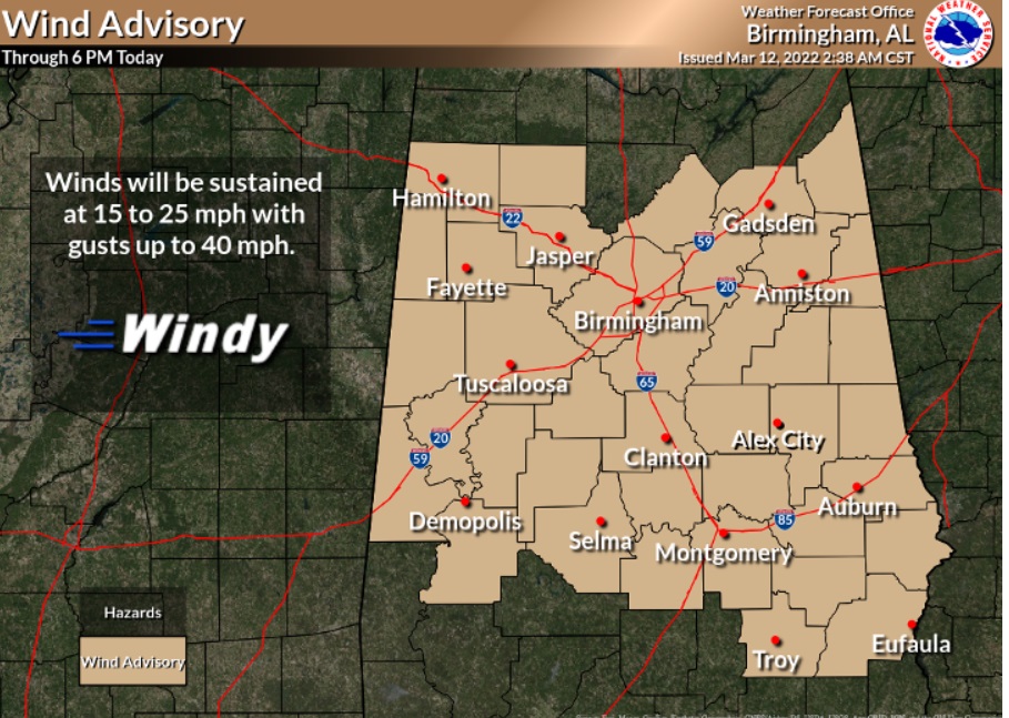
Good Morning! It’s windy & cold this morning. You might call this drastic change an “Arctic Drive-by”. Sharply colder air continues to funnel into the state following a strong Arctic Cold Front. Strong northwest winds could gust to 30 to 35 mph today. A wind advisory is in effect. The wind will make today’s high temperatures 38-42, feel more like the 20’s with the wind chill.
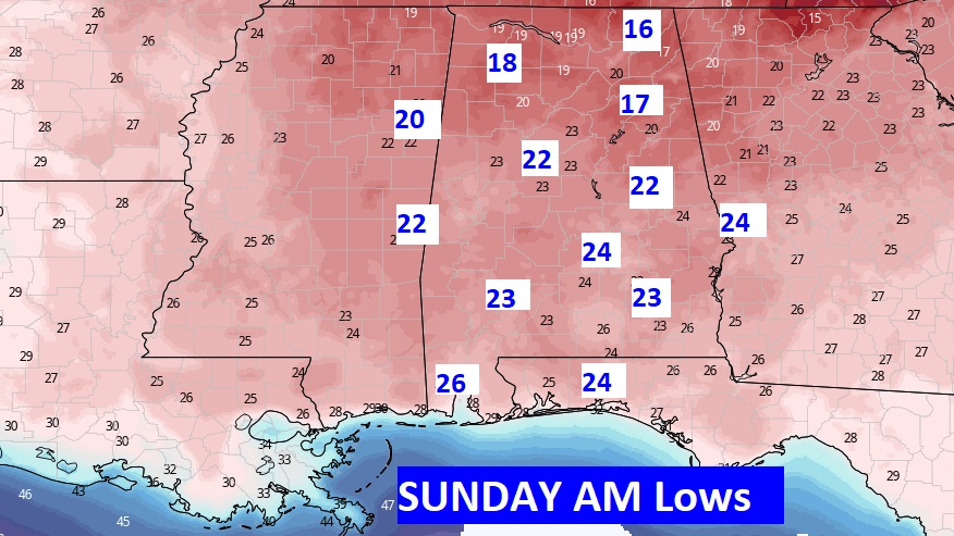
But, here’s the biggest news. We have a Freeze Warning across the area tonight. This will be a hard, killing freeze, with so many plants and trees in bloom. Expect record lows Sunday morning. Probably lower 20’s.
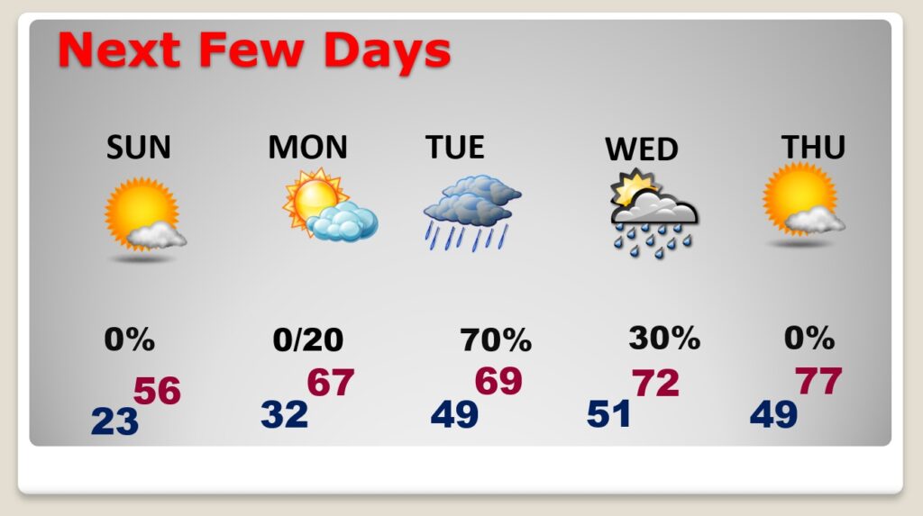
This Drastic Cold Snap won’t last long. Expect 50’s Sunday afternoon. Another Freeze Warning is in effect Sunday night. We’ll be close to a freeze Monday morning. Afternoon highs will recover to the 60’s. Rain returns Tuesday.
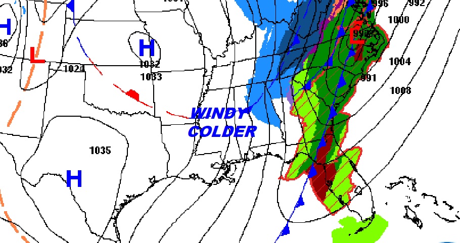
NORTH ALABAMA TRAVEL PROBLEMS: A Winter weather advisory continues in effect mainly north of I-20/I-59 this morning. There’s a little bit of snow on the ground. But, a Flash Freeze is effecting roads and bridges that did not have enough time to dry off. The heaviest snow threat is in northeast Alabama right now, where a Winter Storm Warning continues in effect. Guin in Marion county has 2” on the ground. Avoid travel to north Alabama until travel conditions improve later today.

TODAY: Wind advisory in effect. Windy & much colder. High today 41. Strong northwest winds could gust to 30 to 35 mph today. Wind chill for much of today will be in the 20’s. FREEZE WARNING tonight. This will be a hard, killing freeze. Protect your tender vegetation. Expect a record low on Sunday morning. Most towns will be in the low 20’s.
SUNDAY: Morning Record Low Deep Freeze. Low 23. (Record 24 in 1998). Sunshine. Afternoon recovery. High 56. Freeze Warning again Sunday night. Clear and cold Sunday night. Low 32.
NEXT FEW DAYS: After a bitter cold start Sunday morning, expect a nice afternoon recovery. Sunshine. High 56. Clear and cold Sunday night. Low 32. Upper 60’s Monday. More rain Tuesday. Warmer late week.
SUPER STORM ANNIVERSARY: 29 years ago today, we had the biggest storm storm/blizzard in modern times. The so-called Super Storm of the Century. Click below, in a feature I produced 5 years ago, to read more.
.
I’ll have another Blog update in the morning. Stay warm today. Drees in layers.
–Rich