The set-up for a mega storm was perfect. Even 4 days before the storm, computer models were forecasting a huge storm.
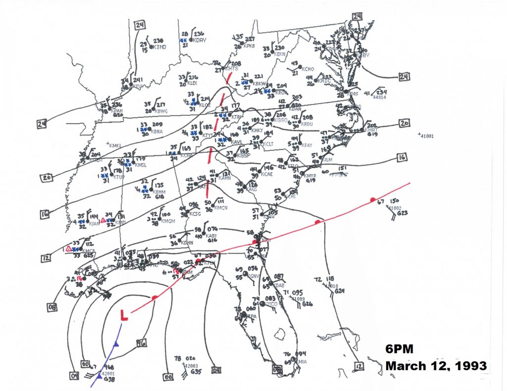
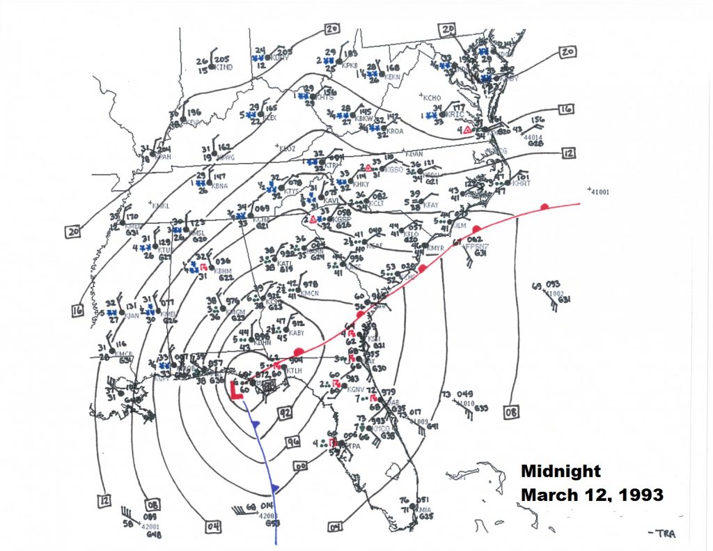
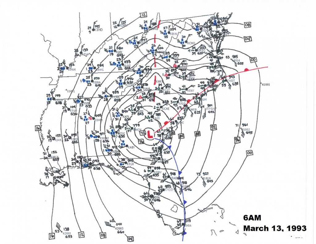
On Friday morning, March 12, 2993, Low pressure off the Texas coast was deepening rapidly and tracking east. By 6PM Friday evening, the low was south of Mobile. By Midnight it was near Panama City and growing stronger. A powerful super storm was centered over south Georgia on Saturday morning at Dawn, March 13th. It brought the first widespread blizzard conditions to much of the southern states in history. All 67 Alabama counties had snow cover, for the first time in modern history.
The storm then headed for the middle Atlantic coast with the strength of a category 3 hurricane. Lowest pressure was recorded near the eastern shore of Maryland reached an incredible 960 millibars.
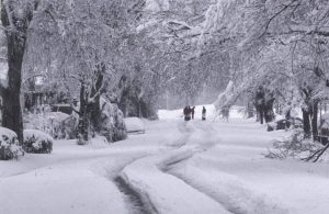
In central Alabama, heavy rain, on that Friday night, turned to heavy sleet, then heavy snow, including rare thunder-snow. There was a lot of eerie green lightning, too. Winds gusted to 40, 50 even 60+ mph in spots. Many records were broken at Montgomery, including highest sustained winds, wind gusts and lowest station pressure. After the storm, record low temperatures were recorded. Although the official Montgomery snowfall was 4 inches, drifts were a 2-3 feet high in spots. There was a band of higher 6”+ accumulations from Evergreen to Camden to Highland Home. Drifting snow was significant around the state, especially in north central Alabama.
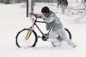
The Birmingham area was paralyzed by 13- 16” of snow. Many folks were stranded for several days.

ALL 67 counties in Alabama had a snow cover. Very rare, indeed. Here is some snow totals:
20 inches at Walnut Grove
17 inches at Valley Head
16 inches in Oneonta and Bessemer
13 inches at Anniston, Talladega, Pinson, Birmingham
12 inches at Thomasville, Childersburg, Scottsboro
11 inches at Sylacauga
10 inches at Cullman, Clanton and Heflin
9 inches in Thorsby
8 inches in Ashland, Centreville, Moulton and Guntersville
7 inches in Alexander City, Huntsville and Whatley
6 inches in Camden, Evergreen, Jasper, Livingston, Andalusia, Haleyville and Highland Home
5 inches in Auburn, Winfield, Muscle Shoals and Chatom
4 inches in Montgomery, Union Springs, Vernon, Tuscaloosa, Demopolis, Frisco City, Greenville, Troy
3 inches at Brewton, Hamilton, Bay Minette, Mobile Airport
2 inches at Atmore and Robertsdale
*These snow amounts do not count the drifts. Drifts reached 5 to 6 feet high in spots.
Record cold temperatures were seen across portions of the south and east of the US in the wake of this storm. In the United States, the storm was responsible for the loss of electric power to more than 10 million households. An estimated 40 percent of the country’s population experienced the effects of the storm[ with a total of 208 fatalities, making it one of the deadliest winter storms of the 20th century.
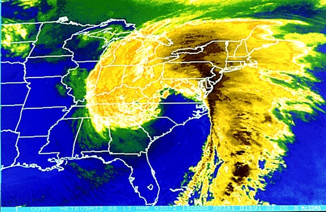
This satellite view speaks volumes about the power and structure of the mega storm.