Good morning! There’s rain on the radar this morning as a weakening front approaches, and then fizzles. Today’s best chance of showers/storms would be during the morning and mid-day hours, with improvement later. Looking ahead, the month of May will begin on a very warm note. We will be near 90 by Thursday. Another small chance of showers and storms will return to the forecast Friday and over the weekend. Here’s my brief forecast discussion.
TODAY: Today’s best chance of showers/storms would be during the morning and mid-day hours, with improvement later. It’ll be mostly cloudy through early improvement, but gradually sunshine will return later. Warm again. High 83. Southwest withs of 6 to 12 will shift to westerly by afternoon following the frontal passage. Mostly clear and comfortable tonight.
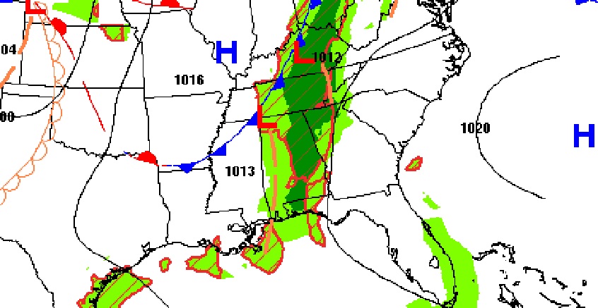
FUTURE RADAR: As the front weakens and heads southeast, the broken line of showers/storms will be most likely in the morning and early afternoon.
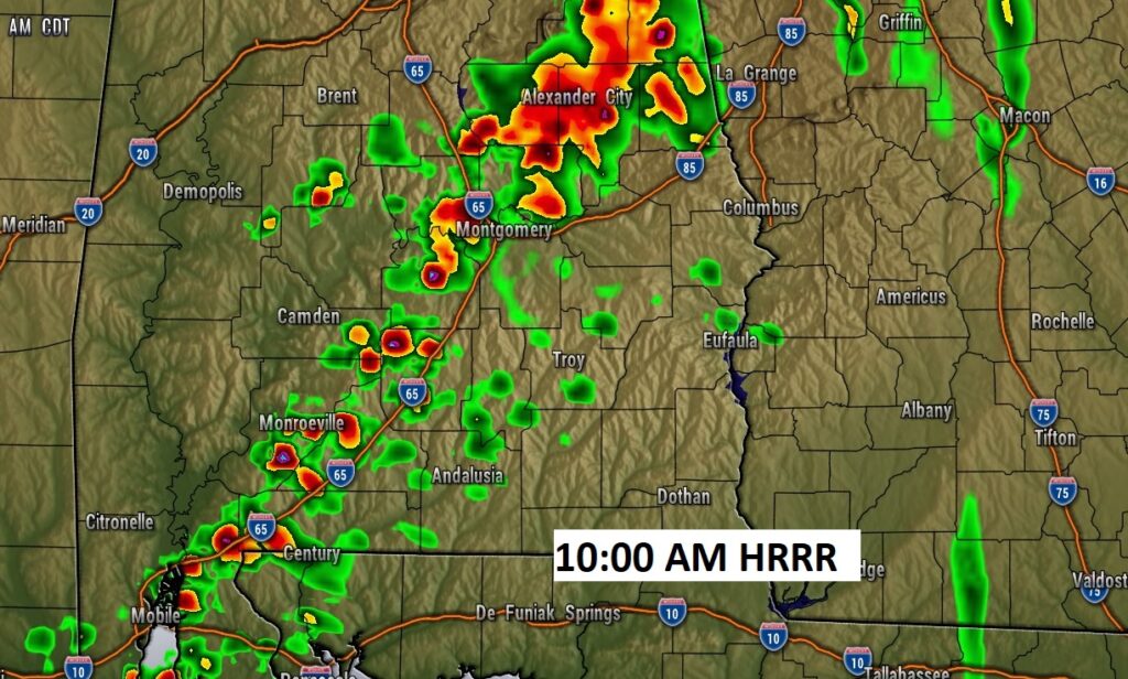
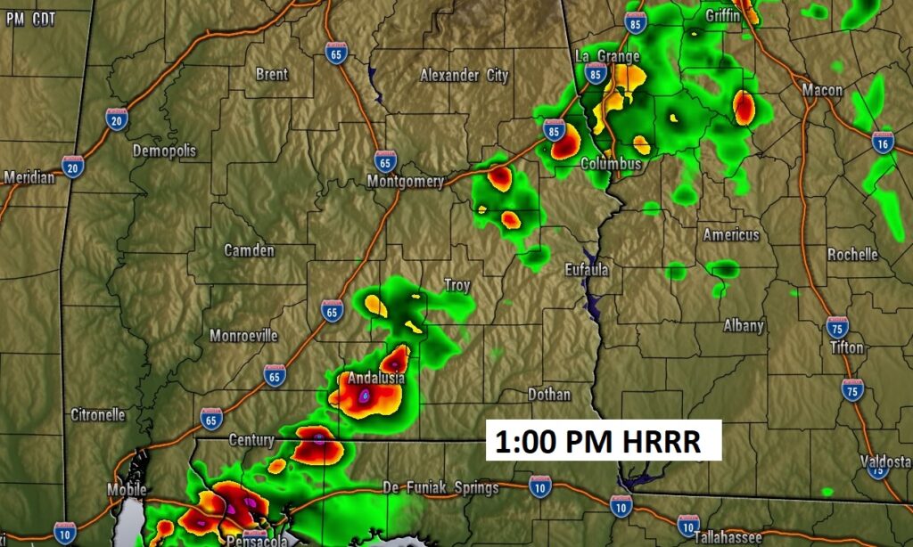
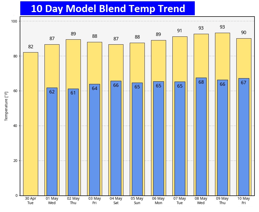
NEXT FEW DAYS: Scattered showers and thunderstorms first half of the day Tuesday. Mostly sunny Tuesday afternoon. The month of May will begin on a very warm note as temperatures tease the 90 degree mark Wednesday and Thursday. Another small chance of showers and storms will return Friday and Saturday. Widely scattered.
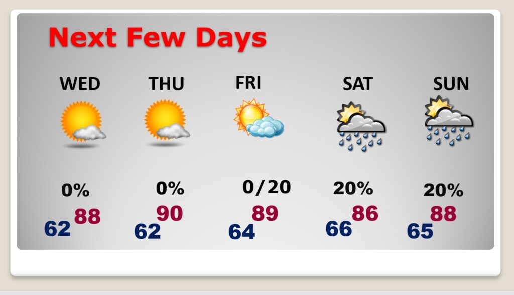
Here’s the 10 day temperature trend. As you can see, we are in an extended string of very warm days.
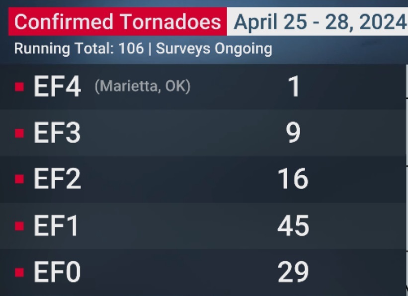
NWS survey teams have now confirmed 106 tornadoes in the epic 4 day weekend outbreak in the Plains. This includes 28 strong tornadoes, EF-2 or stronger. Surveys continue today.
Thanks for reading the blog. There will be another complete Blog update and video forecast discussion tomorrow morning. This morning, everything is normal including LIVE on the Radio from 6 to 9AM on NewsTalk 93.1 – WACV. Have a nice day!
–Rich
