
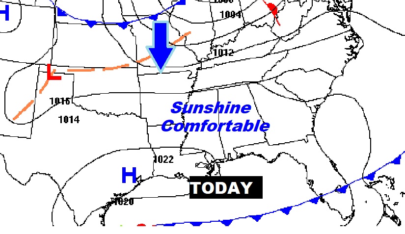
Good Morning! It should be a sensational first weekend of March. Sunshine will dominate today through Sunday. Highs today and Saturday will be in the mid 70’s. A dry cold front will sweep across the area Saturday PM. Sunday will be breezy and quite a bit cooler. Highs will barely reach the lower 60’s. An important storm system will bring a Severe Weather Threat to the Gulf states this week. The greatest threat here in Alabama will arrive Tuesday night into Wednesday. There will be damaging straight-line winds and the risk of tornadoes along a strong squall-line (QLCS). Here’s my brief forecast discussion.
TODAY: Sunny and nice. High 71. West wind 6 to 12 mph. Mostly clear tonight. Low 45.
NEXT FEW DAYS: It should be a sensational first weekend of March. Sunshine will dominate today through Sunday. Highs Saturday will be in the mid 70’s. Sunday will be breezy and quite a bit cooler. Highs will barely reach the lower 60’s. We’ll be back in the 70’s Tuesday ahead of that next hefty storm-system.
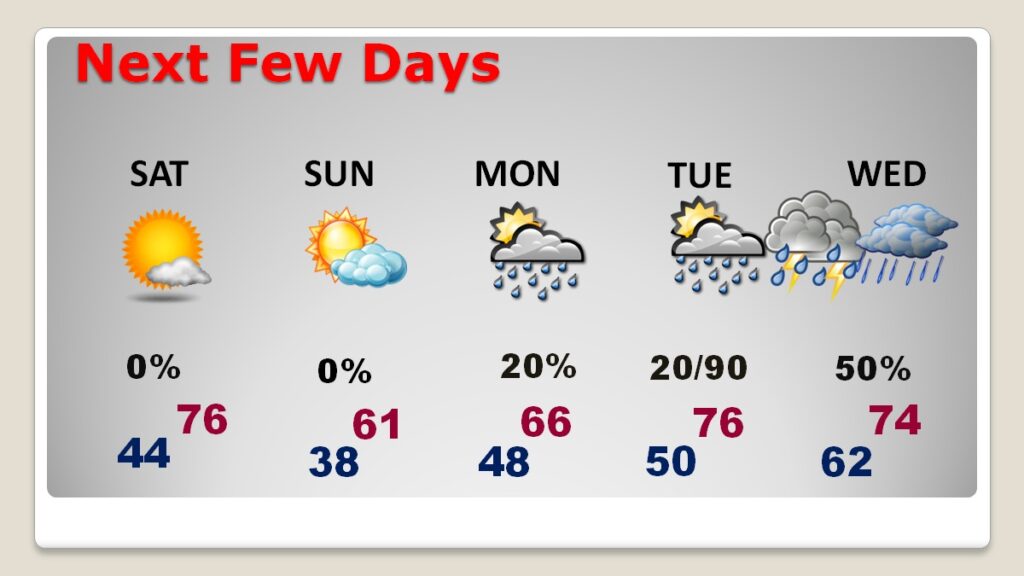
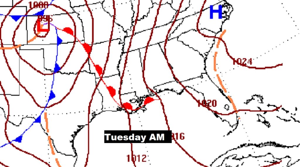
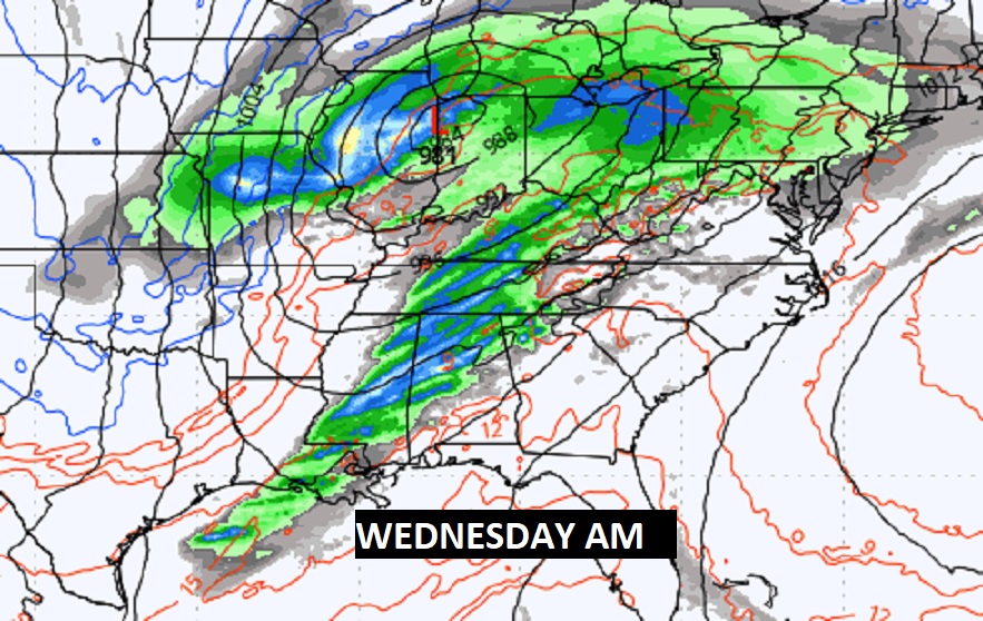
SEVERE WEATHER THREAT WEEK : Severe Weather will spread eastward from the plains and the Ark/La/Tex region Tuesday, across the lower MS valley during the day Tuesday, and toward MS and Alabama Tuesday night into early Wednesday. There will be damaging straight-line winds and the risk of tornadoes along a strong squall-line (QLCS).
A dry cold front will sweep across the area Saturday PM. Sunday will be breezy and quite a bit cooler.
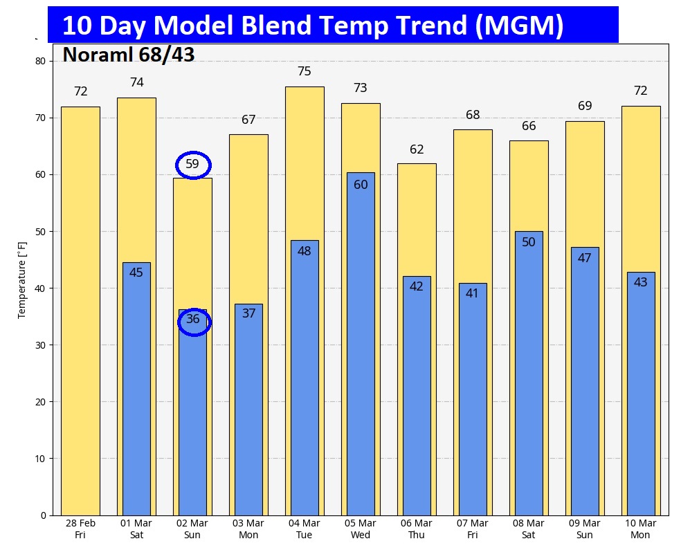
Here’s the 10 Day model blend Temperature trend. Sunday stands out as much cooler. Briefly.
We are now 20 days away from the Vernal Equinox. But, today is the last day of Meteoritical Winter. Meteorological Spring starts tomorrow on March 1st. We are 9 days from the change back to DST, as we Spring forward one hour.

Thanks for reading this blog update. There will be another Blog Update and Forecast Video discussion in the 4’o’clock hour tomorrow morning. Have a good day.
–Rich