
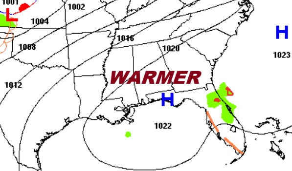
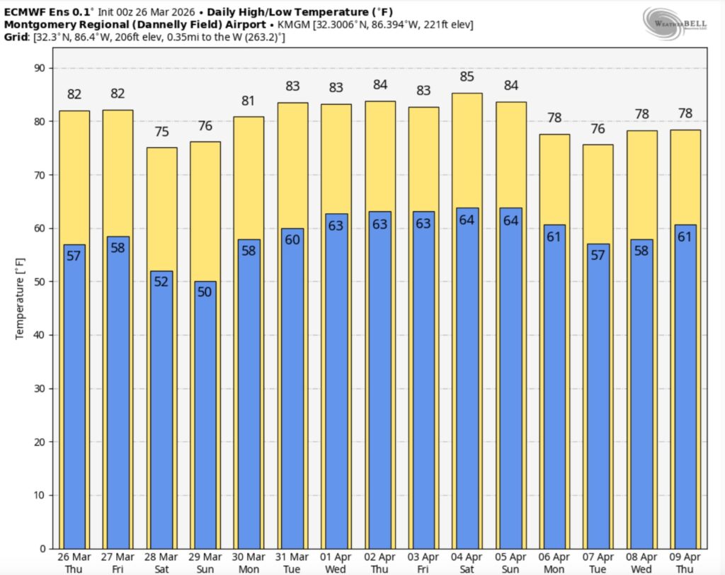
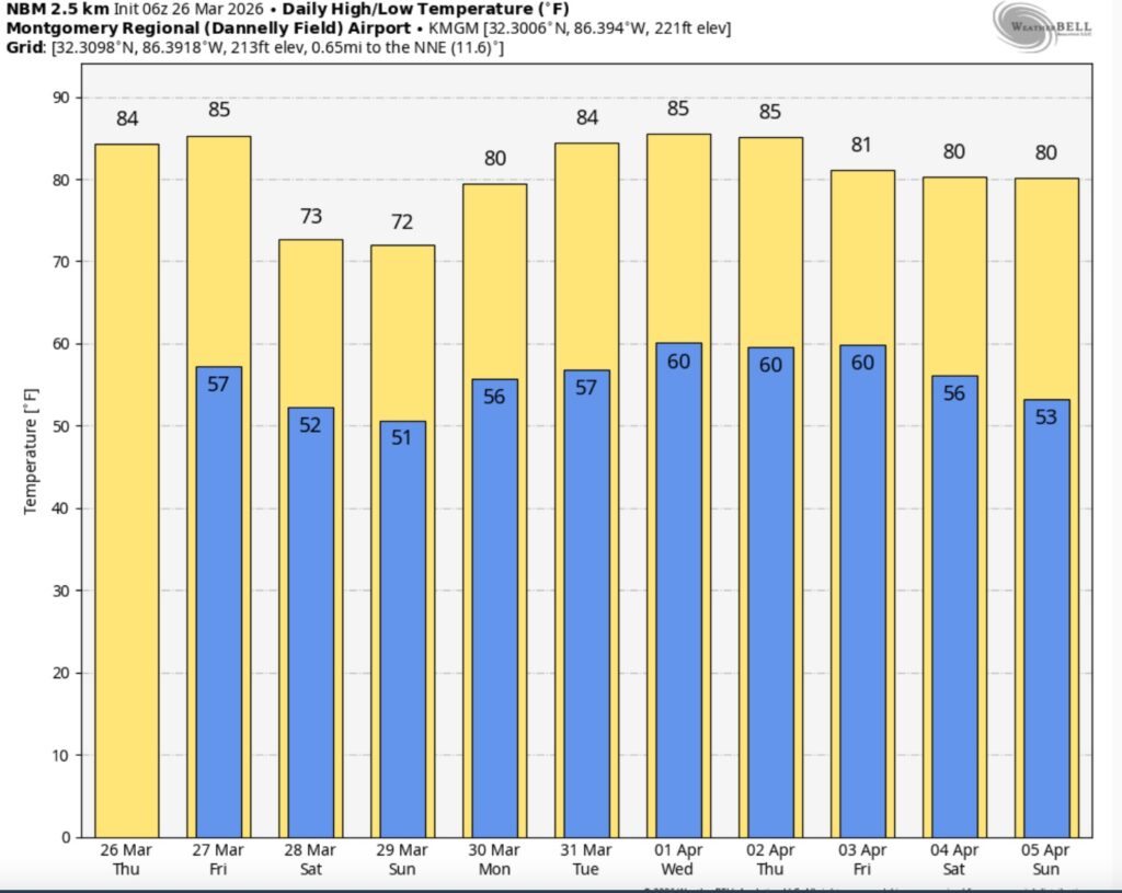
Good morning! Temperatures are getting warmer. Plenty of sunshine will push highs into the middle 80’s today and Friday. (Normal 74/48)
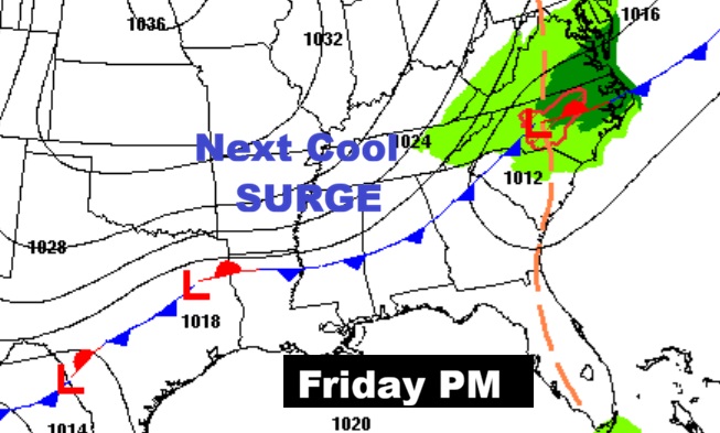
The next cool front will sweep through the state Friday. It looks like a dry front. Expect cooler days and nights over the weekend as we fall back to the 70’s. Looks like we could start to get into a more active pattern first week of April. Here’s my brief video forecast discussion.
TODAY: Mostly sunny and warmer. High 85. South wind 5 to 10 mph.
(Normal 74/48)
TONIGHT: Mostly clear. Low 57.
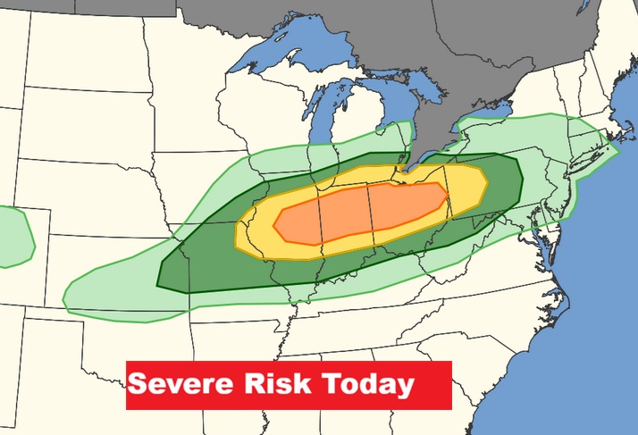
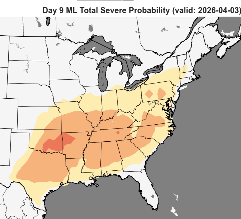
A very DANGEROUS SEVERE WEATHER RISK for a multi-state area today.
NEXT FEW DAYS: The forecast continues very quiet. Uneventful. Friday’s high will be in the middle 80’s again
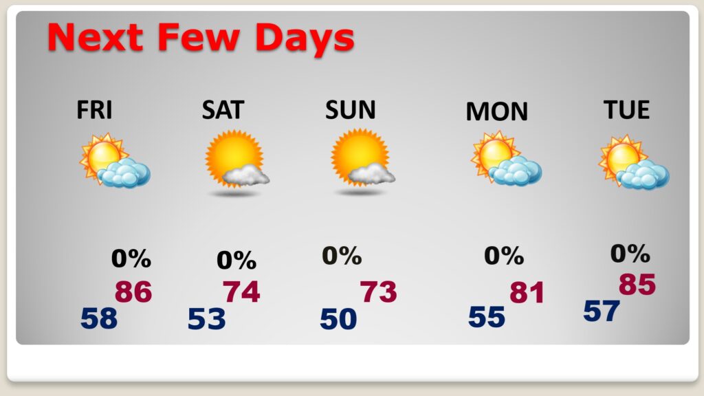
The next cool front will sweep through the state Friday. Expect cooler days and nights over the weekend as we fall back to the 70’s.. The extended pattern of dry/storm-free days will continue for several days.
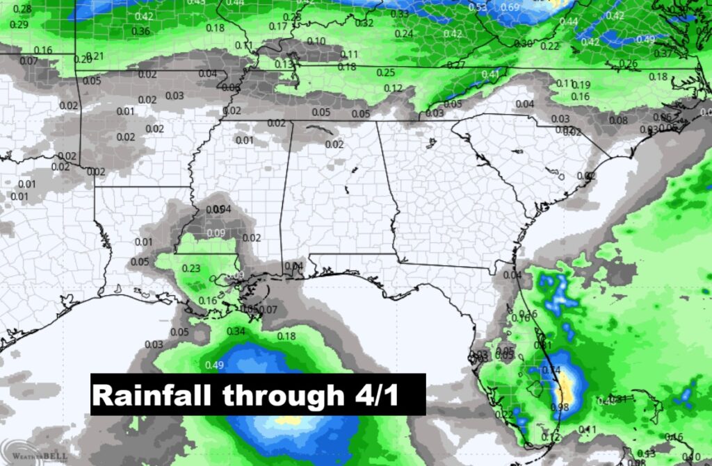
The rainfall outlook through April 1st continues bone-dry. But, the first week of April could start to get a lot more active.
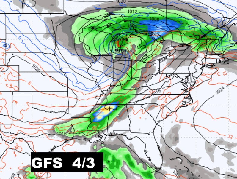
The next Big Deal?
The 10 Day model Blend Temperature Trend. After a weekend cool-down, we’ll warm up again.

The 16 Day EURO Ensembles. No cold air.
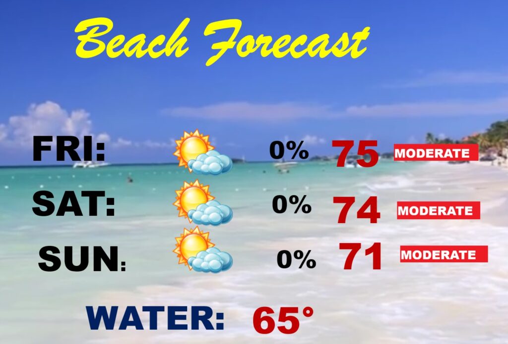
BEACH FORECAST: Looks like a nice weekend. Not as cool as last weekend. Still chilly Gulf water. Moderate rip current risk especially from Destin eastward.
POLLEN FORECAST: Still some very high number for the next few days. No end in sight.
Thanks for reading this Blog this morning. This morning we are LIVE on the radio from 6 to 9 on NewsTalk 93.1. I’ll have another update for you in the 4 o’clock hour tomorrow morning. Have a nice day.
–Rich