
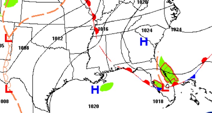
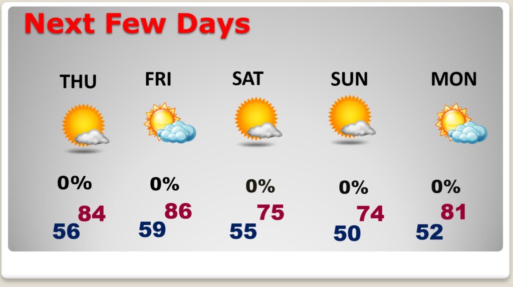
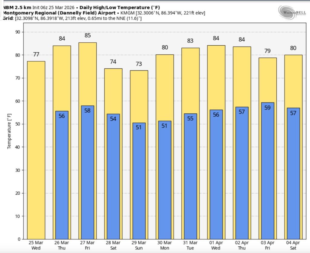
Good morning! Yesterday was cooler than Monday by about 10 degrees. The high in Montgomery was 76. Get ready for a very pleasant Wednesday. We’re the comfortable mid 70’s today. There will be another temperature rebound Thursday & Friday as highs recover into the low to mid 80’s.
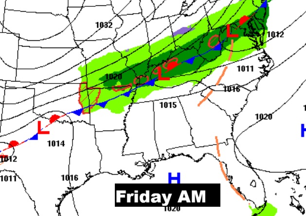
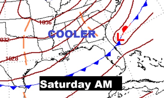
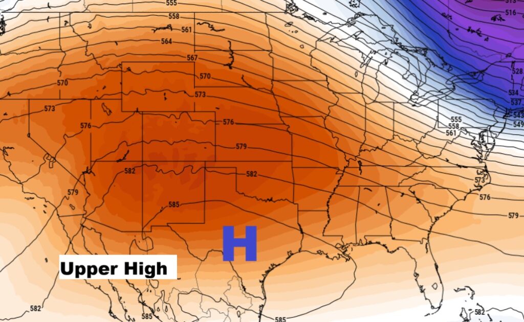
The next cool front will sweep through the state Friday. It looks like a dry front. The extended pattern of dry/storm-free days will continue for several days. Upper level high pressure is in control. Here’s my brief video forecast discussion.
TODAY: Sun/cloud mix. Cool. High 75. Southwest wind 6 to 12 mph.
(Normal 74/48)
TONIGHT: Partly cloudy. Low 56
NEXT FEW DAYS: The forecast is very quiet. Uneventful. There will be another temperature rebound Thursday & Friday as highs recover into the low to mid 80’s.
The next cool front will sweep through the state Friday. It looks like a dry front. The extended pattern of dry/storm-free days will continue for several days.
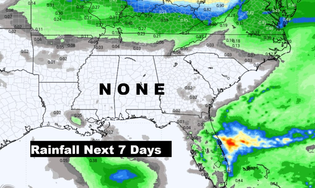
The drought continues to grows worse. No rain for the next 7 days. Not a drop.
The 10 Day model Blend Temperature Trend. Brief weekend set-back. Otherwise a very warm, comfortable pattern.
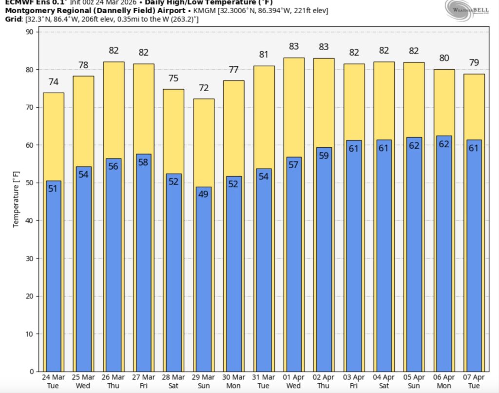
The 16 Day EURO Ensembles. No cold air.
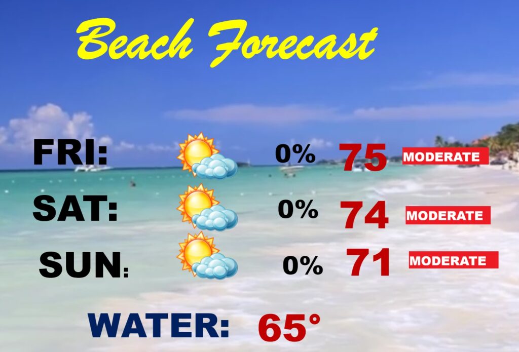
BEACH FORECAST: Looks like a nice weekend. Not as cool as last weekend. Still chilly Gulf water. Moderate rip current risk especially from Destin eastward.
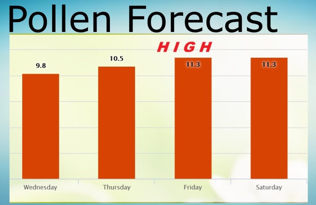
POLLEN FORECAST: Not good. Still some very high number for the next few days. No end in sight.
Thanks for reading this Blog this morning. This morning we are LIVE on the radio from 6 to 9 on NewsTalk 93.1. I’ll have another update for you in the 4 o’clock hour tomorrow morning. Have a nice day.
–Rich