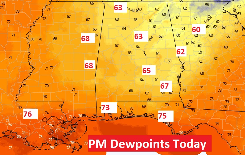
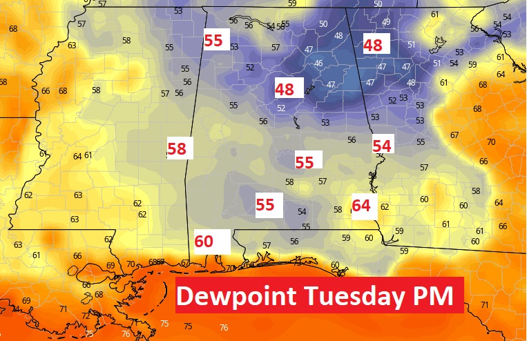
Good Morning! After an extremely humid weekend with dangerous heat indices. The news is getting a bit better as July ends and August begins. The dewpoint will come down from the mid 70’s today, to the 60’s this afternoon and perhaps the 50’s tomorrow. That’s a nice improvement. It’ll still be hot with highs in the upper 90’s today and tomorrow. After a stormy Sunday, rain is out the forecast at least through Wednesday. By Thursday, we’ll be easing back to normal – more humid and random storms will return. Meanwhile, NHC is monitoring two Invests in the Atlantic. Here’s my brief forecast discussion.
TODAY: Dense fog advisory until 8 AM. Abundant sunshine today. Not quite as humid. High 97. Light wind. Low 76.
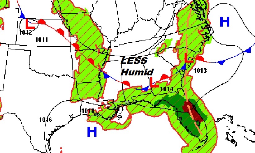
Afternoon dewpoints will be lower today…in the 60’s. And, my gosh, perhaps the dewpoints in the 50’s tomorrow. That would be GREAT!
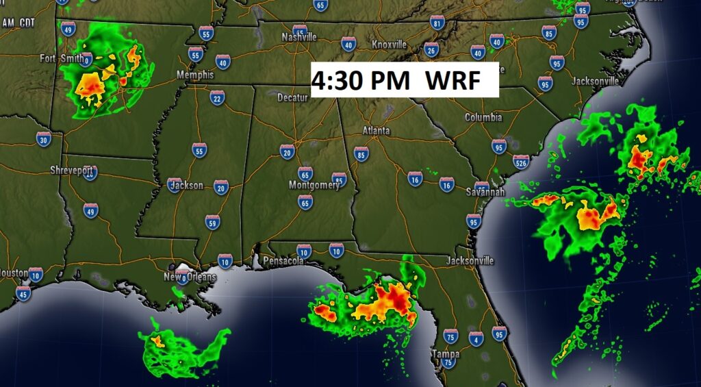
Future Radar shows various storm clusters across the south, but Alabama should be primarily dry. .
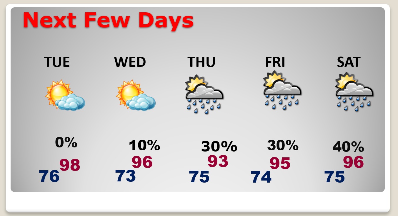
NEXT FEW DAYS: HOT days will continue. We’ll be in the upper 90’s today and tomorrow, and the mid 90’s Wednesday. By Thursday, we’ll be easing back to normal – more humid and random storms will return.
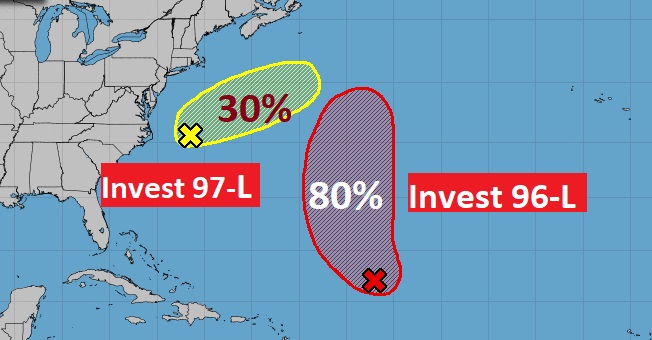
TROPICAL UPDATE: NHC is monitoring Invest 96-L , and Invest 97-L in the Atlantic. 96-L is likely to become a Depression in the next day or two.
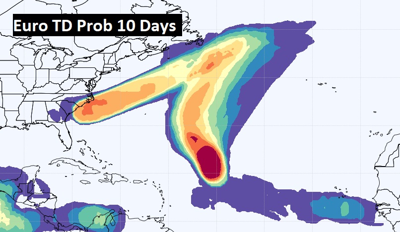
The EURO model also hints at another wave coming off the African coast could eventually develop.
FULL MOON: Officially the moon is full Tuesday, August 1st at 1:31 PM. The full Sturgeon moon.
Thanks for reading this Blog this morning! This morning we are LIVE on the radio from 6 to 9 on NewsTalk 93.1. Watch us on TV on CBS 8 and ABC 32. I’ll have another update for you in the morning. Have a nice day!
–Rich
