
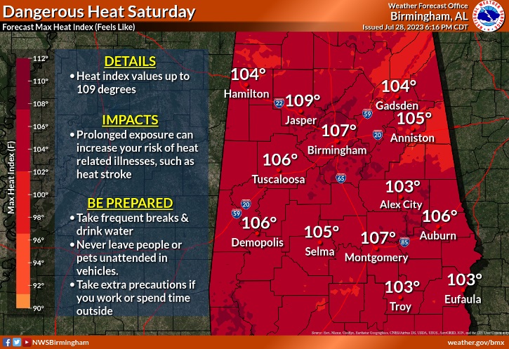
Good Morning! Dangerous Heat continues. Heat Index as high as 109 (like yesterday). A Heat Advisory continues through Sunday. There will be widely scattered heat relief. Like yesterday, random storms will pop up here and there during the afternoon and evening hours. The intense heat continues for several more days. Each day highs will be in the upper 90’s, with dangerous heat indices. There will be little day to day change.
TODAY: HEAT ADVISORY in effect through Sunday. Mostly sunny & hot. Widely scattered, random, afternoon and evening storms are possible. High 98. Heat Index as high as 109. Low tonight 77. Light wind.
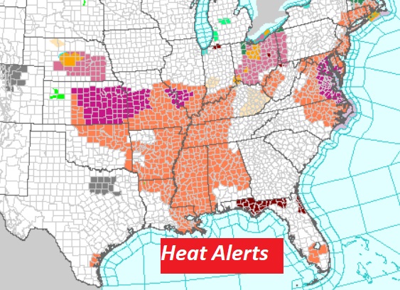
Various Heat Alerts continue across multiple states from Alabama to Ohio. For us the Heat Advisory continues through Sunday.
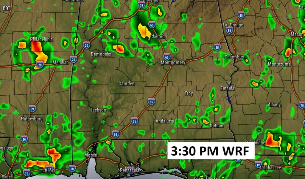
Once again today, random storms will dot the radar screen, like yesterday. Here’s one model’s Future Radar example.
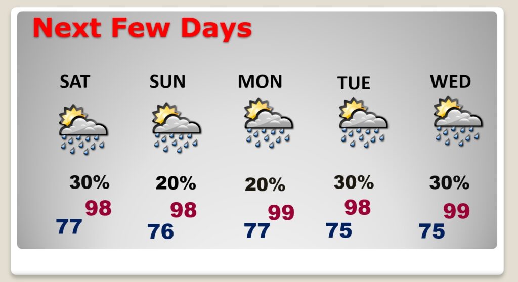
NEXT FEW DAYS: The extended heatwave rolls on. Upper 90’s Sunday through Thursday. Daily heat index 102 to 108. Scattered random storms, each day, especially in the afternoon & evening. Little day to day change.
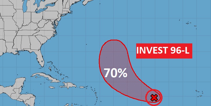
TROPICAL UPDATE: NHC is monitoring Invest 96-L in the tropical Atlantic. The probability for development is 70% in the next 7 days. A tropical depression may form early next week.
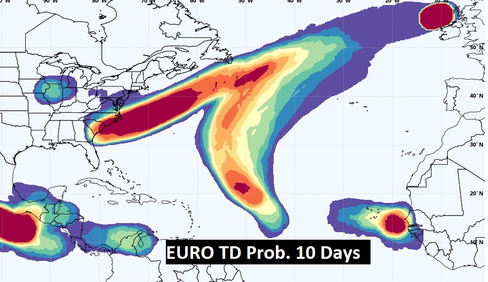
The EURO model is quite interesting. It highlights several areas of potential Tropical Mischief in the next 10 days.
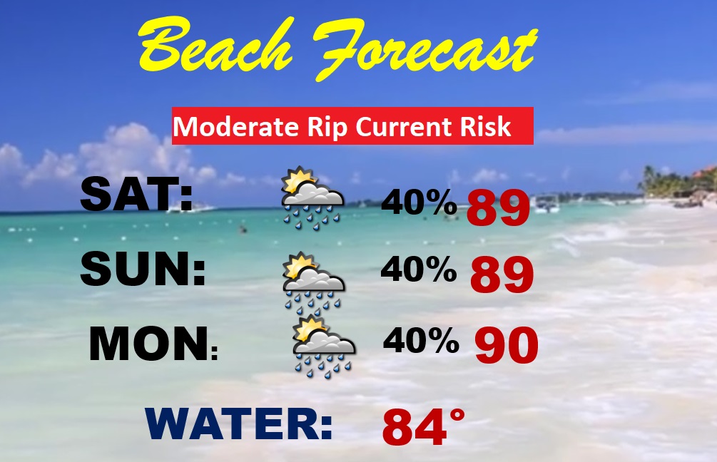
BEACH FORECAST: Lots of sun. Excessive Heat Warning.. Hot and humid. Scattered spotty storms each day. Highs in the upper 80’s. Heat Index 110+. Moderate Rip Current Risk.
Thanks for reading this Blog this morning! There will NOT be a Blog Update on Sunday morning. I’ll have another update for you on MONDAY morning. Have a nice day!
–Rich